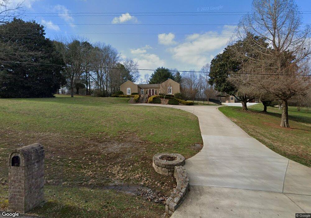
2172 Osburn Rd Arrington, TN 37014
Triune Area NeighborhoodEstimated Value: $663,269 - $840,000
--
Bed
2
Baths
1,878
Sq Ft
$398/Sq Ft
Est. Value
About This Home
This home is located at 2172 Osburn Rd, Arrington, TN 37014 and is currently estimated at $747,317, approximately $397 per square foot. 2172 Osburn Rd is a home located in Williamson County with nearby schools including Trinity Elementary School, Fred J. Page Middle School, and Fred J. Page High School.
Ownership History
Date
Name
Owned For
Owner Type
Purchase Details
Closed on
Jul 31, 2000
Sold by
Martin Leonard and Martin Brow Ambrose
Bought by
Mabry Kenneth W and Mabry Heather E
Current Estimated Value
Home Financials for this Owner
Home Financials are based on the most recent Mortgage that was taken out on this home.
Original Mortgage
$156,800
Outstanding Balance
$56,108
Interest Rate
8.23%
Estimated Equity
$691,209
Create a Home Valuation Report for This Property
The Home Valuation Report is an in-depth analysis detailing your home's value as well as a comparison with similar homes in the area
Home Values in the Area
Average Home Value in this Area
Purchase History
| Date | Buyer | Sale Price | Title Company |
|---|---|---|---|
| Mabry Kenneth W | $196,000 | -- |
Source: Public Records
Mortgage History
| Date | Status | Borrower | Loan Amount |
|---|---|---|---|
| Open | Mabry Kenneth W | $156,800 |
Source: Public Records
Tax History Compared to Growth
Tax History
| Year | Tax Paid | Tax Assessment Tax Assessment Total Assessment is a certain percentage of the fair market value that is determined by local assessors to be the total taxable value of land and additions on the property. | Land | Improvement |
|---|---|---|---|---|
| 2025 | $1,933 | $160,225 | $60,075 | $100,150 |
| 2024 | $1,933 | $102,800 | $32,475 | $70,325 |
| 2023 | $1,933 | $102,800 | $32,475 | $70,325 |
| 2022 | $1,933 | $102,800 | $32,475 | $70,325 |
| 2021 | $1,933 | $102,800 | $32,475 | $70,325 |
| 2020 | $1,754 | $79,000 | $21,650 | $57,350 |
| 2019 | $1,754 | $79,000 | $21,650 | $57,350 |
| 2018 | $1,699 | $79,000 | $21,650 | $57,350 |
| 2017 | $1,583 | $73,625 | $21,650 | $51,975 |
| 2016 | $1,583 | $73,625 | $21,650 | $51,975 |
| 2015 | -- | $60,525 | $18,050 | $42,475 |
| 2014 | -- | $60,525 | $18,050 | $42,475 |
Source: Public Records
Map
Nearby Homes
- 6021 Elliott Ct
- 5171 High Park Hill Dr
- 5178 High Park Hill Dr
- 5147 High Park Hill Dr
- 0 Osburn Rd
- 5159 High Park Hill Dr
- 5170 High Park Hill Dr
- 5155 High Park Hill Dr
- 5151 High Park Hill Dr
- 6025 Elliott Ct
- 6009 Elliott Ct
- 5901 Luke Ct
- 5906 Luke Ct
- Monroe Plan at High Park Hill - 85'
- COLTON Plan at High Park Hill - 85'
- Arydale Plan at High Park Hill - 85'
- Marshall Plan at High Park Hill - 85'
- Wilshire Plan at High Park Hill - 85'
- Belterra Plan at High Park Hill - 85'
- Belvidere Plan at High Park Hill - 85'
- 2168 Osburn Rd
- 2176 Osburn Rd
- 2175 Osburn Rd
- 1003 Lake Colonial Dr
- 1002 Valley Forge Dr
- 1000 Valley Forge Dr
- 1007 Lake Colonial Dr
- 1006 Valley Forge Dr
- 1002 Lake Colonial Dr
- 1010 Valley Forge Dr
- 1003 Valley Forge Dr
- 1011 Lake Colonial Dr
- 1001 Valley Forge Dr
- 1009 Valley Forge Dr
- 1015 Lake Colonial Dr
- 1008 Lake Colonial Dr
- 2169 Osburn Rd
- 2158 Osburn Rd
- 2163 Osburn Rd
- 1018 Valley Forge Dr