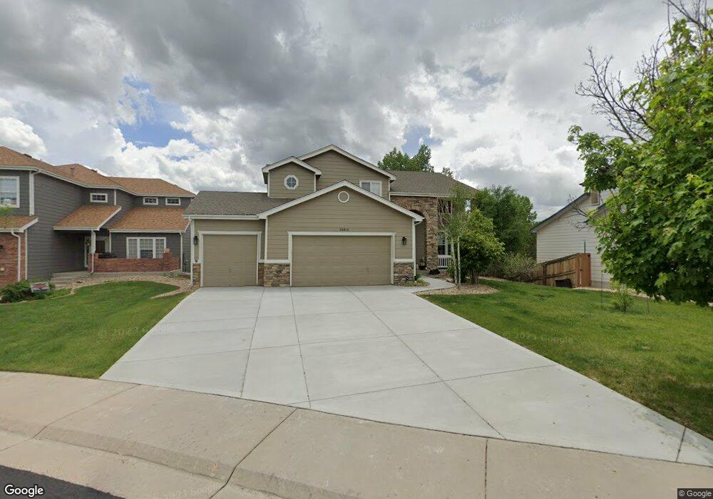
21812 Longs Peak Ln Parker, CO 80138
Estimated Value: $672,000 - $709,000
4
Beds
4
Baths
2,678
Sq Ft
$258/Sq Ft
Est. Value
About This Home
This home is located at 21812 Longs Peak Ln, Parker, CO 80138 and is currently estimated at $690,956, approximately $258 per square foot. 21812 Longs Peak Ln is a home located in Douglas County with nearby schools including Pioneer Elementary School, Cimarron Middle School, and Legend High School.
Ownership History
Date
Name
Owned For
Owner Type
Purchase Details
Closed on
Nov 20, 2020
Sold by
Kubit Deanna and Kubit Timothy
Bought by
Pitt Albert and Pitt Alison
Current Estimated Value
Home Financials for this Owner
Home Financials are based on the most recent Mortgage that was taken out on this home.
Original Mortgage
$502,151
Outstanding Balance
$446,843
Interest Rate
2.8%
Mortgage Type
VA
Estimated Equity
$244,113
Purchase Details
Closed on
Oct 13, 2005
Sold by
Ferrel Richard E and Ferrel Judy T
Bought by
Kubit Deanna and Kubit Timothy
Home Financials for this Owner
Home Financials are based on the most recent Mortgage that was taken out on this home.
Original Mortgage
$248,400
Interest Rate
7.37%
Mortgage Type
Unknown
Purchase Details
Closed on
May 26, 2000
Sold by
Centex International Inc
Bought by
Ferrel Richard E and Ferrel Judy T
Home Financials for this Owner
Home Financials are based on the most recent Mortgage that was taken out on this home.
Original Mortgage
$214,930
Interest Rate
7.37%
Create a Home Valuation Report for This Property
The Home Valuation Report is an in-depth analysis detailing your home's value as well as a comparison with similar homes in the area
Home Values in the Area
Average Home Value in this Area
Purchase History
| Date | Buyer | Sale Price | Title Company |
|---|---|---|---|
| Pitt Albert | $520,000 | Land Title Guarantee Co | |
| Kubit Deanna | $310,500 | Security Title | |
| Ferrel Richard E | $233,930 | -- |
Source: Public Records
Mortgage History
| Date | Status | Borrower | Loan Amount |
|---|---|---|---|
| Open | Pitt Albert | $502,151 | |
| Previous Owner | Kubit Deanna | $248,400 | |
| Previous Owner | Ferrel Richard E | $214,930 |
Source: Public Records
Tax History Compared to Growth
Tax History
| Year | Tax Paid | Tax Assessment Tax Assessment Total Assessment is a certain percentage of the fair market value that is determined by local assessors to be the total taxable value of land and additions on the property. | Land | Improvement |
|---|---|---|---|---|
| 2024 | $4,000 | $49,480 | $9,030 | $40,450 |
| 2023 | $4,048 | $49,480 | $9,030 | $40,450 |
| 2022 | $3,000 | $34,700 | $6,080 | $28,620 |
| 2021 | $3,123 | $34,700 | $6,080 | $28,620 |
| 2020 | $2,842 | $32,100 | $5,090 | $27,010 |
| 2019 | $2,860 | $33,130 | $5,090 | $28,040 |
| 2018 | $2,678 | $29,300 | $5,110 | $24,190 |
| 2017 | $2,485 | $29,300 | $5,110 | $24,190 |
| 2016 | $2,283 | $26,430 | $4,010 | $22,420 |
| 2015 | $2,325 | $26,430 | $4,010 | $22,420 |
| 2014 | $2,347 | $23,790 | $3,500 | $20,290 |
Source: Public Records
Map
Nearby Homes
- 21822 Longs Peak Ln
- 10760 Mount Antero Way
- 21770 Mount Elbert Place
- 21807 Silver Meadow Cir
- 21796 Silver Meadow Ln
- 21589 Omaha Ave
- 22380 Quail Run Dr
- 11048 Tim Tam Way
- 22389 Quail Run Dr
- 22428 Quail Run Ln
- 21701 Swale Ave
- 22158 Wintergreen Way
- 11001 Cardinal Dr
- 21906 Swale Dr
- 20781 Parker Vista Cir
- 20720 Parker Vista Rd
- 7372 Talon Trail
- 22938 Blackwolf Way
- 22695 E River Chase Way
- 11333 S Lost Creek Cir
- 21810 Longs Peak Ln
- 21814 Longs Peak Ln
- 21816 Longs Peak Ln
- 21750 Longs Peak Ln
- 21815 Longs Peak Ln
- 21813 Longs Peak Ln
- 21740 Longs Peak Ln
- 21811 Longs Peak Ln
- 21817 Longs Peak Ln
- 21809 Longs Peak Ln
- 21745 Longs Peak Ln
- 21730 Longs Peak Ln
- 21814 Mount Snowmass Ln
- 21819 Longs Peak Ln
- 21810 Mount Snowmass Ln
- 21735 Longs Peak Ln
- 21818 Mount Snowmass Ln
- 21749 Saddlebrook Dr
- 21753 Saddlebrook Dr
- 21745 Saddlebrook Dr