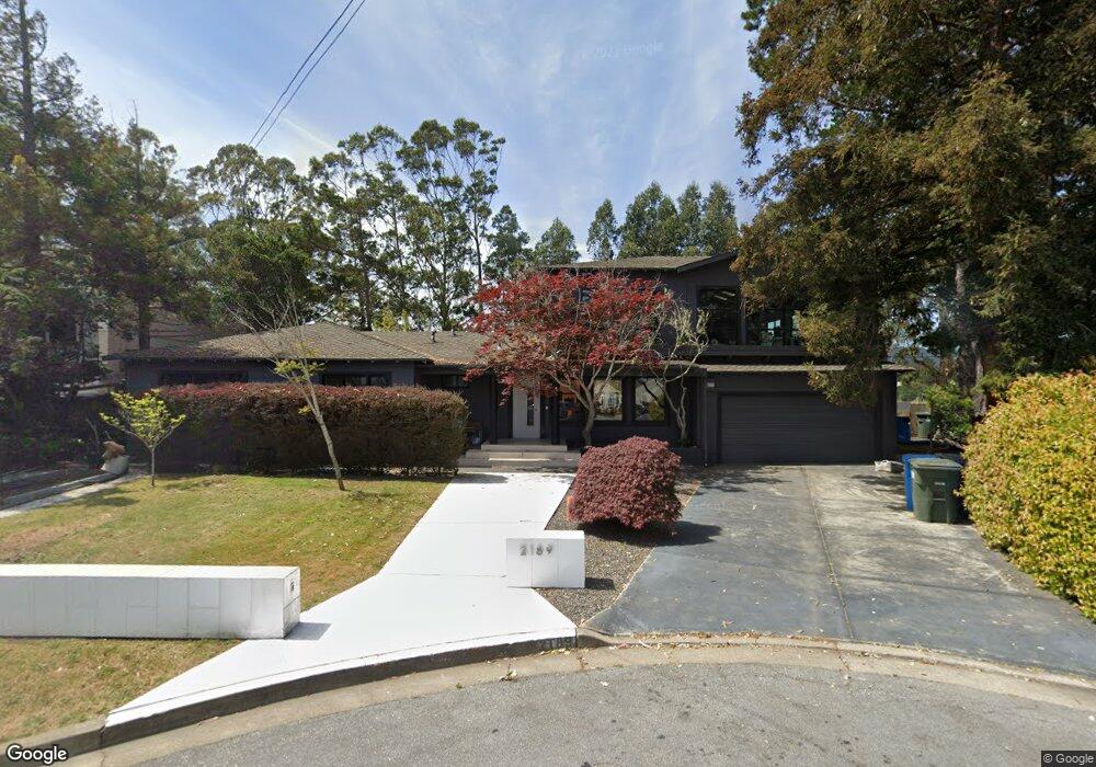
2189 Queens Ln San Mateo, CA 94402
Baywood Park NeighborhoodEstimated Value: $1,832,000 - $2,913,444
5
Beds
4
Baths
2,500
Sq Ft
$1,022/Sq Ft
Est. Value
About This Home
This home is located at 2189 Queens Ln, San Mateo, CA 94402 and is currently estimated at $2,554,361, approximately $1,021 per square foot. 2189 Queens Ln is a home located in San Mateo County with nearby schools including Highlands Elementary School, Borel Middle School, and Aragon High School.
Ownership History
Date
Name
Owned For
Owner Type
Purchase Details
Closed on
Aug 4, 2004
Sold by
Tyndall Martha A and Tyndall Alan F
Bought by
Hoang Robert Q
Current Estimated Value
Home Financials for this Owner
Home Financials are based on the most recent Mortgage that was taken out on this home.
Original Mortgage
$819,200
Outstanding Balance
$402,721
Interest Rate
5.87%
Mortgage Type
Purchase Money Mortgage
Estimated Equity
$2,151,640
Purchase Details
Closed on
Sep 20, 2000
Sold by
Tyndall Alan F and Tyndall Martha A
Bought by
Tyndall Martha A and Tyndall Alan F
Create a Home Valuation Report for This Property
The Home Valuation Report is an in-depth analysis detailing your home's value as well as a comparison with similar homes in the area
Home Values in the Area
Average Home Value in this Area
Purchase History
| Date | Buyer | Sale Price | Title Company |
|---|---|---|---|
| Hoang Robert Q | $1,024,000 | Chicago Title Co | |
| Tyndall Martha A | -- | -- |
Source: Public Records
Mortgage History
| Date | Status | Borrower | Loan Amount |
|---|---|---|---|
| Open | Hoang Robert Q | $819,200 | |
| Closed | Hoang Robert Q | $102,400 |
Source: Public Records
Tax History Compared to Growth
Tax History
| Year | Tax Paid | Tax Assessment Tax Assessment Total Assessment is a certain percentage of the fair market value that is determined by local assessors to be the total taxable value of land and additions on the property. | Land | Improvement |
|---|---|---|---|---|
| 2025 | $18,094 | $1,427,352 | $713,676 | $713,676 |
| 2023 | $18,094 | $1,371,928 | $685,964 | $685,964 |
| 2022 | $17,420 | $1,345,028 | $672,514 | $672,514 |
| 2021 | $17,112 | $1,318,656 | $659,328 | $659,328 |
| 2020 | $16,538 | $1,305,136 | $652,568 | $652,568 |
| 2019 | $16,097 | $1,279,546 | $639,773 | $639,773 |
| 2018 | $15,476 | $1,254,458 | $627,229 | $627,229 |
| 2017 | $15,254 | $1,229,862 | $614,931 | $614,931 |
| 2016 | $15,176 | $1,205,748 | $602,874 | $602,874 |
| 2015 | $14,856 | $1,187,638 | $593,819 | $593,819 |
| 2014 | $14,514 | $1,164,374 | $582,187 | $582,187 |
Source: Public Records
Map
Nearby Homes
- 2371 Ticonderoga Dr
- 2369 Ticonderoga Dr
- 2219 Allegheny Way
- 1657 Sugarloaf Dr
- 2005 Parrott Dr
- 1521 Cherrywood Dr
- 0 Ralston Ave Unit ML81985419
- 3400 Douglas Ct
- 1418 Crestwood Ct
- 1712 Los Altos Dr
- 62 Lyonridge Ln
- 2224 Bunker Hill Dr
- 0 Lower Lock Ave
- 38 Weepingridge Ct
- 1764 Lexington Ave
- 3806 Naughton Ave
- 0 W Naughton Ave
- 1685 Bayridge Way Unit 204
- 0 Bartlett Way Unit ML82003351
- 3414 Beresford Ave