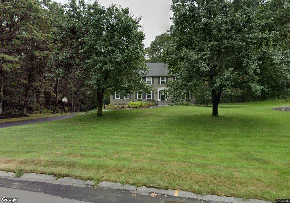
22 Peters Ln Franklin, MA 02038
Wadsworth NeighborhoodEstimated Value: $949,697 - $1,053,000
5
Beds
4
Baths
2,966
Sq Ft
$342/Sq Ft
Est. Value
About This Home
This home is located at 22 Peters Ln, Franklin, MA 02038 and is currently estimated at $1,013,674, approximately $341 per square foot. 22 Peters Ln is a home located in Norfolk County with nearby schools including Jefferson Elementary School, Remington Middle School, and Franklin High School.
Ownership History
Date
Name
Owned For
Owner Type
Purchase Details
Closed on
Nov 21, 2006
Sold by
Vartanian Frances E and Vartanian Paul V
Bought by
Melton Andrew T and Melton Lisa E
Current Estimated Value
Home Financials for this Owner
Home Financials are based on the most recent Mortgage that was taken out on this home.
Original Mortgage
$417,000
Interest Rate
6.33%
Mortgage Type
Purchase Money Mortgage
Purchase Details
Closed on
Dec 28, 2001
Sold by
Murra Dianne L
Bought by
White Mark S and White Ellen M
Purchase Details
Closed on
Dec 21, 1990
Sold by
J C Builders Inc
Bought by
Vartanian Paul
Create a Home Valuation Report for This Property
The Home Valuation Report is an in-depth analysis detailing your home's value as well as a comparison with similar homes in the area
Home Values in the Area
Average Home Value in this Area
Purchase History
| Date | Buyer | Sale Price | Title Company |
|---|---|---|---|
| Melton Andrew T | $591,000 | -- | |
| White Mark S | $320,000 | -- | |
| Vartanian Paul | $274,400 | -- |
Source: Public Records
Mortgage History
| Date | Status | Borrower | Loan Amount |
|---|---|---|---|
| Open | Vartanian Paul | $417,000 | |
| Closed | Vartanian Paul | $50,000 | |
| Closed | Melton Andrew T | $417,000 |
Source: Public Records
Tax History Compared to Growth
Tax History
| Year | Tax Paid | Tax Assessment Tax Assessment Total Assessment is a certain percentage of the fair market value that is determined by local assessors to be the total taxable value of land and additions on the property. | Land | Improvement |
|---|---|---|---|---|
| 2025 | $9,575 | $824,000 | $380,800 | $443,200 |
| 2024 | $9,832 | $833,900 | $380,800 | $453,100 |
| 2023 | $9,027 | $717,600 | $323,500 | $394,100 |
| 2022 | $9,641 | $686,200 | $337,000 | $349,200 |
| 2021 | $8,219 | $561,000 | $282,600 | $278,400 |
| 2020 | $7,914 | $545,400 | $282,600 | $262,800 |
| 2019 | $7,953 | $542,500 | $279,700 | $262,800 |
| 2018 | $7,650 | $522,200 | $285,500 | $236,700 |
| 2017 | $7,743 | $531,100 | $294,400 | $236,700 |
| 2016 | $7,388 | $509,500 | $270,000 | $239,500 |
| 2015 | $6,823 | $459,800 | $220,300 | $239,500 |
| 2014 | $6,883 | $476,300 | $236,800 | $239,500 |
Source: Public Records
Map
Nearby Homes
- 236 Williams St
- 17 Stanford Rd
- 10 Stanford Rd
- 851 Washington St
- 584 Washington St
- 1 Spring St
- 2095 West St
- 732 King St
- 8 Bubbling Brook Rd
- 246 Washington St
- 60 Grant Ave
- 50 Heather Ln
- 955 Summer St
- 0 Prospect St
- 6 Woodchester Rd
- 0 Fall Ln
- 39 Sumner Brown Rd
- 25 Nature View Dr
- 417 Union St
- 352 Lake St