Estimated Value: $155,783 - $234,000
3
Beds
2
Baths
1,634
Sq Ft
$119/Sq Ft
Est. Value
About This Home
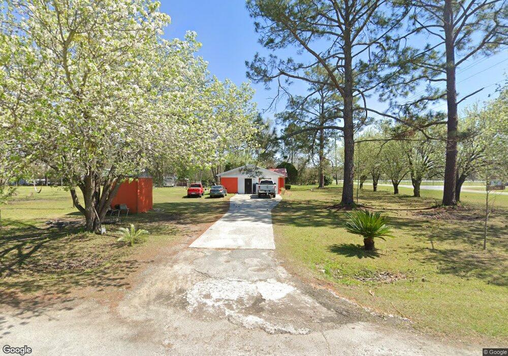
This home is located at 22 Westover Dr, Adel, GA 31620 and is currently estimated at $194,446, approximately $119 per square foot. 22 Westover Dr is a home located in Cook County with nearby schools including Cook Primary School, Cook Elementary School, and Cook County Middle School.
Ownership History
Date
Name
Owned For
Owner Type
Purchase Details
Closed on
Aug 26, 2013
Sold by
Federal National Mortgage Association
Bought by
Layne Nohora
Current Estimated Value
Home Financials for this Owner
Home Financials are based on the most recent Mortgage that was taken out on this home.
Original Mortgage
$29,824
Interest Rate
4.31%
Mortgage Type
New Conventional
Purchase Details
Closed on
Feb 5, 2013
Sold by
Nationstar Mtg Llc
Bought by
Federal National Mtg Associati
Purchase Details
Closed on
Apr 27, 2007
Sold by
Allgood Rebecca G
Bought by
Landy Maria
Home Financials for this Owner
Home Financials are based on the most recent Mortgage that was taken out on this home.
Original Mortgage
$106,000
Interest Rate
6.11%
Mortgage Type
New Conventional
Create a Home Valuation Report for This Property
The Home Valuation Report is an in-depth analysis detailing your home's value as well as a comparison with similar homes in the area
Home Values in the Area
Average Home Value in this Area
Purchase History
| Date | Buyer | Sale Price | Title Company |
|---|---|---|---|
| Layne Nohora | -- | -- | |
| Federal National Mtg Associati | $88,889 | -- | |
| Nationstar Mtg Llc | -- | -- | |
| Landy Maria | $106,000 | -- |
Source: Public Records
Mortgage History
| Date | Status | Borrower | Loan Amount |
|---|---|---|---|
| Closed | Layne Nohora | $29,824 | |
| Previous Owner | Landy Maria | $106,000 |
Source: Public Records
Tax History Compared to Growth
Tax History
| Year | Tax Paid | Tax Assessment Tax Assessment Total Assessment is a certain percentage of the fair market value that is determined by local assessors to be the total taxable value of land and additions on the property. | Land | Improvement |
|---|---|---|---|---|
| 2024 | $940 | $36,901 | $4,368 | $32,533 |
| 2023 | $343 | $32,725 | $4,368 | $28,357 |
| 2022 | $815 | $32,257 | $3,900 | $28,357 |
| 2021 | $738 | $27,505 | $3,900 | $23,605 |
| 2020 | $738 | $27,505 | $3,900 | $23,605 |
| 2019 | $739 | $27,505 | $3,900 | $23,605 |
| 2018 | $795 | $27,505 | $3,900 | $23,605 |
| 2017 | $740 | $27,505 | $3,900 | $23,605 |
| 2016 | $741 | $27,505 | $3,900 | $23,605 |
| 2015 | $814 | $29,972 | $3,900 | $26,072 |
| 2014 | $815 | $29,972 | $3,900 | $26,072 |
| 2013 | -- | $29,972 | $3,900 | $26,072 |
Source: Public Records
Map
Nearby Homes
- 120 Westover Dr
- 123 Westover Dr
- 4711 Highway 37
- 134 Brandy Ct
- 103 N College St
- 729 W 7th St
- 515 John Keigans Memorial
- 11 Antioch Rd
- 304 E 3rd St
- 7051 Antioch Rd
- 507 S Poplar St
- 418 E 3rd St
- 1306 Bear Creek Rd
- 1402 Bear Creek Rd
- 211 S Gordon Ave
- 0 Georgia 76
- 701 Gloria St
- 315 Newton Dr
- 415 E 8th St
- 105 Orchard Cir
- 1550 W Mitchell St
- 1515 W Mitchell St
- 45 Westover Dr
- 96 Westover Dr
- 71 Westover Dr
- 1530 W Mitchell St
- 1644 W Mitchell St
- 1500 W Mitchell St
- 123 Westover Dr
- 65 Debbie Dr
- 1466 W Mitchell St
- 99 Michael Dr
- 183 Westover Dr
- 1718 W Mitchell St
- 55 Michael Dr
- 101 Debbie Dr
- 96 Debbie Dr
- 96 Debbie Dr
- 1750 W Mitchell St
- 151 Debbie Dr