Estimated Value: $320,811 - $336,000
3
Beds
3
Baths
1,312
Sq Ft
$252/Sq Ft
Est. Value
About This Home
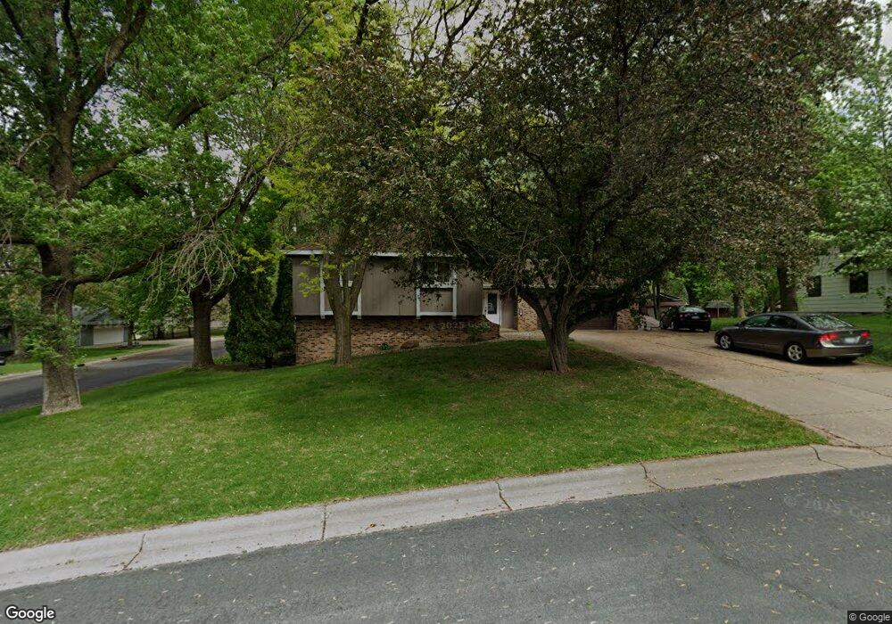
This home is located at 220 Crest Ct, Mayer, MN 55360 and is currently estimated at $330,203, approximately $251 per square foot. 220 Crest Ct is a home located in Carver County with nearby schools including Watertown-Mayer Elementary School, Watertown-Mayer Middle School, and Watertown Mayer High School.
Ownership History
Date
Name
Owned For
Owner Type
Purchase Details
Closed on
Aug 29, 2024
Sold by
Dimaggio Cheri Lee and Stein Lee Michelle
Bought by
Dimaggio Stephen
Current Estimated Value
Purchase Details
Closed on
Jun 29, 2005
Sold by
Mosqueda John A and Mosqueda Cindy L
Bought by
Dimaggio Stephen and Dimaggio Cheri Lee
Home Financials for this Owner
Home Financials are based on the most recent Mortgage that was taken out on this home.
Original Mortgage
$172,000
Interest Rate
5.69%
Mortgage Type
New Conventional
Purchase Details
Closed on
Aug 28, 2000
Sold by
Wehrwein Gary F and Wehrwein Barbara S Collins
Bought by
Mosqueda John A and Mosqueda Cindy L
Purchase Details
Closed on
Apr 29, 1999
Sold by
Johnson Jean A
Bought by
Wehrwein Gary F and Wehrwein Barbara S Collins
Create a Home Valuation Report for This Property
The Home Valuation Report is an in-depth analysis detailing your home's value as well as a comparison with similar homes in the area
Home Values in the Area
Average Home Value in this Area
Purchase History
| Date | Buyer | Sale Price | Title Company |
|---|---|---|---|
| Dimaggio Stephen | -- | None Listed On Document | |
| Dimaggio Stephen | $215,000 | -- | |
| Mosqueda John A | $158,900 | -- | |
| Wehrwein Gary F | $143,000 | -- |
Source: Public Records
Mortgage History
| Date | Status | Borrower | Loan Amount |
|---|---|---|---|
| Previous Owner | Dimaggio Stephen | $172,000 |
Source: Public Records
Tax History
| Year | Tax Paid | Tax Assessment Tax Assessment Total Assessment is a certain percentage of the fair market value that is determined by local assessors to be the total taxable value of land and additions on the property. | Land | Improvement |
|---|---|---|---|---|
| 2025 | $2,846 | $275,500 | $55,000 | $220,500 |
| 2024 | $3,066 | $275,500 | $55,000 | $220,500 |
| 2023 | $3,156 | $284,700 | $52,000 | $232,700 |
| 2022 | $2,914 | $278,700 | $52,000 | $226,700 |
| 2021 | $2,914 | $221,700 | $43,400 | $178,300 |
| 2020 | $3,004 | $223,700 | $43,400 | $180,300 |
| 2019 | $2,788 | $213,100 | $41,300 | $171,800 |
| 2018 | $2,786 | $213,100 | $41,300 | $171,800 |
| 2017 | $2,284 | $203,000 | $41,300 | $161,700 |
| 2016 | $2,344 | $143,600 | $0 | $0 |
| 2015 | $4,240 | $141,800 | $0 | $0 |
| 2014 | $4,240 | $118,600 | $0 | $0 |
Source: Public Records
Map
Nearby Homes
- 337 2nd St NW
- 190 Morning Dr
- XXX 62nd St
- 2083 River Bend Trail
- 2091 River Bend Trail
- 2095 River Bend Trail
- 2102 River Bend Trail
- 2103 River Bend Trail
- 2107 River Bend Trail
- 2119 River Bend Trail
- 2127 River Bend Trail
- 2200 Timber Dr
- 1518 Hidden Trail
- 2146 River Bend Trail
- 5875 Highway 25
- 1379 Birch Dr
- 7250 Rutz Lake Rd
- 127XX 58th St
- 14680 County Road 32
- 5225 Upland Ave
Your Personal Tour Guide
Ask me questions while you tour the home.