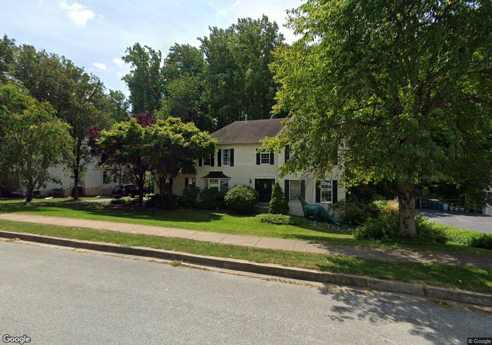
220 Cullen Way Newark, DE 19711
Estimated Value: $698,000 - $778,000
4
Beds
3
Baths
2,718
Sq Ft
$275/Sq Ft
Est. Value
About This Home
This home is located at 220 Cullen Way, Newark, DE 19711 and is currently estimated at $746,657, approximately $274 per square foot. 220 Cullen Way is a home located in New Castle County with nearby schools including R. Elisabeth Maclary Elementary School, Shue-Medill Middle School, and Newark High School.
Ownership History
Date
Name
Owned For
Owner Type
Purchase Details
Closed on
Mar 31, 2006
Sold by
Relocation Advantage Llc
Bought by
Brennecke Sean M and Brennecke Krystin M
Current Estimated Value
Home Financials for this Owner
Home Financials are based on the most recent Mortgage that was taken out on this home.
Original Mortgage
$73,177
Outstanding Balance
$57,555
Interest Rate
6.28%
Mortgage Type
Purchase Money Mortgage
Estimated Equity
$689,102
Create a Home Valuation Report for This Property
The Home Valuation Report is an in-depth analysis detailing your home's value as well as a comparison with similar homes in the area
Home Values in the Area
Average Home Value in this Area
Purchase History
| Date | Buyer | Sale Price | Title Company |
|---|---|---|---|
| Brennecke Sean M | $487,850 | None Available | |
| Relocation Advantage Llc | $487,500 | None Available |
Source: Public Records
Mortgage History
| Date | Status | Borrower | Loan Amount |
|---|---|---|---|
| Open | Relocation Advantage Llc | $73,177 | |
| Open | Brennecke Sean M | $390,280 |
Source: Public Records
Tax History Compared to Growth
Tax History
| Year | Tax Paid | Tax Assessment Tax Assessment Total Assessment is a certain percentage of the fair market value that is determined by local assessors to be the total taxable value of land and additions on the property. | Land | Improvement |
|---|---|---|---|---|
| 2024 | $1,493 | $141,500 | $17,400 | $124,100 |
| 2023 | $5,117 | $141,500 | $17,400 | $124,100 |
| 2022 | $5,062 | $141,500 | $17,400 | $124,100 |
| 2021 | $4,933 | $141,500 | $17,400 | $124,100 |
| 2020 | $4,790 | $141,500 | $17,400 | $124,100 |
| 2019 | $4,199 | $141,500 | $17,400 | $124,100 |
| 2018 | $4,102 | $141,500 | $17,400 | $124,100 |
| 2017 | $3,981 | $141,500 | $17,400 | $124,100 |
| 2016 | $3,969 | $141,500 | $17,400 | $124,100 |
| 2015 | $3,558 | $141,500 | $17,400 | $124,100 |
| 2014 | $3,557 | $141,500 | $17,400 | $124,100 |
Source: Public Records
Map
Nearby Homes
- 211 Cullen Way
- 230 Aronimink Dr
- 6 Shenandoah Dr
- 335 Old Paper Mill Rd
- 324 Delaplane Ave
- 300 Capitol Trail
- 305 Poplar Ave
- 109 Mulberry Rd
- 402 Stafford Ave
- 41 Fremont Rd
- 344 Delaware Cir
- 311 Stamford Dr
- 123 Unami Trail
- 7 Warbler Ct
- 424 Brewster Dr
- 132 Osage Ln
- 506 Cambridge Dr
- 8 Peacock Place
- 91 Old Red Mill Rd
- 2 Graham Ct