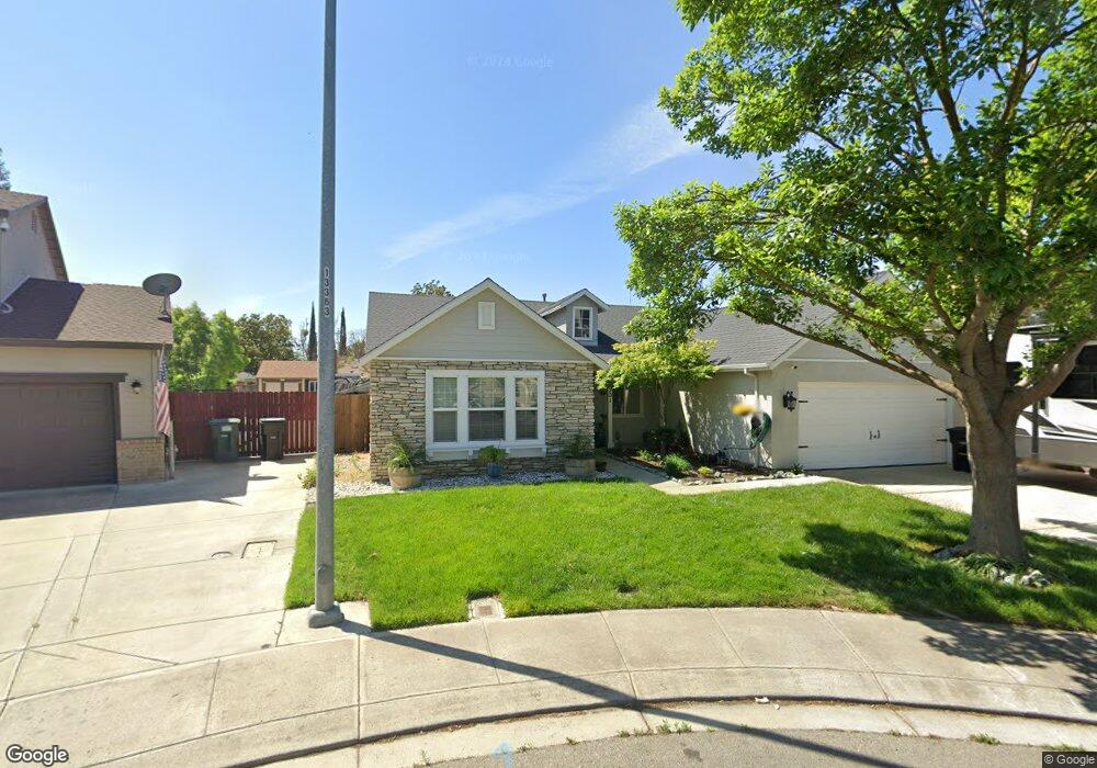
2201 Lionudakis Ct Modesto, CA 95355
Northeast Modesto NeighborhoodEstimated Value: $585,632 - $641,000
4
Beds
3
Baths
2,503
Sq Ft
$243/Sq Ft
Est. Value
About This Home
This home is located at 2201 Lionudakis Ct, Modesto, CA 95355 and is currently estimated at $607,408, approximately $242 per square foot. 2201 Lionudakis Ct is a home located in Stanislaus County with nearby schools including Coleman F. Brown Elementary School, Daniel J. Savage Middle School, and Fred C. Beyer High School.
Ownership History
Date
Name
Owned For
Owner Type
Purchase Details
Closed on
Mar 19, 2021
Sold by
King Bruce A and King Debra Diane
Bought by
Ram Pritika and Lal Roneel
Current Estimated Value
Home Financials for this Owner
Home Financials are based on the most recent Mortgage that was taken out on this home.
Original Mortgage
$428,400
Outstanding Balance
$385,319
Interest Rate
2.9%
Mortgage Type
New Conventional
Estimated Equity
$222,089
Purchase Details
Closed on
Jul 20, 2016
Sold by
King Bruce and King Debra
Bought by
King Bruce A and King Debra Diane
Purchase Details
Closed on
Jun 4, 2010
Sold by
Orchard Terrace Llc
Bought by
King Bruce and King Debra
Home Financials for this Owner
Home Financials are based on the most recent Mortgage that was taken out on this home.
Original Mortgage
$155,000
Interest Rate
4.99%
Mortgage Type
New Conventional
Purchase Details
Closed on
Mar 17, 2010
Sold by
Malsom Robert A
Bought by
Orchard Terrace Llc
Purchase Details
Closed on
Oct 21, 2004
Sold by
Marshall Richard A and Marshall Denise A
Bought by
Malsom Robert A
Home Financials for this Owner
Home Financials are based on the most recent Mortgage that was taken out on this home.
Original Mortgage
$323,200
Interest Rate
5.74%
Mortgage Type
Credit Line Revolving
Purchase Details
Closed on
Oct 20, 2004
Sold by
Malsom Shoko
Bought by
Malsom Robert A
Home Financials for this Owner
Home Financials are based on the most recent Mortgage that was taken out on this home.
Original Mortgage
$323,200
Interest Rate
5.74%
Mortgage Type
Credit Line Revolving
Purchase Details
Closed on
Jun 25, 2002
Sold by
Florsheim Bros
Bought by
Marshall Richard A and Marshall Denise A
Home Financials for this Owner
Home Financials are based on the most recent Mortgage that was taken out on this home.
Original Mortgage
$261,100
Interest Rate
6.86%
Create a Home Valuation Report for This Property
The Home Valuation Report is an in-depth analysis detailing your home's value as well as a comparison with similar homes in the area
Home Values in the Area
Average Home Value in this Area
Purchase History
| Date | Buyer | Sale Price | Title Company |
|---|---|---|---|
| Ram Pritika | $504,000 | Cypress Title Corporation | |
| King Bruce A | -- | None Available | |
| King Bruce | -- | First American Title Company | |
| Orchard Terrace Llc | $208,500 | Accommodation | |
| Malsom Robert A | $404,000 | Fidelity National Title | |
| Malsom Robert A | -- | Fidelity National Title | |
| Marshall Richard A | $290,500 | Alliance Title Company |
Source: Public Records
Mortgage History
| Date | Status | Borrower | Loan Amount |
|---|---|---|---|
| Open | Ram Pritika | $428,400 | |
| Previous Owner | King Bruce | $155,000 | |
| Previous Owner | Malsom Robert A | $323,200 | |
| Previous Owner | Marshall Richard A | $261,100 | |
| Closed | Malsom Robert A | $35,800 |
Source: Public Records
Tax History
| Year | Tax Paid | Tax Assessment Tax Assessment Total Assessment is a certain percentage of the fair market value that is determined by local assessors to be the total taxable value of land and additions on the property. | Land | Improvement |
|---|---|---|---|---|
| 2025 | $6,028 | $545,543 | $189,425 | $356,118 |
| 2024 | $5,920 | $534,847 | $185,711 | $349,136 |
| 2023 | $5,807 | $524,361 | $182,070 | $342,291 |
| 2022 | $5,572 | $514,080 | $178,500 | $335,580 |
| 2021 | $2,987 | $282,010 | $53,657 | $228,353 |
| 2020 | $2,943 | $279,119 | $53,107 | $226,012 |
| 2019 | $2,888 | $273,647 | $52,066 | $221,581 |
| 2018 | $2,830 | $268,283 | $51,046 | $217,237 |
| 2017 | $2,761 | $263,024 | $50,046 | $212,978 |
| 2016 | $2,743 | $257,867 | $49,065 | $208,802 |
| 2015 | $2,702 | $253,994 | $48,328 | $205,666 |
| 2014 | -- | $249,020 | $47,382 | $201,638 |
Source: Public Records
Map
Nearby Homes
- 2307 Oakdale Rd Unit 13
- 2307 Oakdale Rd Unit 32
- 1508 Celeste Dr
- 1900 Ellison Dr
- 2045 Celeste Dr
- 2005 Althoff Way
- 1500 Floyd Ave
- 1624 Falmouth Way
- 2210 San Blas Ct
- 2113 Milford Ln
- 1313 Floyd Ave Unit 179
- 1313 Floyd Ave Unit 119
- 2209 Lantern Dr
- 2209 Perth Dr
- 1125 Athens Ave
- 3205 Pleasant Bay Cir
- 1805 E Orangeburg Ave
- 1320 Coffee Villa Dr
- 1177 Norwegian Ave Unit 8
- 1500 Thorsen Ave
- 2200 Lionudakis Ct
- 2116 Winslow Ct
- 2208 Rose Ave
- 2113 Winslow Ct
- 2209 Lionudakis Ct
- 2204 Lionudakis Ct
- 2112 Winslow Ct
- 2112 Rose Ave
- 2208 Lionudakis Ct
- 2213 Lionudakis Ct
- 2220 Rose Ave
- 2121 Woodbury Dr
- 2125 Woodbury Dr
- 2109 Winslow Ct
- 2212 Lionudakis Ct
- 2201 Woodbury Dr
- 2108 Rose Ave
- 2117 Woodbury Dr
- 2108 Winslow Ct
- 2224 Rose Ave