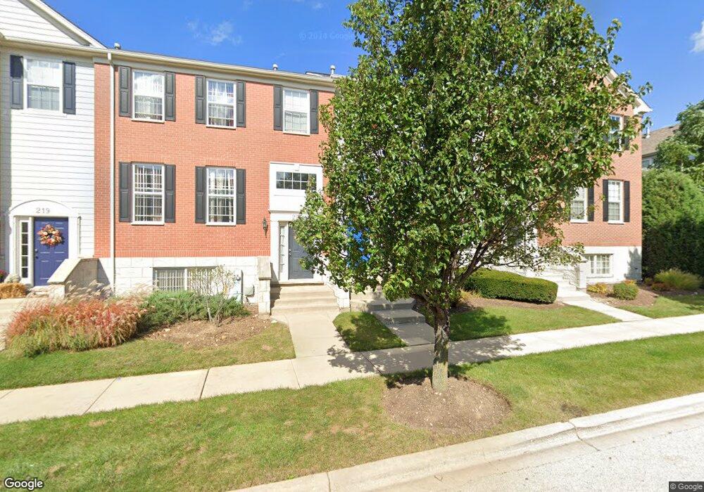
221 Comstock Dr Unit 1954 Elgin, IL 60124
Providence NeighborhoodEstimated Value: $313,000 - $328,000
3
Beds
3
Baths
1,906
Sq Ft
$168/Sq Ft
Est. Value
About This Home
This home is located at 221 Comstock Dr Unit 1954, Elgin, IL 60124 and is currently estimated at $319,581, approximately $167 per square foot. 221 Comstock Dr Unit 1954 is a home located in Kane County with nearby schools including Otter Creek Elementary School, Abbott Middle School, and South Elgin High School.
Ownership History
Date
Name
Owned For
Owner Type
Purchase Details
Closed on
Mar 23, 2021
Sold by
Omorodion Richard and Omorodion Flora
Bought by
Omorodion Flora
Current Estimated Value
Purchase Details
Closed on
Sep 9, 2013
Sold by
Omorodion Richard and Qmorodion Flora
Bought by
Qmorodion Richard and Qmorodion Flora
Purchase Details
Closed on
Aug 16, 2007
Sold by
The Ryland Group Inc
Bought by
Omorodion Richard and Omorodion Flora
Home Financials for this Owner
Home Financials are based on the most recent Mortgage that was taken out on this home.
Original Mortgage
$248,096
Interest Rate
6.66%
Mortgage Type
FHA
Create a Home Valuation Report for This Property
The Home Valuation Report is an in-depth analysis detailing your home's value as well as a comparison with similar homes in the area
Home Values in the Area
Average Home Value in this Area
Purchase History
| Date | Buyer | Sale Price | Title Company |
|---|---|---|---|
| Omorodion Flora | -- | Attorney | |
| Qmorodion Richard | -- | None Available | |
| Omorodion Richard | $252,000 | Ryland Title Co |
Source: Public Records
Mortgage History
| Date | Status | Borrower | Loan Amount |
|---|---|---|---|
| Previous Owner | Omorodion Richard | $248,096 |
Source: Public Records
Tax History Compared to Growth
Tax History
| Year | Tax Paid | Tax Assessment Tax Assessment Total Assessment is a certain percentage of the fair market value that is determined by local assessors to be the total taxable value of land and additions on the property. | Land | Improvement |
|---|---|---|---|---|
| 2024 | $6,913 | $94,387 | $26,007 | $68,380 |
| 2023 | $6,587 | $85,271 | $23,495 | $61,776 |
| 2022 | $6,222 | $77,752 | $21,423 | $56,329 |
| 2021 | $5,950 | $72,693 | $20,029 | $52,664 |
| 2020 | $5,782 | $69,397 | $19,121 | $50,276 |
| 2019 | $5,614 | $66,105 | $18,214 | $47,891 |
| 2018 | $5,564 | $62,275 | $17,159 | $45,116 |
| 2017 | $5,438 | $58,872 | $16,221 | $42,651 |
| 2016 | $5,185 | $54,618 | $15,049 | $39,569 |
| 2015 | -- | $50,063 | $13,794 | $36,269 |
| 2014 | -- | $49,445 | $13,624 | $35,821 |
| 2013 | -- | $50,749 | $13,983 | $36,766 |
Source: Public Records
Map
Nearby Homes
- 294 Comstock Dr Unit 2013
- 3134 Kyra Ln
- 366 Copper Springs Ln
- 312 Monument Rd
- 3311 Lafayette St
- 379 Fountain Ave
- COVENTRY Plan at West Point Gardens
- EMERSON Plan at West Point Gardens
- HENLEY Plan at West Point Gardens
- FAIRFIELD Plan at West Point Gardens
- Lot 267 Marigold Dr
- Lot 264 Marigold Dr
- Lot 266 Marigold Dr
- Lot 255 Marigold Dr
- 315 Snow Drop Ln
- 313 Snow Drop Ln
- 311 Snowdrop Ln
- 264 Snowdrop Ln
- 313 Snowdrop Ln
- 315 Snowdrop Ln
- 219 Comstock Dr Unit 1953
- 225 Comstock Dr Unit 1956
- 217 Comstock Dr Unit 1952
- 223 Comstock Dr Unit 1955
- 221 Comstock Dr Unit 195
- 215 Comstock Dr Unit 1951
- 215 Comstock Dr Unit 195
- 214 Comstock Dr
- 224 Comstock Dr
- 222 Comstock Dr
- 220 Comstock Dr
- 218 Comstock Dr Unit 1933
- 216 Comstock Dr Unit 1932
- 222 Comstock Dr Unit 193-5
- 220 Comstock Dr Unit 220
- 276 Comstock Dr Unit 1995
- 270 Comstock Dr Unit 1992
- 274 Comstock Dr Unit 1994
- 272 Comstock Dr Unit 1993
- 270 Comstock Dr