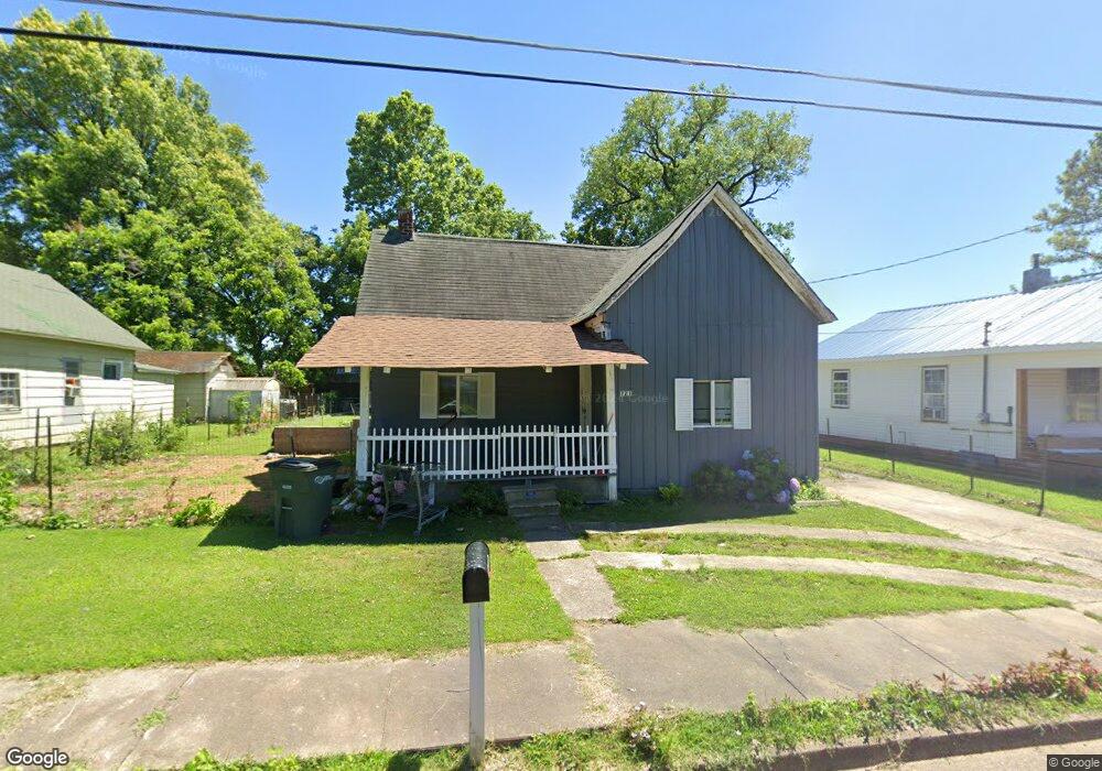
221 E Palmer St Union City, TN 38261
Estimated Value: $40,000 - $79,000
--
Bed
1
Bath
1,052
Sq Ft
$57/Sq Ft
Est. Value
About This Home
This home is located at 221 E Palmer St, Union City, TN 38261 and is currently estimated at $60,093, approximately $57 per square foot. 221 E Palmer St is a home located in Obion County with nearby schools including Union City Elementary School, Union City Middle School, and Union City High School.
Ownership History
Date
Name
Owned For
Owner Type
Purchase Details
Closed on
Feb 20, 2014
Sold by
Morse Juanita
Bought by
Villa Israel and Garcia Yazmin
Current Estimated Value
Purchase Details
Closed on
Oct 18, 2010
Sold by
Pigg Martha
Bought by
Morse Bill
Purchase Details
Closed on
Jun 16, 2003
Bought by
Pigg Martha
Purchase Details
Closed on
Jan 1, 1976
Bought by
Pigg Gaylon W
Create a Home Valuation Report for This Property
The Home Valuation Report is an in-depth analysis detailing your home's value as well as a comparison with similar homes in the area
Home Values in the Area
Average Home Value in this Area
Purchase History
| Date | Buyer | Sale Price | Title Company |
|---|---|---|---|
| Villa Israel | $24,900 | -- | |
| Morse Bill | $15,000 | -- | |
| Pigg Martha | -- | -- | |
| Pigg Gaylon W | $3,500 | -- |
Source: Public Records
Tax History Compared to Growth
Tax History
| Year | Tax Paid | Tax Assessment Tax Assessment Total Assessment is a certain percentage of the fair market value that is determined by local assessors to be the total taxable value of land and additions on the property. | Land | Improvement |
|---|---|---|---|---|
| 2025 | -- | $9,025 | $0 | $0 |
| 2024 | -- | $8,875 | $2,100 | $6,775 |
| 2023 | $248 | $8,875 | $2,100 | $6,775 |
| 2022 | $85 | $5,325 | $1,500 | $3,825 |
| 2021 | $83 | $5,325 | $1,500 | $3,825 |
| 2020 | $85 | $5,325 | $1,500 | $3,825 |
| 2019 | $198 | $5,325 | $1,500 | $3,825 |
| 2018 | $197 | $5,325 | $1,500 | $3,825 |
| 2017 | $196 | $5,125 | $1,500 | $3,625 |
| 2016 | $196 | $5,125 | $1,500 | $3,625 |
| 2015 | $194 | $5,125 | $1,500 | $3,625 |
| 2014 | $194 | $5,125 | $1,500 | $3,625 |
Source: Public Records
Map
Nearby Homes
- 501 N 1st St
- 922 N Division St
- 724 E Martin Luther King
- 803 E Main St
- 817 Exchange St
- 1009 E Cheatham St
- 610 Perkins St
- 616 S 3rd St
- 605 S 5th St
- 841 Mosswood Dr
- 0 Mosswood Dr Unit RRA45928
- 0 Mosswood Dr Unit 44704
- 901 S Home St
- 1414 Forest Dr
- 633 E Jackson St
- 422-426 430 W Jackson St
- 1129 S 4th St
- 903 Sherwood Dr
- 0 S Miles Ave Unit 41030
- 1449 Forest Dr
- 227 E Palmer St
- 219 E Palmer St
- 231 E Palmer
- 222 E Palmer St
- 300 E College St
- 302 E College St
- 218 E Palmer St
- 510 N Division St
- 304 E College St
- 514 N Division St
- 520 N Bank St
- 604 N Division St
- 608 N Division St
- 506 N Division St
- 610 N Division St
- 504 N Division St
- 118 E Palmer St
- 305 E College St
- 620 N Division St
- 114 E Palmer St