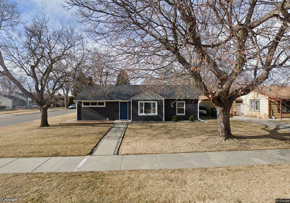
2214 Maple St Billings, MT 59102
Hilands NeighborhoodEstimated Value: $332,461 - $372,000
3
Beds
2
Baths
1,640
Sq Ft
$218/Sq Ft
Est. Value
About This Home
This home is located at 2214 Maple St, Billings, MT 59102 and is currently estimated at $357,615, approximately $218 per square foot. 2214 Maple St is a home located in Yellowstone County with nearby schools including Highland Elementary School, Lewis & Clark Junior High School, and Billings Senior High School.
Ownership History
Date
Name
Owned For
Owner Type
Purchase Details
Closed on
Mar 28, 2019
Sold by
Ashbaker Jeffrey M and Ashbaker Sarah B
Bought by
Colbrese Craig E
Current Estimated Value
Home Financials for this Owner
Home Financials are based on the most recent Mortgage that was taken out on this home.
Original Mortgage
$200,000
Outstanding Balance
$175,836
Interest Rate
4.3%
Mortgage Type
New Conventional
Estimated Equity
$181,779
Purchase Details
Closed on
Aug 22, 2016
Sold by
Brookshire David P
Bought by
Ashbaker Jeffrey M and Kouba Sarah B
Home Financials for this Owner
Home Financials are based on the most recent Mortgage that was taken out on this home.
Original Mortgage
$173,700
Interest Rate
3.45%
Mortgage Type
New Conventional
Create a Home Valuation Report for This Property
The Home Valuation Report is an in-depth analysis detailing your home's value as well as a comparison with similar homes in the area
Home Values in the Area
Average Home Value in this Area
Purchase History
| Date | Buyer | Sale Price | Title Company |
|---|---|---|---|
| Colbrese Craig E | -- | First American Title | |
| Ashbaker Jeffrey M | -- | First Montana Title |
Source: Public Records
Mortgage History
| Date | Status | Borrower | Loan Amount |
|---|---|---|---|
| Open | Colbrese Craig E | $200,000 | |
| Previous Owner | Ashbaker Jeffrey M | $173,700 |
Source: Public Records
Tax History
| Year | Tax Paid | Tax Assessment Tax Assessment Total Assessment is a certain percentage of the fair market value that is determined by local assessors to be the total taxable value of land and additions on the property. | Land | Improvement |
|---|---|---|---|---|
| 2025 | $2,631 | $297,600 | $51,412 | $246,188 |
| 2024 | $2,631 | $271,700 | $48,959 | $222,741 |
| 2023 | $2,634 | $271,700 | $48,959 | $222,741 |
| 2022 | $2,445 | $221,700 | $0 | $0 |
| 2021 | $2,328 | $221,700 | $0 | $0 |
| 2020 | $2,352 | $214,900 | $0 | $0 |
| 2019 | $2,245 | $214,900 | $0 | $0 |
| 2018 | $2,036 | $190,100 | $0 | $0 |
| 2017 | $1,759 | $190,100 | $0 | $0 |
| 2016 | $1,935 | $188,500 | $0 | $0 |
| 2015 | $504 | $188,500 | $0 | $0 |
| 2014 | -- | $75,472 | $0 | $0 |
Source: Public Records
Map
Nearby Homes
- 545 Beverly Hill Blvd
- 607 Avenue F Unit 4
- 803 Parkhill Dr
- 509 Avenue E
- 609 Avenue D
- 2620 Highwood Dr
- 934 Delphinium Dr
- 2223 Elm St
- 641 Avenue C
- 1617 8th St W Unit C
- 824 Avenue D
- 810 Rimrock Rd
- 240 Beverly Hill Blvd
- 1028 Princeton Ave
- 921 Avenue B
- 2914 Rimview Dr
- 1119 O Malley Dr
- 1124 Parkhill Dr
- 202 Avenue E
- 804 Alderson Ave
- 2218 Maple St
- 2222 Maple St
- 637 Crawford Dr
- 2219 7th St W
- 636 Crawford Dr
- 640 Crawford Dr
- 632 Crawford Dr
- 2223 7th St W
- 2228 Maple St
- 646 Crawford Dr
- 2211 Maple St
- 620 Crawford Dr
- 2219 Maple St
- 2225 7th St W
- 2223 Maple St
- 618 Crawford Dr
- 2232 Maple St
- 629 Beverly Hill Blvd
- 2225 Maple St
- 2227 7th St W
Your Personal Tour Guide
Ask me questions while you tour the home.