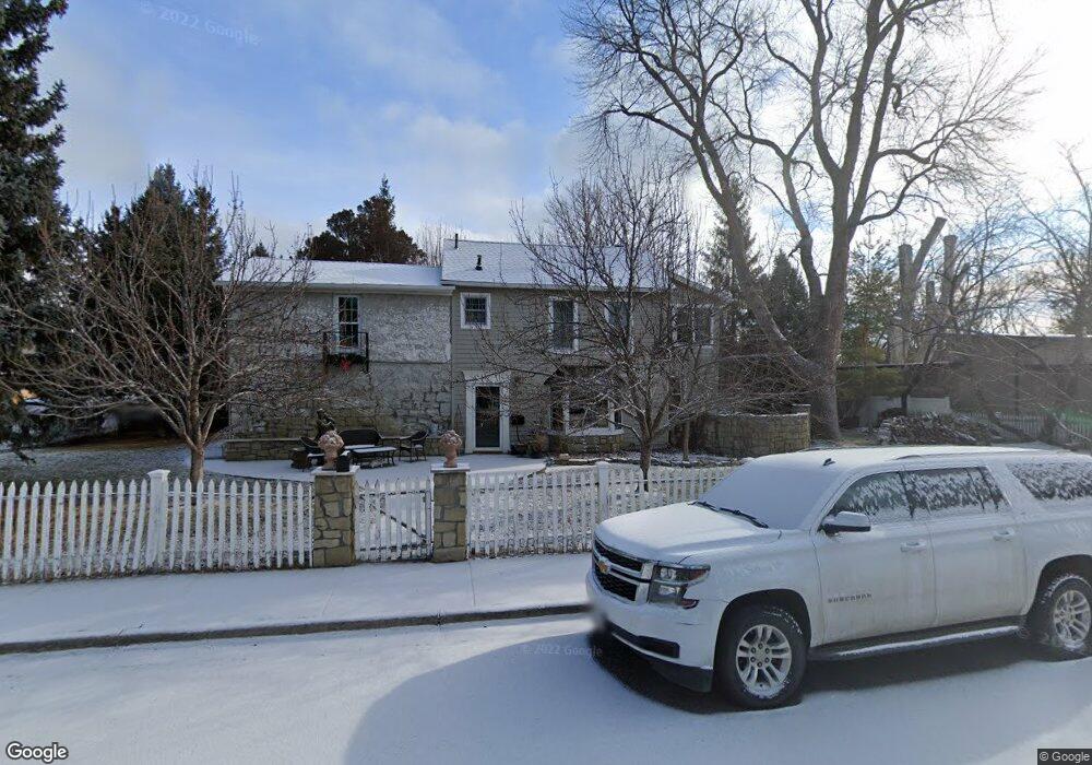
2225 Tree Ln Billings, MT 59102
Hilands NeighborhoodEstimated Value: $454,000 - $600,000
4
Beds
3
Baths
2,838
Sq Ft
$186/Sq Ft
Est. Value
About This Home
This home is located at 2225 Tree Ln, Billings, MT 59102 and is currently estimated at $527,186, approximately $185 per square foot. 2225 Tree Ln is a home located in Yellowstone County with nearby schools including Highland Elementary School, Lewis & Clark Junior High School, and Billings Senior High School.
Ownership History
Date
Name
Owned For
Owner Type
Purchase Details
Closed on
Jun 7, 2019
Sold by
Simon Scott P and Simon Brenda G
Bought by
Stevenson Jill D and Mathis Brian
Current Estimated Value
Home Financials for this Owner
Home Financials are based on the most recent Mortgage that was taken out on this home.
Original Mortgage
$275,000
Outstanding Balance
$180,434
Interest Rate
4.1%
Mortgage Type
New Conventional
Estimated Equity
$346,752
Purchase Details
Closed on
Jan 11, 2016
Sold by
Wilson Darryl S and Wilson Corrine L
Bought by
Simon Scott P and Simon Brenda G
Purchase Details
Closed on
Dec 7, 2015
Sold by
Wilson Darryl S and Wilson Corrine L
Bought by
Simon Scott P and Simon Brenda G
Purchase Details
Closed on
Nov 15, 2012
Sold by
Petro Kenneth T
Bought by
Simon Scott P and Simon Brenda G
Create a Home Valuation Report for This Property
The Home Valuation Report is an in-depth analysis detailing your home's value as well as a comparison with similar homes in the area
Home Values in the Area
Average Home Value in this Area
Purchase History
| Date | Buyer | Sale Price | Title Company |
|---|---|---|---|
| Stevenson Jill D | -- | -- | |
| Simon Scott P | -- | Servicelink | |
| Simon Scott P | -- | None Available | |
| Simon Scott P | -- | None Available |
Source: Public Records
Mortgage History
| Date | Status | Borrower | Loan Amount |
|---|---|---|---|
| Open | Stevenson Jill D | $275,000 |
Source: Public Records
Tax History
| Year | Tax Paid | Tax Assessment Tax Assessment Total Assessment is a certain percentage of the fair market value that is determined by local assessors to be the total taxable value of land and additions on the property. | Land | Improvement |
|---|---|---|---|---|
| 2025 | $4,980 | $532,800 | $91,096 | $441,704 |
| 2024 | $4,980 | $507,100 | $115,027 | $392,073 |
| 2023 | $4,997 | $507,100 | $115,027 | $392,073 |
| 2022 | $3,847 | $407,500 | $0 | $0 |
| 2021 | $4,322 | $407,500 | $0 | $0 |
| 2020 | $4,289 | $387,700 | $0 | $0 |
| 2019 | $4,095 | $387,700 | $0 | $0 |
| 2018 | $4,281 | $400,300 | $0 | $0 |
| 2017 | $3,865 | $369,300 | $0 | $0 |
| 2016 | $3,000 | $283,600 | $0 | $0 |
| 2015 | $2,934 | $283,600 | $0 | $0 |
| 2014 | $2,801 | $144,054 | $0 | $0 |
Source: Public Records
Map
Nearby Homes
- 545 Beverly Hill Blvd
- 607 Avenue F Unit 4
- 509 Avenue E
- 310 Beverly Hill Blvd
- 240 Beverly Hill Blvd
- 2415 Ash St
- 803 Parkhill Dr
- 934 Delphinium Dr
- 644 Avenue B
- 824 Avenue D
- 229 Avenue B
- 2214 North Place
- 1065 O Malley Dr
- 125 Avenue B
- 1034 Avenue F
- 1907 St Peter Ln
- 1933 St Peter Ln
- 1919 St Peter Ln
- 1929 St Peter Ln
- 1925 St Peter Ln