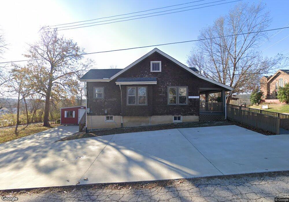
224 N Central Ave Eureka, MO 63025
Estimated Value: $358,700
Studio
--
Bath
2,472
Sq Ft
$145/Sq Ft
Est. Value
About This Home
This home is located at 224 N Central Ave, Eureka, MO 63025 and is currently estimated at $358,700, approximately $145 per square foot. 224 N Central Ave is a home located in St. Louis County with nearby schools including Eureka Elementary School, Lasalle Springs Middle School, and Eureka Senior High School.
Ownership History
Date
Name
Owned For
Owner Type
Purchase Details
Closed on
Mar 15, 2018
Sold by
Stites Jeffrey and Stites Cynthia
Bought by
Carlson Frank and Carlson Nancy
Current Estimated Value
Purchase Details
Closed on
Aug 14, 2000
Sold by
Jeffries Michael and Jeffries Patricia
Bought by
Stites Jeffrey and Stites Cynthia
Home Financials for this Owner
Home Financials are based on the most recent Mortgage that was taken out on this home.
Original Mortgage
$104,800
Interest Rate
8.22%
Create a Home Valuation Report for This Property
The Home Valuation Report is an in-depth analysis detailing your home's value as well as a comparison with similar homes in the area
Home Values in the Area
Average Home Value in this Area
Purchase History
| Date | Buyer | Sale Price | Title Company |
|---|---|---|---|
| Carlson Frank | $227,000 | None Available | |
| Stites Jeffrey | $131,000 | -- |
Source: Public Records
Mortgage History
| Date | Status | Borrower | Loan Amount |
|---|---|---|---|
| Previous Owner | Stites Jeffrey | $104,800 |
Source: Public Records
Tax History
| Year | Tax Paid | Tax Assessment Tax Assessment Total Assessment is a certain percentage of the fair market value that is determined by local assessors to be the total taxable value of land and additions on the property. | Land | Improvement |
|---|---|---|---|---|
| 2025 | $5,867 | $63,360 | $20,060 | $43,300 |
| 2024 | $5,867 | $63,130 | $20,060 | $43,070 |
| 2023 | $5,869 | $63,130 | $20,060 | $43,070 |
| 2022 | $5,265 | $53,560 | $20,060 | $33,500 |
| 2021 | $5,267 | $53,560 | $20,060 | $33,500 |
| 2020 | $5,399 | $53,340 | $20,060 | $33,280 |
| 2019 | $5,424 | $53,340 | $20,060 | $33,280 |
| 2018 | $5,203 | $48,990 | $20,060 | $28,930 |
| 2017 | $5,039 | $48,990 | $20,060 | $28,930 |
| 2016 | $5,204 | $48,990 | $20,060 | $28,930 |
Source: Public Records
Map
Nearby Homes
- 125 Towne Square Ct Unit 4E
- 118 Towne Square Ct Unit D4
- 637 N Virginia Ave
- 318 Kevin Jon Ct
- 329 Kevin Jon Ct
- 15 Rockwood Place Ct
- 944 Emerald Oaks Ct
- 369 Cerny Ave
- 3 Leona Ln
- 160 Hunters Run Ct
- 826 Lower Field Ln
- 75 Old Farmhouse Way
- 830 Lower Field Ln
- 83 Old Farmhouse Way
- 808 Lower Field Ln
- 17114 Elm Trail Dr
- 345 Palisades Ridge Ct
- 17134 Elm Trail Dr
- 897 Top Notch Ln
- 814 Eureka Rd
- 216 N Central Ave
- 212 N Central Ave
- 223 Beverly St
- 211 Beverly St
- 201 Beverly St
- 302 N Central Ave
- 301 N Central Ave
- 21 E 3rd St
- 312 N Central Ave
- 309 N Central Ave
- 0TBB Ashton Woods 1 2 Story Homes
- 0TBB Aspen Lot 1&2 Lower Byrnesmill
- 17 E 3rd St
- 789456 E Second Ct
- 218 Beverly St
- 313 N Central Ave
- 120 N Central Ave
- 315 Beverly St
- 0TBB 2 Sty@ashton Woods
- 116 N Central Ave
Your Personal Tour Guide
Ask me questions while you tour the home.