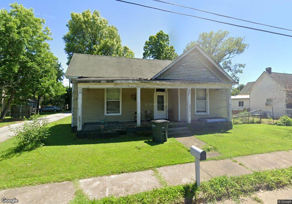
227 E Palmer St Union City, TN 38261
Estimated Value: $64,889 - $110,000
--
Bed
1
Bath
1,416
Sq Ft
$59/Sq Ft
Est. Value
About This Home
This home is located at 227 E Palmer St, Union City, TN 38261 and is currently estimated at $83,222, approximately $58 per square foot. 227 E Palmer St is a home located in Obion County with nearby schools including Union City Elementary School, Union City Middle School, and Union City High School.
Ownership History
Date
Name
Owned For
Owner Type
Purchase Details
Closed on
Mar 11, 2013
Sold by
Landeros Bernice
Bought by
Ortiz Angela M and Ortiz Alejandro
Current Estimated Value
Purchase Details
Closed on
Oct 26, 2009
Sold by
Ellingsworth Steven Chase
Bought by
Landeros Bernice
Purchase Details
Closed on
Apr 29, 2008
Sold by
Pigg Martha R
Bought by
Chase Ellingsworth Steven
Home Financials for this Owner
Home Financials are based on the most recent Mortgage that was taken out on this home.
Original Mortgage
$16,959
Interest Rate
5.86%
Mortgage Type
Cash
Purchase Details
Closed on
Jan 1, 1978
Bought by
Pigg Martha
Create a Home Valuation Report for This Property
The Home Valuation Report is an in-depth analysis detailing your home's value as well as a comparison with similar homes in the area
Home Values in the Area
Average Home Value in this Area
Purchase History
| Date | Buyer | Sale Price | Title Company |
|---|---|---|---|
| Ortiz Angela M | $23,000 | -- | |
| Landeros Bernice | $22,000 | -- | |
| Chase Ellingsworth Steven | $19,000 | -- | |
| Pigg Martha | $5,500 | -- |
Source: Public Records
Mortgage History
| Date | Status | Borrower | Loan Amount |
|---|---|---|---|
| Previous Owner | Pigg Martha | $16,959 |
Source: Public Records
Tax History Compared to Growth
Tax History
| Year | Tax Paid | Tax Assessment Tax Assessment Total Assessment is a certain percentage of the fair market value that is determined by local assessors to be the total taxable value of land and additions on the property. | Land | Improvement |
|---|---|---|---|---|
| 2025 | -- | $17,125 | $0 | $0 |
| 2024 | -- | $17,125 | $2,100 | $15,025 |
| 2023 | $480 | $17,125 | $2,100 | $15,025 |
| 2022 | $160 | $10,025 | $1,500 | $8,525 |
| 2021 | $157 | $10,025 | $1,500 | $8,525 |
| 2020 | $160 | $10,025 | $1,500 | $8,525 |
| 2019 | $379 | $10,200 | $1,500 | $8,700 |
| 2018 | $377 | $10,200 | $1,500 | $8,700 |
| 2017 | $375 | $9,850 | $1,500 | $8,350 |
| 2016 | $375 | $9,850 | $1,500 | $8,350 |
| 2015 | $373 | $9,850 | $1,500 | $8,350 |
| 2014 | $373 | $9,850 | $1,500 | $8,350 |
Source: Public Records
Map
Nearby Homes
- 501 N 1st St
- 922 N Division St
- 724 E Martin Luther King
- 803 E Main St
- 817 Exchange St
- 1009 E Cheatham St
- 610 Perkins St
- 616 S 3rd St
- 605 S 5th St
- 841 Mosswood Dr
- 0 Mosswood Dr Unit RRA45928
- 0 Mosswood Dr Unit 44704
- 901 S Home St
- 1414 Forest Dr
- 633 E Jackson St
- 422-426 430 W Jackson St
- 903 Sherwood Dr
- 1129 S 4th St
- 1449 Forest Dr
- 0 S Miles Ave Unit 41030
- 221 E Palmer St
- 231 E Palmer
- 219 E Palmer St
- 302 E College St
- 510 N Division St
- 304 E College St
- 300 E College St
- 514 N Division St
- 222 E Palmer St
- 506 N Division St
- 604 N Division St
- 504 N Division St
- 218 E Palmer St
- 608 N Division St
- 520 N Bank St
- 610 N Division St
- 305 E College St
- 519 N Division St
- 515 N Division St Unit 517
- 404 E College St