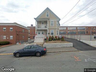
227 University Ave Lowell, MA 01854
Pawtucketville NeighborhoodEstimated Value: $683,728 - $878,000
6
Beds
2
Baths
3,658
Sq Ft
$212/Sq Ft
Est. Value
About This Home
This home is located at 227 University Ave, Lowell, MA 01854 and is currently estimated at $774,182, approximately $211 per square foot. 227 University Ave is a home located in Middlesex County with nearby schools including Joseph McAvinnue Elementary School, Charlotte M Murkland Elementary School, and Charles W. Morey Elementary School.
Ownership History
Date
Name
Owned For
Owner Type
Purchase Details
Closed on
Apr 7, 2006
Sold by
Hultgren Michelle P and Hultgren Thomas S
Bought by
Hultgren Michelle P
Current Estimated Value
Home Financials for this Owner
Home Financials are based on the most recent Mortgage that was taken out on this home.
Original Mortgage
$220,000
Interest Rate
6.26%
Mortgage Type
Purchase Money Mortgage
Create a Home Valuation Report for This Property
The Home Valuation Report is an in-depth analysis detailing your home's value as well as a comparison with similar homes in the area
Home Values in the Area
Average Home Value in this Area
Purchase History
| Date | Buyer | Sale Price | Title Company |
|---|---|---|---|
| Hultgren Michelle P | -- | -- | |
| Hultgren Michelle P | -- | -- |
Source: Public Records
Mortgage History
| Date | Status | Borrower | Loan Amount |
|---|---|---|---|
| Open | Hultgren Michelle P | $214,500 | |
| Closed | Hultgren Michelle P | $220,000 |
Source: Public Records
Tax History Compared to Growth
Tax History
| Year | Tax Paid | Tax Assessment Tax Assessment Total Assessment is a certain percentage of the fair market value that is determined by local assessors to be the total taxable value of land and additions on the property. | Land | Improvement |
|---|---|---|---|---|
| 2025 | $8,423 | $733,700 | $128,800 | $604,900 |
| 2024 | $7,603 | $638,400 | $103,900 | $534,500 |
| 2023 | $7,021 | $565,300 | $84,900 | $480,400 |
| 2022 | $6,464 | $509,400 | $75,100 | $434,300 |
| 2021 | $5,998 | $445,600 | $65,400 | $380,200 |
| 2020 | $5,810 | $434,900 | $84,500 | $350,400 |
| 2019 | $5,127 | $365,200 | $74,200 | $291,000 |
| 2018 | $4,694 | $326,200 | $70,700 | $255,500 |
| 2017 | $4,437 | $297,400 | $64,300 | $233,100 |
| 2016 | $4,284 | $282,600 | $62,500 | $220,100 |
| 2015 | $3,898 | $251,800 | $59,900 | $191,900 |
| 2013 | $3,431 | $228,600 | $66,100 | $162,500 |
Source: Public Records
Map
Nearby Homes
- 8 Dracut St
- 238 Emery Ave
- 136 Gershom Ave
- 310 4th Ave
- 99 White St
- 63 3rd Ave
- 30 4th Ave
- 121 Old Meadow Rd
- 199 Mammoth Rd
- 89 Mammoth Rd
- 445 Textile Ave
- 53 Brissette St
- 33 Hally Rd
- 267 Pawtucket St
- 67 Halley Rd
- 390 Pawtucket St Unit 1
- 47 Mount Vernon St
- 19 Hopeland St
- 136 Chase Ave
- 113 School St Unit 12
- 227 University Ave
- 229 University Ave
- 234 University Ave
- 228 University Ave
- 228 University Ave
- 217 University Ave
- 217 University Ave
- 224 University Ave
- 222 University Ave Unit 2
- 222 University Ave
- 220 University Ave
- 220 University Ave Unit 1
- 215 University Ave
- 215 University Ave
- 215 University Ave Unit 1
- 215 University Ave Unit 3
- 246 University Ave
- 218 University Ave
- 251 University Ave
- 40 Dracut St