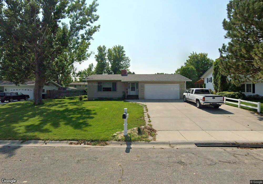
228 Ashley Ct N Billings, MT 59105
Billings Heights NeighborhoodEstimated Value: $396,000 - $440,000
5
Beds
3
Baths
2,641
Sq Ft
$160/Sq Ft
Est. Value
About This Home
This home is located at 228 Ashley Ct N, Billings, MT 59105 and is currently estimated at $423,814, approximately $160 per square foot. 228 Ashley Ct N is a home located in Yellowstone County with nearby schools including Eagle Cliffs Elementary School, Castle Rock Junior High School, and Skyview High School.
Ownership History
Date
Name
Owned For
Owner Type
Purchase Details
Closed on
Apr 22, 2016
Sold by
Dewitt Jason J and Dewitt Misty D
Bought by
Smith Rick D and Smith Judy C
Current Estimated Value
Home Financials for this Owner
Home Financials are based on the most recent Mortgage that was taken out on this home.
Original Mortgage
$216,997
Outstanding Balance
$172,094
Interest Rate
3.71%
Mortgage Type
FHA
Estimated Equity
$249,820
Purchase Details
Closed on
Jan 24, 2007
Sold by
Mccullough Flint E and Mccullough Carey M
Bought by
Dewitt Jason J and Dewitt Misty D
Home Financials for this Owner
Home Financials are based on the most recent Mortgage that was taken out on this home.
Original Mortgage
$14,500
Interest Rate
6.11%
Mortgage Type
Unknown
Create a Home Valuation Report for This Property
The Home Valuation Report is an in-depth analysis detailing your home's value as well as a comparison with similar homes in the area
Home Values in the Area
Average Home Value in this Area
Purchase History
| Date | Buyer | Sale Price | Title Company |
|---|---|---|---|
| Smith Rick D | -- | Stewart Title | |
| Dewitt Jason J | -- | None Available | |
| Dewitt Jason J | -- | None Available |
Source: Public Records
Mortgage History
| Date | Status | Borrower | Loan Amount |
|---|---|---|---|
| Open | Smith Rick D | $216,997 | |
| Previous Owner | Dewitt Jason J | $14,500 | |
| Previous Owner | Dewitt Jason J | $116,000 |
Source: Public Records
Tax History Compared to Growth
Tax History
| Year | Tax Paid | Tax Assessment Tax Assessment Total Assessment is a certain percentage of the fair market value that is determined by local assessors to be the total taxable value of land and additions on the property. | Land | Improvement |
|---|---|---|---|---|
| 2025 | $3,907 | $429,500 | $65,847 | $363,653 |
| 2024 | $3,907 | $389,900 | $65,301 | $324,599 |
| 2023 | $3,913 | $389,900 | $65,301 | $324,599 |
| 2022 | $3,268 | $283,100 | $0 | $0 |
| 2021 | $3,103 | $283,100 | $0 | $0 |
| 2020 | $2,992 | $259,700 | $0 | $0 |
| 2019 | $2,697 | $242,600 | $0 | $0 |
| 2018 | $2,595 | $228,300 | $0 | $0 |
| 2017 | $2,527 | $228,300 | $0 | $0 |
| 2016 | $2,328 | $210,900 | $0 | $0 |
| 2015 | $2,279 | $210,900 | $0 | $0 |
| 2014 | $1,965 | $94,976 | $0 | $0 |
Source: Public Records
Map
Nearby Homes
- 1322 Babcock Cir
- 324 Stewart Ct N
- 1017 Toole Cir
- 475 Republic Ave
- 1126 Yorktown St
- 277 Westchester Square S
- 961 Governors Blvd
- 69 Nugget Place
- 2011 Gleneagles Blvd
- 2059 Gleneagles Blvd
- 2027 Gleneagles Blvd
- 2019 Gleneagles Blvd
- 2067 Gleneagles Blvd
- 1168 Minuteman St
- 844 Governors Blvd
- 153 W Hilltop Rd
- 707 Aquarius Place
- 1422 Watson Peak Rd
- 721 Constitution Ave
- 325 Sahara Dr
- 224 Ashley Ct N
- 232 Ashley Ct N
- 274 Ashley Ct S
- 278 Ashley Ct S
- 270 Ashley Ct S
- 220 Ashley Ct N
- 236 Ashley Ct N
- 229 Ashley Ct N
- 225 Ashley Ct N
- 282 Ashley Ct S
- 233 Ashley Ct N
- 266 Ashley Ct S
- 221 Ashley Ct N
- 237 Ashley Ct N
- 298 Ashley Ct E
- 240 Ashley Ct N
- 292 Ashley Ct E
- 217 Ashley Ct N
- 275 Ashley Ct S
- 279 Ashley Ct S