Estimated Value: $1,070,000 - $1,207,000
5
Beds
3
Baths
2,105
Sq Ft
$536/Sq Ft
Est. Value
About This Home
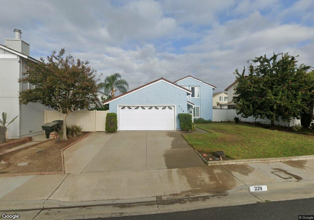
This home is located at 229 Redbay Ave, Brea, CA 92821 and is currently estimated at $1,128,302, approximately $536 per square foot. 229 Redbay Ave is a home located in Orange County with nearby schools including Brea Country Hills Elementary School, Brea Junior High School, and Brea-Olinda High School.
Ownership History
Date
Name
Owned For
Owner Type
Purchase Details
Closed on
Mar 25, 2025
Sold by
Anderson Charles A
Bought by
Ca Anderson 2025 Revocable Trust and Anderson
Current Estimated Value
Purchase Details
Closed on
Sep 10, 2024
Sold by
Margaret W Anderson Living Trust and Anderson Charles A
Bought by
Anderson Charles A
Purchase Details
Closed on
Sep 1, 2009
Sold by
Anderson Margaret W
Bought by
Anderson Margaret W and The Margaret W Anderson Living Trust
Create a Home Valuation Report for This Property
The Home Valuation Report is an in-depth analysis detailing your home's value as well as a comparison with similar homes in the area
Home Values in the Area
Average Home Value in this Area
Purchase History
| Date | Buyer | Sale Price | Title Company |
|---|---|---|---|
| Ca Anderson 2025 Revocable Trust | -- | None Listed On Document | |
| Anderson Charles A | -- | None Listed On Document | |
| Anderson Margaret W | -- | None Available |
Source: Public Records
Tax History
| Year | Tax Paid | Tax Assessment Tax Assessment Total Assessment is a certain percentage of the fair market value that is determined by local assessors to be the total taxable value of land and additions on the property. | Land | Improvement |
|---|---|---|---|---|
| 2025 | $2,623 | $214,826 | $77,326 | $137,500 |
| 2024 | $2,623 | $210,614 | $75,810 | $134,804 |
| 2023 | $2,548 | $206,485 | $74,324 | $132,161 |
| 2022 | $2,518 | $202,437 | $72,867 | $129,570 |
| 2021 | $2,471 | $198,468 | $71,438 | $127,030 |
| 2020 | $2,453 | $196,433 | $70,705 | $125,728 |
| 2019 | $2,392 | $192,582 | $69,319 | $123,263 |
| 2018 | $2,355 | $188,806 | $67,959 | $120,847 |
| 2017 | $2,311 | $185,104 | $66,626 | $118,478 |
| 2016 | $2,266 | $181,475 | $65,320 | $116,155 |
| 2015 | $2,232 | $178,750 | $64,339 | $114,411 |
| 2014 | $2,168 | $175,249 | $63,079 | $112,170 |
Source: Public Records
Map
Nearby Homes
- 1975 Heather Cir
- 136 Donnybrook Rd
- 2304 Carrotwood Dr
- 2440 Sanabria Ln
- 2851 Rolling Hills Dr Unit 178
- 2851 Rolling Hills Dr Unit 257
- 2851 Rolling Hills Dr Unit 248
- 2851 Rolling Hills Dr
- 570 Olive Ave
- 2418 Rainbow Ln
- 2257 Shadetree Cir
- 341 Adalina Ln
- 688 Buttonwood Dr
- 145 S Poplar Ave Unit 20
- 3054 Associated Rd Unit 20
- 2849 Tarragon Ct
- 360 Meadow Ct
- 38 Rogers Ct
- 3059 Heather Dr
- 127 S Redwood Ave
- 223 Redbay Ave
- 1705 E Eucalyptus St
- 226 Plum Ave
- 232 Plum Ave
- 220 Plum Ave
- 217 Redbay Ave
- 234 Redbay Ave
- 238 Redbay Ave
- 228 Redbay Ave
- 214 Plum Ave
- 211 Redbay Ave
- 222 Redbay Ave
- 1714 E Eucalyptus St
- 1702 E Eucalyptus St
- 1743 E Eucalyptus St
- 216 Redbay Ave
- 1726 E Eucalyptus St
- 1690 E Eucalyptus St
- 1665 E Eucalyptus St
- 239 Camphor Cir
Your Personal Tour Guide
Ask me questions while you tour the home.