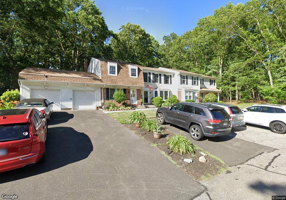
23 Thornton Commons Yaphank, NY 11980
Estimated Value: $411,213 - $441,000
2
Beds
2
Baths
1,044
Sq Ft
$412/Sq Ft
Est. Value
About This Home
This home is located at 23 Thornton Commons, Yaphank, NY 11980 and is currently estimated at $429,803, approximately $411 per square foot. 23 Thornton Commons is a home located in Suffolk County with nearby schools including Longwood Junior High School, Longwood Middle School, and Longwood Senior High School.
Ownership History
Date
Name
Owned For
Owner Type
Purchase Details
Closed on
Jun 25, 2018
Sold by
Rubenacker Michael
Bought by
Luchatt Annette D
Current Estimated Value
Purchase Details
Closed on
Dec 23, 2009
Sold by
Lechmanski John and Lechmanski Susan
Bought by
Rubenacker Michael and Rubenacker Courtney
Home Financials for this Owner
Home Financials are based on the most recent Mortgage that was taken out on this home.
Original Mortgage
$213,675
Interest Rate
4.62%
Mortgage Type
FHA
Purchase Details
Closed on
Oct 5, 2001
Sold by
Lobel Scott and Lobel Mary
Bought by
Lechmanski John and Lechmanski Susan
Create a Home Valuation Report for This Property
The Home Valuation Report is an in-depth analysis detailing your home's value as well as a comparison with similar homes in the area
Home Values in the Area
Average Home Value in this Area
Purchase History
| Date | Buyer | Sale Price | Title Company |
|---|---|---|---|
| Luchatt Annette D | -- | -- | |
| Rubenacker Michael | $222,500 | -- | |
| Lechmanski John | $139,900 | -- |
Source: Public Records
Mortgage History
| Date | Status | Borrower | Loan Amount |
|---|---|---|---|
| Previous Owner | Rubenacker Michael | $213,675 |
Source: Public Records
Tax History Compared to Growth
Tax History
| Year | Tax Paid | Tax Assessment Tax Assessment Total Assessment is a certain percentage of the fair market value that is determined by local assessors to be the total taxable value of land and additions on the property. | Land | Improvement |
|---|---|---|---|---|
| 2024 | $4,669 | $1,115 | $110 | $1,005 |
| 2023 | $4,669 | $1,115 | $110 | $1,005 |
| 2022 | $3,097 | $1,115 | $110 | $1,005 |
| 2021 | $3,097 | $1,115 | $110 | $1,005 |
| 2020 | $4,402 | $1,115 | $110 | $1,005 |
| 2019 | $4,402 | $0 | $0 | $0 |
| 2018 | $3,004 | $1,115 | $110 | $1,005 |
| 2017 | $3,004 | $1,115 | $110 | $1,005 |
| 2016 | $2,980 | $1,115 | $110 | $1,005 |
| 2015 | -- | $1,365 | $110 | $1,255 |
| 2014 | -- | $1,365 | $110 | $1,255 |
Source: Public Records
Map
Nearby Homes
- 3 Wilson Commons
- 11 Bartlett Commons
- 14 Franklin Commons
- 10 Smith Commons
- 22 Huntington Commons
- 195 Belmont Cir
- 201 Belmont Cir Unit 201
- 227 Belmont Cir
- 208 Belmont Cir
- 137 Grace Hall Ln
- 295 Silver Timber Dr
- 366 Wavell Ave
- 306 Silver Timber Dr
- 358 Wavell Ave
- 261 Silver Timber Dr
- 333 Wavell Ave
- 329 Silver Timber Dr Unit 329
- The Aster Plan at Country Pointe Preserve
- The Birch Plan at Country Pointe Preserve
- The Aspen Plan at Country Pointe Preserve
- 23 Thornton Commons
- 22 Thornton Commons
- 25 Thornton Commons Unit 25
- 18 Thornton Commons
- 17 Thornton Commons
- 17 Thornton Commons
- 30 Thornton Commons
- 17 Hopkins Commons
- 17 Hopkins Commons
- 15 Thornton Commons
- 15 Thornton Commons
- 18 Hopkins Commons
- 32 Thornton Commons
- 19 Hopkins Commons
- 19 Hopkins Commons
- 13 Thornton Commons
- 13 Thornton Commons
- 22 Harrison Commons
- 22 Harrison Commons
- 12 Thornton Commons