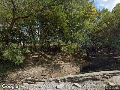
2321 205th St Fort Scott, KS 66701
Estimated Value: $201,000 - $245,000
8
Beds
--
Bath
3,029
Sq Ft
$73/Sq Ft
Est. Value
About This Home
This home is located at 2321 205th St, Fort Scott, KS 66701 and is currently estimated at $221,308, approximately $73 per square foot. 2321 205th St is a home located in Bourbon County with nearby schools including Winfield Scott Elementary School, Eugene Ware Elementary School, and Fort Scott Middle School.
Ownership History
Date
Name
Owned For
Owner Type
Purchase Details
Closed on
Apr 14, 2022
Bought by
Hochstetler Amos N and Hochstetler Fannie C
Current Estimated Value
Purchase Details
Closed on
Sep 5, 2014
Sold by
Noah Hochstetler and Noah Mary A
Bought by
Borntreger Noah and Borntreger Fannie E
Home Financials for this Owner
Home Financials are based on the most recent Mortgage that was taken out on this home.
Original Mortgage
$91,400
Interest Rate
3.75%
Mortgage Type
New Conventional
Create a Home Valuation Report for This Property
The Home Valuation Report is an in-depth analysis detailing your home's value as well as a comparison with similar homes in the area
Home Values in the Area
Average Home Value in this Area
Purchase History
| Date | Buyer | Sale Price | Title Company |
|---|---|---|---|
| Hochstetler Amos N | $43,000 | -- | |
| Borntreger Noah | $114,250 | Security First Title |
Source: Public Records
Mortgage History
| Date | Status | Borrower | Loan Amount |
|---|---|---|---|
| Previous Owner | Borntreger Noah | $91,400 | |
| Closed | Borntreger Noah | $91,400 |
Source: Public Records
Tax History Compared to Growth
Tax History
| Year | Tax Paid | Tax Assessment Tax Assessment Total Assessment is a certain percentage of the fair market value that is determined by local assessors to be the total taxable value of land and additions on the property. | Land | Improvement |
|---|---|---|---|---|
| 2024 | $1,453 | $10,373 | $1,816 | $8,557 |
| 2023 | $1,402 | $9,597 | $1,816 | $7,781 |
| 2022 | $1,331 | $9,713 | $2,316 | $7,397 |
| 2021 | $1,437 | $9,212 | $2,280 | $6,932 |
| 2020 | $1,580 | $10,007 | $2,262 | $7,745 |
| 2019 | $1,639 | $10,315 | $2,253 | $8,062 |
| 2018 | $1,055 | $6,701 | $1,836 | $4,865 |
| 2017 | $1,050 | $6,641 | $1,726 | $4,915 |
| 2016 | -- | $6,607 | $1,485 | $5,122 |
| 2015 | -- | $6,594 | $1,047 | $5,547 |
| 2014 | -- | $6,796 | $1,224 | $5,572 |
Source: Public Records
Map
Nearby Homes
- 0 69 Hwy and Xavier Rd Unit HMS2519850
- 2259 245th St
- 151 W Main St
- 1965 Overbrook Rd
- 0 E 600th Rd
- 1486 215th St
- 6721 Read Rd
- 5189 Lee Rd
- 93 SW Skyline Cir
- 305 & 309 E Sugar Lake Dr
- 33 E Sugar Lake Cove
- 22 & 42 Prine Loop & 165 Locust St
- 726 W Sugar Lake Dr
- 69 W Sugar Lake Cove
- 239 E Sugar Lake Dr
- 225 E Sugarlake Dr
- 125 Locust Dr
- 98 Locust Dr
- 78,82,90 Locust Dr
- 9 Locust Dr
- 2321 205th St
- 2386 205th St
- 2350 205th St
- 1578 Wagon Rd
- 2294 205th St
- 0000 242 & Xylem Rd
- 2020 Wagon Rd
- 2330 215th St
- 2253 205th St
- 2064 Highway 31
- 2064 Highway 31
- 709 W Spruce St
- 603 W Spruce St
- 2404 209 Th St
- 708 W Spruce St
- 503 W Spruce St
- 2260 205th St
- 602 W Spruce St
- 711 W Osage St
- 627 W Osage St
