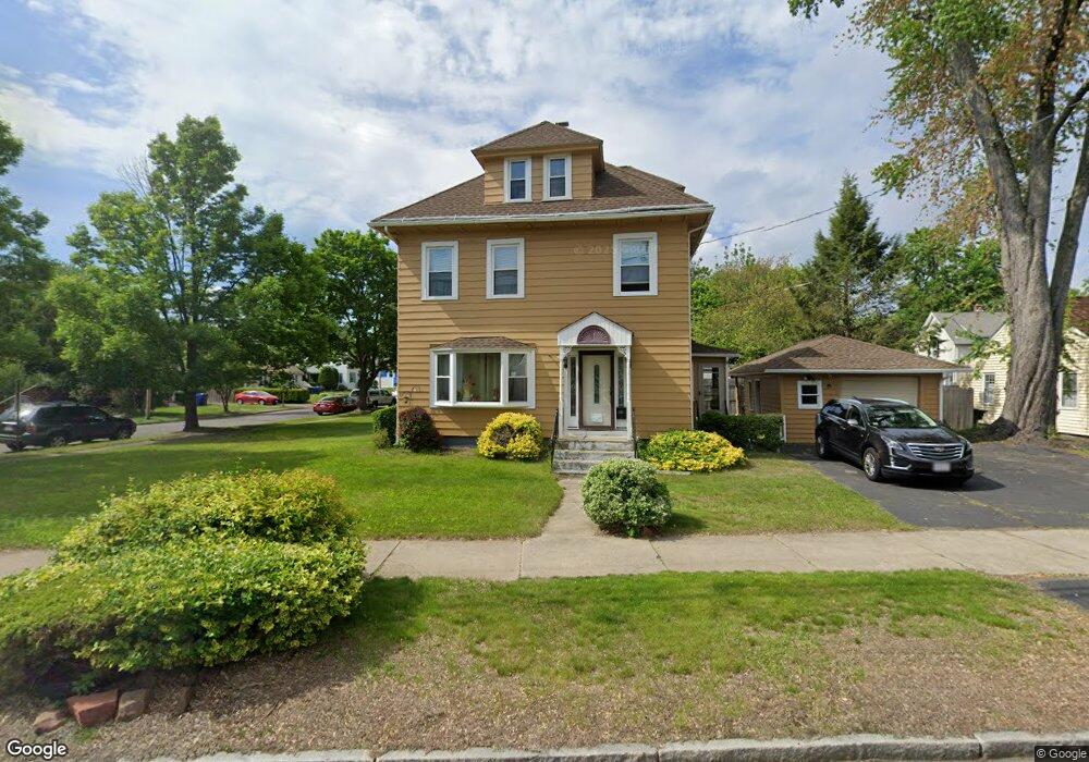
234 Plumtree Rd Springfield, MA 01118
East Forest Park NeighborhoodEstimated Value: $325,812 - $355,000
4
Beds
2
Baths
2,074
Sq Ft
$163/Sq Ft
Est. Value
About This Home
This home is located at 234 Plumtree Rd, Springfield, MA 01118 and is currently estimated at $338,953, approximately $163 per square foot. 234 Plumtree Rd is a home located in Hampden County with nearby schools including Mary A. Dryden Veterans Memorial School, M Marcus Kiley Middle, and Springfield High School of Science and Technology.
Ownership History
Date
Name
Owned For
Owner Type
Purchase Details
Closed on
Mar 15, 2021
Sold by
Paulin Rodney N and Smith Patricia
Bought by
Smith Patricia P
Current Estimated Value
Purchase Details
Closed on
Sep 29, 2005
Sold by
Laflamme Raymond L and Laflamme Jean M
Bought by
Paulin Dorothy J
Home Financials for this Owner
Home Financials are based on the most recent Mortgage that was taken out on this home.
Original Mortgage
$169,000
Interest Rate
5.84%
Mortgage Type
Purchase Money Mortgage
Create a Home Valuation Report for This Property
The Home Valuation Report is an in-depth analysis detailing your home's value as well as a comparison with similar homes in the area
Home Values in the Area
Average Home Value in this Area
Purchase History
| Date | Buyer | Sale Price | Title Company |
|---|---|---|---|
| Smith Patricia P | -- | None Available | |
| Paulin Dorothy J | $177,900 | -- |
Source: Public Records
Mortgage History
| Date | Status | Borrower | Loan Amount |
|---|---|---|---|
| Previous Owner | Paulin Dorothy J | $169,000 |
Source: Public Records
Tax History
| Year | Tax Paid | Tax Assessment Tax Assessment Total Assessment is a certain percentage of the fair market value that is determined by local assessors to be the total taxable value of land and additions on the property. | Land | Improvement |
|---|---|---|---|---|
| 2025 | $4,066 | $259,300 | $47,800 | $211,500 |
| 2024 | $3,744 | $233,100 | $47,800 | $185,300 |
| 2023 | $3,379 | $198,200 | $45,500 | $152,700 |
| 2022 | $3,677 | $195,400 | $45,500 | $149,900 |
| 2021 | $3,393 | $179,500 | $41,400 | $138,100 |
| 2020 | $3,279 | $167,900 | $41,400 | $126,500 |
| 2019 | $3,168 | $161,000 | $41,400 | $119,600 |
| 2018 | $2,939 | $152,700 | $41,400 | $111,300 |
| 2017 | $2,939 | $149,500 | $41,400 | $108,100 |
| 2016 | $2,786 | $141,700 | $41,400 | $100,300 |
| 2015 | $2,852 | $145,000 | $41,400 | $103,600 |
Source: Public Records
Map
Nearby Homes
- 7 Ashbrook St
- 170 Plumtree Rd
- 79 Arvilla St
- 134 Eddywood St
- 79 Roosevelt Ave
- 75 Gillette Cir
- 118 Pilgrim Rd
- 1088 Sumner Ave
- 13 Bither St
- 55 Mandalay Rd
- 384 Abbott St
- 509 Plumtree Rd
- 34 Castle St
- 44 Amanda St
- 37 Chesterfield Ave
- 410 Allen St
- 59 Daviston St
- 22 Amanda St
- 54 S Shore Dr
- 854-856 Sumner Ave
- 242 Plumtree Rd
- 7 Grandview St
- 222 Plumtree Rd
- 248 Plumtree Rd
- 14 Brighton St
- 14 Grandview St
- 23 Grandview St
- 216 Plumtree Rd
- 239 Plumtree Rd
- 20 Grandview St
- 245 Plumtree Rd
- 27 Grandview St
- 251 Plumtree Rd
- 24 Brighton St
- 26 Grandview St
- 11 Lancaster St
- 260 Plumtree Rd
- 17 Lancaster St
- 7 Lancaster St
- 23 Lancaster St
Your Personal Tour Guide
Ask me questions while you tour the home.