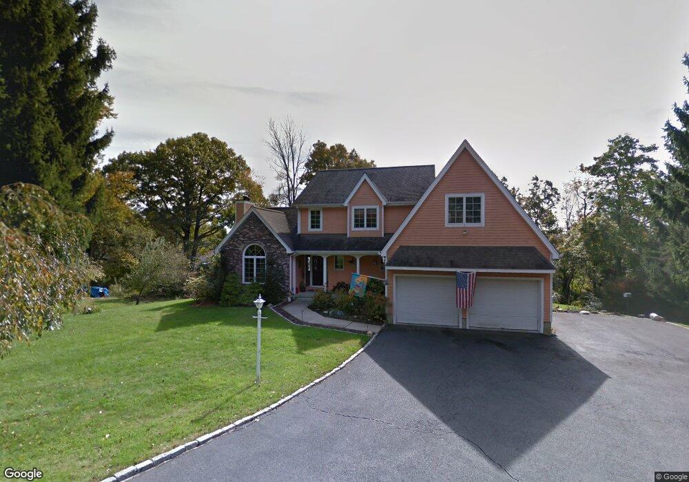
24 Driftway Rd Danbury, CT 06811
Estimated Value: $700,000 - $798,000
3
Beds
4
Baths
2,422
Sq Ft
$305/Sq Ft
Est. Value
About This Home
This home is located at 24 Driftway Rd, Danbury, CT 06811 and is currently estimated at $739,761, approximately $305 per square foot. 24 Driftway Rd is a home located in Fairfield County with nearby schools including Mill Ridge Primary School, Rogers Park Middle School, and Danbury High School.
Ownership History
Date
Name
Owned For
Owner Type
Purchase Details
Closed on
Jan 7, 2000
Sold by
Est Svege Aileen M and Dyer-Pomeroy Kimberly
Bought by
Rocco Michael A and Rocco Vera
Current Estimated Value
Home Financials for this Owner
Home Financials are based on the most recent Mortgage that was taken out on this home.
Original Mortgage
$332,000
Interest Rate
7.73%
Purchase Details
Closed on
Apr 5, 1989
Sold by
Balsam Stephen
Bought by
Svege Eric
Create a Home Valuation Report for This Property
The Home Valuation Report is an in-depth analysis detailing your home's value as well as a comparison with similar homes in the area
Home Values in the Area
Average Home Value in this Area
Purchase History
| Date | Buyer | Sale Price | Title Company |
|---|---|---|---|
| Rocco Michael A | $332,000 | -- | |
| Svege Eric | $75,000 | -- |
Source: Public Records
Mortgage History
| Date | Status | Borrower | Loan Amount |
|---|---|---|---|
| Closed | Svege Eric | $125,700 | |
| Closed | Svege Eric | $332,000 | |
| Previous Owner | Svege Eric | $156,000 | |
| Previous Owner | Svege Eric | $160,000 |
Source: Public Records
Tax History
| Year | Tax Paid | Tax Assessment Tax Assessment Total Assessment is a certain percentage of the fair market value that is determined by local assessors to be the total taxable value of land and additions on the property. | Land | Improvement |
|---|---|---|---|---|
| 2025 | $10,174 | $407,120 | $90,580 | $316,540 |
| 2024 | $9,950 | $407,120 | $90,580 | $316,540 |
| 2023 | $9,498 | $407,120 | $90,580 | $316,540 |
| 2022 | $8,316 | $294,700 | $84,700 | $210,000 |
| 2021 | $12,701 | $294,700 | $84,700 | $210,000 |
| 2020 | $8,134 | $294,700 | $84,700 | $210,000 |
| 2019 | $8,134 | $294,700 | $84,700 | $210,000 |
| 2018 | $8,134 | $294,700 | $84,700 | $210,000 |
| 2017 | $8,022 | $277,100 | $80,600 | $196,500 |
| 2016 | $7,947 | $277,100 | $80,600 | $196,500 |
| 2015 | $7,831 | $277,100 | $80,600 | $196,500 |
| 2014 | $7,648 | $277,100 | $80,600 | $196,500 |
Source: Public Records
Map
Nearby Homes
- 22 Driftway Rd
- 55 Mill Plain Rd Unit 19-3
- 55 Mill Plain Rd Unit 17-6
- 31 Greenlawn Dr
- 34 Lindencrest Dr
- 15 Driftway Point Rd
- 1 Wilderswood Way
- 12 Boulevard Dr Unit 15-104
- 12 Boulevard Dr Unit 31-173
- 12 Boulevard Dr Unit 31-172
- 23 Scuppo Rd Unit 5-7
- 40 Middle River Rd
- 6 Joes Hill Rd
- 1603 Briar Woods Ln
- 11 Boulevard Dr Unit 9-36
- 11 Boulevard Dr Unit 13
- 168 Westville Avenue Extension
- 12-16 Scuppo Rd Unit D4
- 10 Scuppo Rd Unit A13
- 15 Lindencrest Dr
- 26 Driftway Rd
- 20 Driftway Rd
- 28 Driftway Rd
- 4 Hall St
- 6 Hall St
- 16 Driftway Rd
- 27 Driftway Rd
- 8 Hall St
- 1A Sunset Ridge
- 14 Driftway Rd
- 10 Hall St
- 33 Driftway Rd
- 12 Driftway Rd
- 17 Driftway Rd
- 17 Driftway Rd Unit 21
- 3 Hall St
- 5 Hall St
- 8 Driftway Rd Unit B1
- 8 Driftway Rd Unit A8
- 8 Driftway Rd Unit A7
Your Personal Tour Guide
Ask me questions while you tour the home.