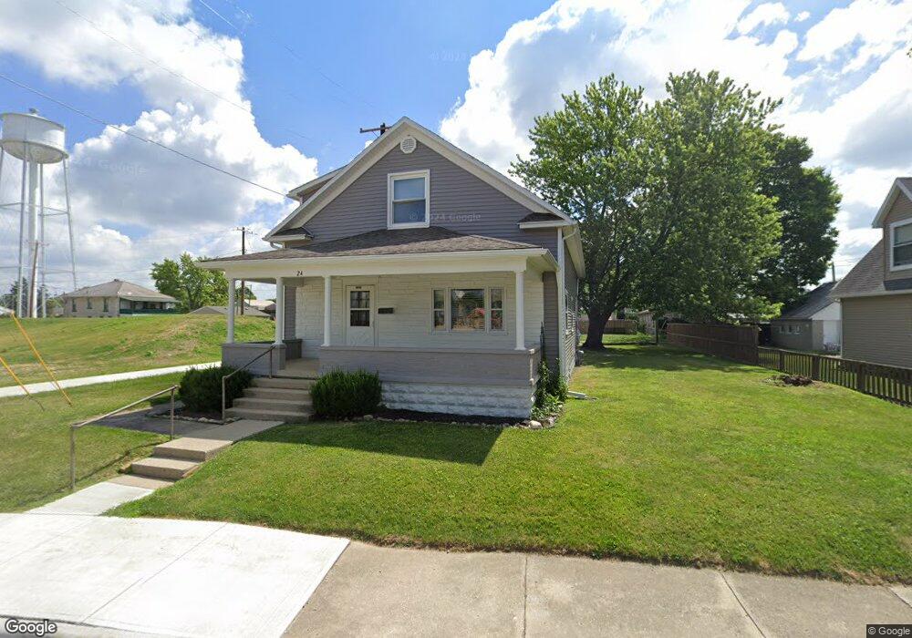
24 N Grant St Covington, OH 45318
Estimated Value: $161,988 - $262,000
4
Beds
2
Baths
1,965
Sq Ft
$106/Sq Ft
Est. Value
About This Home
This home is located at 24 N Grant St, Covington, OH 45318 and is currently estimated at $208,247, approximately $105 per square foot. 24 N Grant St is a home located in Miami County with nearby schools including Covington Elementary/Junior High School, Covington Junior High School, and Covington High School.
Ownership History
Date
Name
Owned For
Owner Type
Purchase Details
Closed on
Oct 19, 2017
Sold by
Homan Julie M
Bought by
Homan Lee R
Current Estimated Value
Purchase Details
Closed on
Nov 4, 2016
Sold by
Homan Robert W
Bought by
Julie M Homan
Home Financials for this Owner
Home Financials are based on the most recent Mortgage that was taken out on this home.
Interest Rate
3.54%
Purchase Details
Closed on
Mar 27, 2007
Sold by
Homan Robert W
Bought by
Homan Robert W and Homan Julie M
Purchase Details
Closed on
Jan 1, 1990
Bought by
Homan Robert W
Create a Home Valuation Report for This Property
The Home Valuation Report is an in-depth analysis detailing your home's value as well as a comparison with similar homes in the area
Home Values in the Area
Average Home Value in this Area
Purchase History
| Date | Buyer | Sale Price | Title Company |
|---|---|---|---|
| Homan Lee R | -- | -- | |
| Julie M Homan | -- | -- | |
| Homan Robert W | -- | -- | |
| Homan Robert W | -- | -- |
Source: Public Records
Mortgage History
| Date | Status | Borrower | Loan Amount |
|---|---|---|---|
| Closed | Homan Robert W | -- |
Source: Public Records
Tax History
| Year | Tax Paid | Tax Assessment Tax Assessment Total Assessment is a certain percentage of the fair market value that is determined by local assessors to be the total taxable value of land and additions on the property. | Land | Improvement |
|---|---|---|---|---|
| 2025 | $1,648 | $49,320 | $9,700 | $39,620 |
| 2024 | $1,648 | $32,760 | $10,500 | $22,260 |
| 2023 | $1,255 | $32,760 | $10,500 | $22,260 |
| 2022 | $1,252 | $32,760 | $10,500 | $22,260 |
| 2021 | $1,039 | $25,210 | $8,090 | $17,120 |
| 2020 | $1,042 | $25,210 | $8,090 | $17,120 |
| 2019 | $1,046 | $25,210 | $8,090 | $17,120 |
| 2018 | $969 | $23,280 | $6,300 | $16,980 |
| 2017 | $986 | $23,280 | $6,300 | $16,980 |
| 2016 | $974 | $23,280 | $6,300 | $16,980 |
| 2015 | $898 | $22,370 | $6,060 | $16,310 |
| 2014 | $898 | $22,370 | $6,060 | $16,310 |
| 2013 | $867 | $22,370 | $6,060 | $16,310 |
Source: Public Records
Map
Nearby Homes
- 16 N Grant St
- 25 N Ludlow St
- 245 University St
- 27 N Ludlow St
- 11 N Ludlow St
- 410 E Walnut St
- 37 N Ludlow St
- 404 E Walnut St
- 328 E Walnut St
- 416 E Walnut St
- 39 N Ludlow St
- 241 University St
- 424 E Walnut St
- 311 E Maple St
- 239 University St
- 304 E Walnut St
- 1 S Grant St
- 407 E Walnut St
- 403 E Walnut St
- 20 N Ludlow St
Your Personal Tour Guide
Ask me questions while you tour the home.