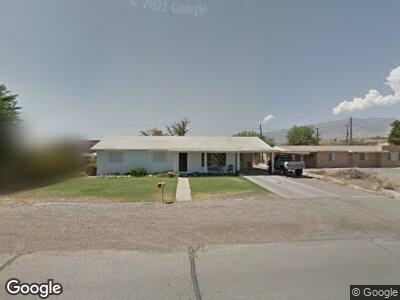
2405 W Relation St Safford, AZ 85546
Estimated Value: $244,000 - $280,000
--
Bed
--
Bath
1,660
Sq Ft
$159/Sq Ft
Est. Value
About This Home
This home is located at 2405 W Relation St, Safford, AZ 85546 and is currently estimated at $264,499, approximately $159 per square foot. 2405 W Relation St is a home located in Graham County with nearby schools including Ruth Powell Elementary School, Dorothy Stinson School, and Lafe Nelson School.
Ownership History
Date
Name
Owned For
Owner Type
Purchase Details
Closed on
May 10, 2016
Sold by
Hoisington Llc
Bought by
Bingham Tanner S
Current Estimated Value
Home Financials for this Owner
Home Financials are based on the most recent Mortgage that was taken out on this home.
Original Mortgage
$98,188
Interest Rate
3.71%
Mortgage Type
FHA
Purchase Details
Closed on
May 2, 2013
Sold by
Hoisington Charles A and Hoisington Jacquelin L
Bought by
Hoisington Llc
Purchase Details
Closed on
Apr 25, 2012
Sold by
Ochoa John and Ochoa Kathy
Bought by
Hoisington Charles A and Hoisington Jacquelin L
Create a Home Valuation Report for This Property
The Home Valuation Report is an in-depth analysis detailing your home's value as well as a comparison with similar homes in the area
Home Values in the Area
Average Home Value in this Area
Purchase History
| Date | Buyer | Sale Price | Title Company |
|---|---|---|---|
| Bingham Tanner S | -- | Pioneer Title | |
| Hoisington Llc | -- | None Available | |
| Hoisington Charles A | -- | Pioneer Title Agency |
Source: Public Records
Mortgage History
| Date | Status | Borrower | Loan Amount |
|---|---|---|---|
| Open | Bingham Tanner Scott | $115,500 | |
| Closed | Bingham Tanner Scott | $116,758 | |
| Closed | Bingham Tanner S | $98,188 |
Source: Public Records
Tax History Compared to Growth
Tax History
| Year | Tax Paid | Tax Assessment Tax Assessment Total Assessment is a certain percentage of the fair market value that is determined by local assessors to be the total taxable value of land and additions on the property. | Land | Improvement |
|---|---|---|---|---|
| 2026 | $754 | -- | -- | -- |
| 2025 | $754 | $16,359 | $2,763 | $13,596 |
| 2024 | $784 | $15,716 | $2,763 | $12,953 |
| 2023 | $784 | $13,009 | $2,456 | $10,553 |
| 2022 | $770 | $9,928 | $2,340 | $7,588 |
| 2021 | $849 | $0 | $0 | $0 |
| 2020 | $817 | $0 | $0 | $0 |
| 2019 | $860 | $0 | $0 | $0 |
| 2018 | $835 | $0 | $0 | $0 |
| 2017 | $788 | $0 | $0 | $0 |
| 2016 | $729 | $0 | $0 | $0 |
| 2015 | $666 | $0 | $0 | $0 |
Source: Public Records
Map
Nearby Homes
- 2692 W Dove Ln
- 0 S 20th Ave Unit no 22325261
- 1653 S Hummingbird Ln Unit S
- 1670 W Relation St
- 849 S Lucille
- 3122 Bryce Canyon Ln
- 1879 W Peppertree Dr
- 1737 S Dark Dr
- 1609 S 12th Ave
- 1785 Camilla Cir
- 2902 W Joshua Dr
- 1309 S Bingham Place
- 1749 Aaron Dr
- 1405 W 24th St
- Lot 204 Joshua
- 2887 Joshua
- 1207 W Tucson St
- 2889 Joshua
- Lot 202 Joshua
- 2911 Joshua
- 2405 W Relation St
- 2327 W Relation St
- 2409 W Relation St
- 2325 W Relation St
- 2406 W Relation St
- 2323 W Relation St
- 2411 W Relation St
- 2319 W Relation St
- 2413 W Relation St
- 1337 S Chelsea Ln
- 2415 W Relation St
- 2311 W Relation St
- 2410 W Relation St
- 2417 W Relation St
- 1334 S Chelsea Ln
- 2309 W Relation St
- 2420 W Relation St
- 1289 S Chelsea Ln
- 2307 W Relation St
- 2625 W Relation St