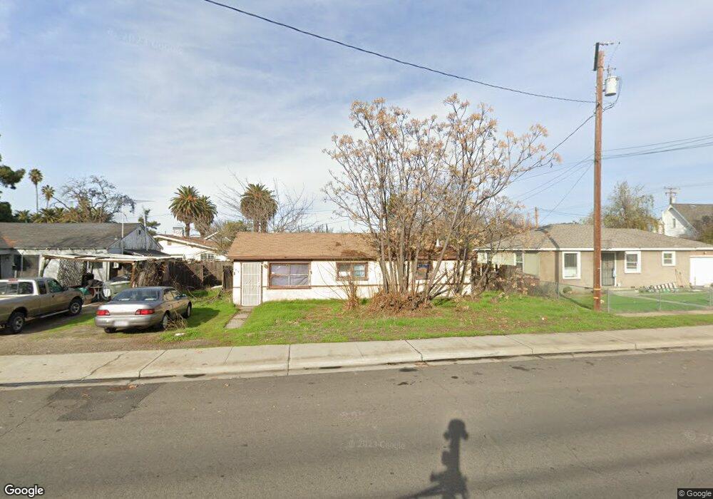
2417 Magnolia St Ceres, CA 95307
Downtown Ceres NeighborhoodEstimated Value: $211,000 - $309,000
2
Beds
1
Bath
672
Sq Ft
$377/Sq Ft
Est. Value
About This Home
This home is located at 2417 Magnolia St, Ceres, CA 95307 and is currently estimated at $253,517, approximately $377 per square foot. 2417 Magnolia St is a home located in Stanislaus County with nearby schools including Cesar Chavez Junior High School, Central Valley High School, and Central Valley Christian Academy.
Ownership History
Date
Name
Owned For
Owner Type
Purchase Details
Closed on
Aug 23, 2017
Sold by
Declarat Johnson Ronald L and Declarat Betty Sargent Johnson
Bought by
Johnson Ronald L
Current Estimated Value
Purchase Details
Closed on
Mar 11, 2014
Sold by
Johnson Betty and Ray & Betty Johnson Trust
Bought by
Betty Sargent Johnson Trust
Purchase Details
Closed on
Dec 29, 1993
Sold by
Johnson Ray and Johnson Betty
Bought by
Johnson Ray and Johnson Betty
Create a Home Valuation Report for This Property
The Home Valuation Report is an in-depth analysis detailing your home's value as well as a comparison with similar homes in the area
Home Values in the Area
Average Home Value in this Area
Purchase History
| Date | Buyer | Sale Price | Title Company |
|---|---|---|---|
| Johnson Ronald L | -- | None Available | |
| Betty Sargent Johnson Trust | -- | None Available | |
| Johnson Ray | -- | -- |
Source: Public Records
Tax History Compared to Growth
Tax History
| Year | Tax Paid | Tax Assessment Tax Assessment Total Assessment is a certain percentage of the fair market value that is determined by local assessors to be the total taxable value of land and additions on the property. | Land | Improvement |
|---|---|---|---|---|
| 2025 | $761 | $64,633 | $19,378 | $45,255 |
| 2024 | $713 | $63,367 | $18,999 | $44,368 |
| 2023 | $694 | $62,126 | $18,627 | $43,499 |
| 2022 | $688 | $60,909 | $18,262 | $42,647 |
| 2021 | $682 | $59,715 | $17,904 | $41,811 |
| 2020 | $657 | $59,104 | $17,721 | $41,383 |
| 2019 | $657 | $57,946 | $17,374 | $40,572 |
| 2018 | $644 | $56,811 | $17,034 | $39,777 |
| 2017 | $639 | $55,698 | $16,700 | $38,998 |
| 2016 | $626 | $54,607 | $16,373 | $38,234 |
| 2015 | $617 | $53,788 | $16,128 | $37,660 |
| 2014 | -- | $52,736 | $15,813 | $36,923 |
Source: Public Records
Map
Nearby Homes
- 3033 Railroad Ave
- 2600 10th St
- 2816 10th St
- 2313 Thomas St
- 2111 Hackett Rd
- 2526 Roeding Rd
- 2004 2nd St
- 2720 Dale Ave
- 3600 Spruce Ave
- 2005 Pleasant Ave
- 2824 Dale Ave
- 2417 Louise Ave
- 3632 9th St
- 1951 Darrah St Unit 1
- 2000 Cardinal Dr
- 3817 Collins Rd
- 3005 Willetts Way
- 2602 Parkway
- 2841 Fowler Rd Unit 149
- 1715 Lois Way