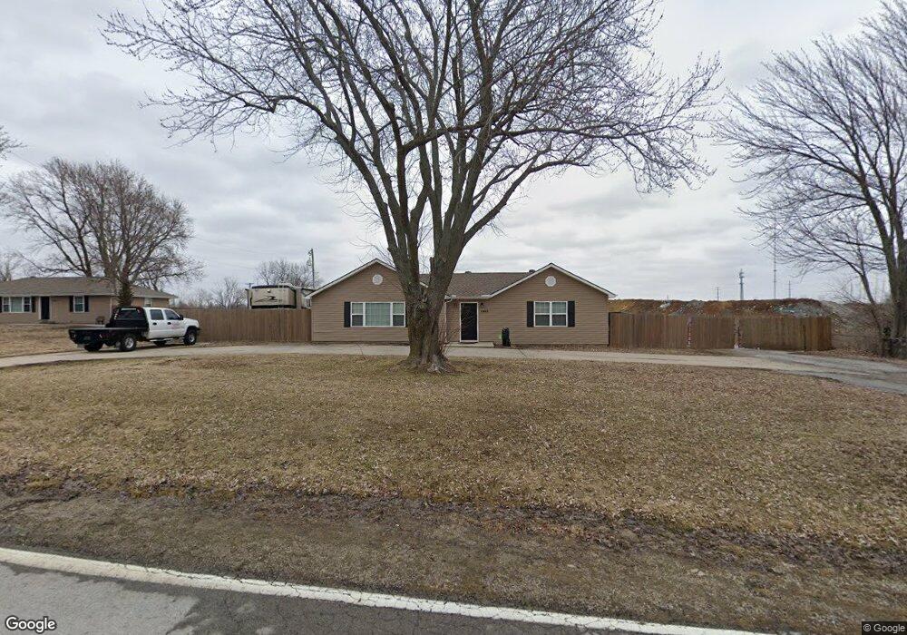
2440 NW Lowenstein Dr Lees Summit, MO 64081
Estimated Value: $227,172 - $410,000
2
Beds
1
Bath
1,084
Sq Ft
$266/Sq Ft
Est. Value
About This Home
This home is located at 2440 NW Lowenstein Dr, Lees Summit, MO 64081 and is currently estimated at $288,293, approximately $265 per square foot. 2440 NW Lowenstein Dr is a home located in Jackson County with nearby schools including Hazel Grove Elementary School, Bernard C. Campbell Middle School, and Lee's Summit North High School.
Ownership History
Date
Name
Owned For
Owner Type
Purchase Details
Closed on
May 6, 2010
Sold by
National Bank Of Kansas City
Bought by
Green Living Properties Llc
Current Estimated Value
Purchase Details
Closed on
Apr 9, 2010
Sold by
Imaginary Mines L L C
Bought by
National Bank Of Kansas City
Purchase Details
Closed on
Dec 22, 2004
Sold by
Wilkinson William C
Bought by
Imaginary Mines Llc
Home Financials for this Owner
Home Financials are based on the most recent Mortgage that was taken out on this home.
Original Mortgage
$114,750
Interest Rate
5.78%
Mortgage Type
Purchase Money Mortgage
Create a Home Valuation Report for This Property
The Home Valuation Report is an in-depth analysis detailing your home's value as well as a comparison with similar homes in the area
Home Values in the Area
Average Home Value in this Area
Purchase History
| Date | Buyer | Sale Price | Title Company |
|---|---|---|---|
| Green Living Properties Llc | -- | Kansas City Title | |
| National Bank Of Kansas City | $49,000 | None Available | |
| Imaginary Mines Llc | -- | Stewart Title Of Ks City Inc |
Source: Public Records
Mortgage History
| Date | Status | Borrower | Loan Amount |
|---|---|---|---|
| Previous Owner | Imaginary Mines Llc | $114,750 |
Source: Public Records
Tax History Compared to Growth
Tax History
| Year | Tax Paid | Tax Assessment Tax Assessment Total Assessment is a certain percentage of the fair market value that is determined by local assessors to be the total taxable value of land and additions on the property. | Land | Improvement |
|---|---|---|---|---|
| 2025 | $1,783 | $21,358 | $12,470 | $8,888 |
| 2024 | $2,097 | $24,700 | $18,791 | $5,909 |
| 2023 | $2,097 | $29,260 | $10,469 | $18,791 |
| 2022 | $1,304 | $16,150 | $2,621 | $13,529 |
| 2021 | $1,331 | $16,150 | $2,621 | $13,529 |
| 2020 | $1,177 | $14,151 | $2,621 | $11,530 |
| 2019 | $1,145 | $14,151 | $2,621 | $11,530 |
| 2018 | $1,074 | $12,315 | $2,281 | $10,034 |
| 2017 | $1,074 | $12,315 | $2,281 | $10,034 |
| 2016 | $1,058 | $12,007 | $1,775 | $10,232 |
| 2014 | $1,079 | $12,007 | $1,775 | $10,232 |
Source: Public Records
Map
Nearby Homes
- 2400 NW Lowenstein Dr
- 13004 E 99th St
- 2436 NW Valley View Dr
- 813 NW High Point Dr
- 2257 NW Summerfield Dr
- 2536 NW Bent Tree Cir
- 2501 NW Shady Bend Ln
- 9600 Dodgion Ct
- 2503 NW Windwood Dr
- 13512 E 95th Terrace
- 130 NW Ambersham Dr
- 2007 NW Chipman Rd
- 2209 NW Wellington Ct
- 505 NW Ambersham Dr
- 1031 NW Cedar Creek Ln
- 928 NW Cedar Creek Ln
- 2122 NW Ashurst Dr
- 2110 NW Ashurst Dr
- 2090 NW O'Brien Rd
- 2086 NW O'Brien Rd
- 2450 NW Lowenstein Dr
- 2325 NW Lowenstein Dr
- 2345 NW Lowenstein Dr
- 2500 NW Clifford Rd
- 9729 Noland Rd
- 1056 NW High Point Dr
- 1052 NW High Point Dr
- 2250 NW Lowenstein Dr
- 1015 NW Silverthorn Dr
- 2305 NW Summerfield Dr
- 1060 NW High Point Dr
- 1048 NW High Point Dr
- 1020 NW Silverthorn Dr
- 1044 NW High Point Dr
- 1009 NW Silverthorn Dr
- 13108 E 99th St
- 2309 NW Summerfield Dr
- 2301 NW Summerfield Dr
- 1064 NW High Point Dr
- 13112 E 99th St