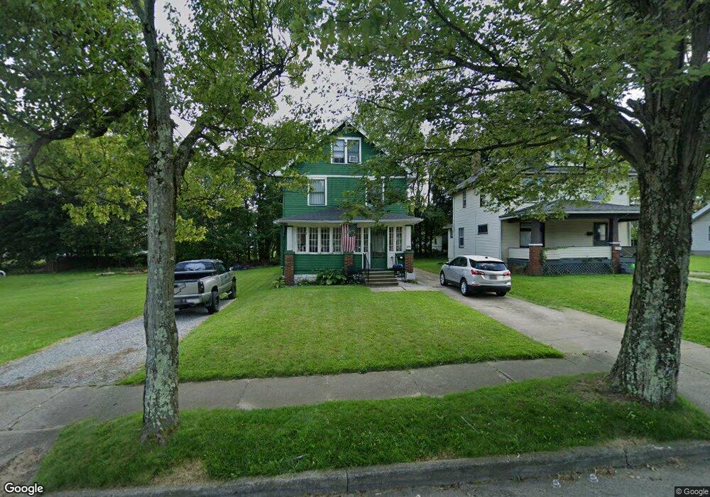
245 E Auburndale Ave Youngstown, OH 44507
Cottage Grove NeighborhoodEstimated Value: $47,977 - $69,000
5
Beds
2
Baths
1,358
Sq Ft
$45/Sq Ft
Est. Value
About This Home
This home is located at 245 E Auburndale Ave, Youngstown, OH 44507 and is currently estimated at $60,744, approximately $44 per square foot. 245 E Auburndale Ave is a home located in Mahoning County with nearby schools including Taft Elementary School, Williamson Elementary School, and East High School.
Ownership History
Date
Name
Owned For
Owner Type
Purchase Details
Closed on
Dec 10, 2019
Sold by
Abold Corporation
Bought by
Execelsis Property Group Ltd
Current Estimated Value
Purchase Details
Closed on
Jan 10, 2002
Sold by
Toth Gary A
Bought by
Abold Corp
Purchase Details
Closed on
Feb 26, 2001
Sold by
Norwest Bank Minnesota Na Trustee
Bought by
Toth Gary A
Purchase Details
Closed on
May 16, 1997
Sold by
Contay Properties Inc
Bought by
Conley Paul A
Home Financials for this Owner
Home Financials are based on the most recent Mortgage that was taken out on this home.
Original Mortgage
$30,100
Interest Rate
8.27%
Purchase Details
Closed on
Sep 29, 1980
Bought by
Bunosky Thomas J
Create a Home Valuation Report for This Property
The Home Valuation Report is an in-depth analysis detailing your home's value as well as a comparison with similar homes in the area
Home Values in the Area
Average Home Value in this Area
Purchase History
| Date | Buyer | Sale Price | Title Company |
|---|---|---|---|
| Execelsis Property Group Ltd | -- | None Available | |
| Abold Corp | -- | -- | |
| Toth Gary A | $4,500 | -- | |
| Conley Paul A | $43,000 | -- | |
| Contay Properties Inc | $18,000 | -- | |
| Bunosky Thomas J | -- | -- |
Source: Public Records
Mortgage History
| Date | Status | Borrower | Loan Amount |
|---|---|---|---|
| Previous Owner | Conley Paul A | $30,100 |
Source: Public Records
Tax History
| Year | Tax Paid | Tax Assessment Tax Assessment Total Assessment is a certain percentage of the fair market value that is determined by local assessors to be the total taxable value of land and additions on the property. | Land | Improvement |
|---|---|---|---|---|
| 2025 | $274 | $6,300 | $610 | $5,690 |
| 2024 | $310 | $6,300 | $610 | $5,690 |
| 2023 | $308 | $6,300 | $610 | $5,690 |
| 2022 | $195 | $3,050 | $680 | $2,370 |
| 2021 | $195 | $3,050 | $680 | $2,370 |
| 2020 | $196 | $3,050 | $680 | $2,370 |
| 2019 | $200 | $2,760 | $610 | $2,150 |
| 2018 | $233 | $2,760 | $610 | $2,150 |
| 2017 | $199 | $2,760 | $610 | $2,150 |
| 2016 | $519 | $3,270 | $610 | $2,660 |
| 2015 | $364 | $3,270 | $610 | $2,660 |
| 2014 | $213 | $3,270 | $610 | $2,660 |
| 2013 | $210 | $3,270 | $610 | $2,660 |
Source: Public Records
Map
Nearby Homes
- 320 E Auburndale Ave
- 221 E Avondale Ave
- 178 E Ravenwood Ave
- 359 Potomac Ave
- 3919 Rush Blvd
- 124 E Midlothian Blvd
- 559 E Avondale Ave
- 173 Clarencedale Ave
- 582 Roxbury Ave
- 192 Hollywood Ave
- 328 Marmion Ave
- 32 E Avondale Ave
- 72 Labelle Ave
- 4038 Sunset Blvd
- 353 Cornell Ave
- 734 Cambridge Ave
- 3031 Market St
- 4206 Rush Blvd
- 28 W Philadelphia Ave
- 3916 Howard St
- 241 E Auburndale Ave
- 253 E Auburndale Ave
- 248 E Ravenwood Ave
- 235 E Auburndale Ave
- 257 E Auburndale Ave
- 242 E Ravenwood Ave
- 250 E Ravenwood Ave
- 256 E Ravenwood Ave
- 246 E Auburndale Ave
- 233 E Auburndale Ave
- 261 E Auburndale Ave
- 260 E Ravenwood Ave
- 234 E Ravenwood Ave
- 250 E Auburndale Ave
- 242 E Auburndale Ave
- 238 E Auburndale Ave
- 254 E Auburndale Ave
- 267 E Auburndale Ave
- 230 E Ravenwood Ave
- 231 E Auburndale Ave
Your Personal Tour Guide
Ask me questions while you tour the home.