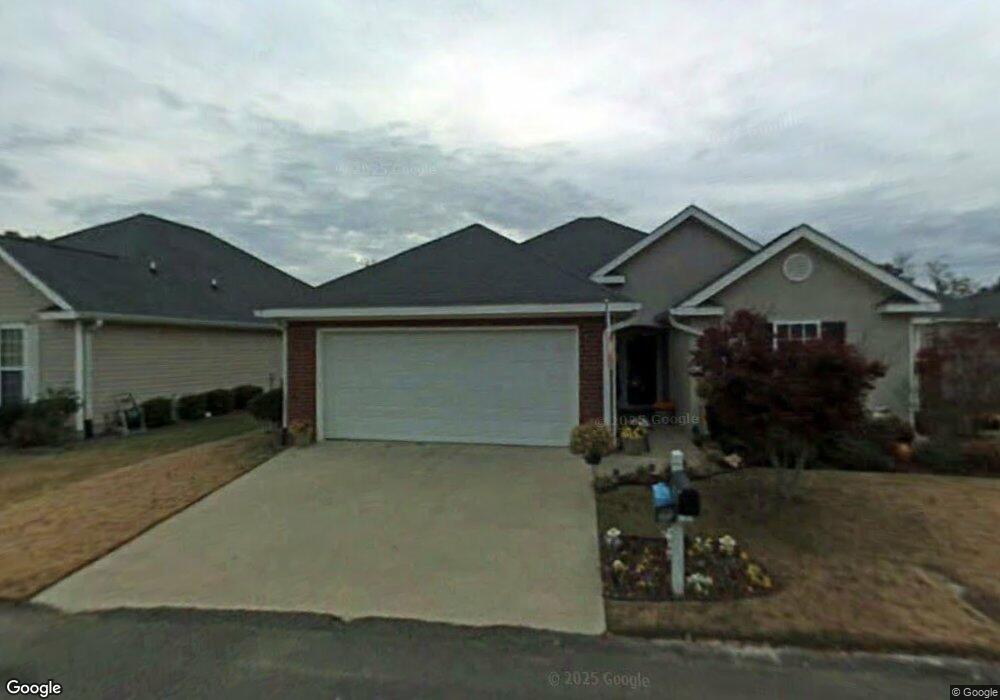
248 Hudson Trace Augusta, GA 30907
Westside NeighborhoodEstimated Value: $211,681 - $226,000
2
Beds
2
Baths
1,276
Sq Ft
$173/Sq Ft
Est. Value
About This Home
This home is located at 248 Hudson Trace, Augusta, GA 30907 and is currently estimated at $221,170, approximately $173 per square foot. 248 Hudson Trace is a home located in Richmond County with nearby schools including Warren Road Elementary School, Tutt Middle School, and Johnson Magnet.
Ownership History
Date
Name
Owned For
Owner Type
Purchase Details
Closed on
Sep 19, 2000
Sold by
Suntrust Mtg Inc
Bought by
Peterson David and Peterson Yolanda F
Current Estimated Value
Purchase Details
Closed on
Jun 11, 1998
Sold by
D&H Development Inc D & H Development I
Bought by
Peterson David Peterson Yolanda F
Purchase Details
Closed on
Nov 27, 1996
Sold by
Whisenhunt Children Inc
Bought by
Whisenhunt Children Inc
Purchase Details
Closed on
Jun 18, 1996
Sold by
Whisenhunt Children Inc
Bought by
D & H Development Inc D&H Development
Purchase Details
Closed on
Jun 12, 1996
Sold by
Kuhkle William B
Bought by
Whisenhunt Children
Purchase Details
Closed on
Jan 17, 1995
Sold by
Whisenhunt Trent
Bought by
Whisenhunt Children Inc
Create a Home Valuation Report for This Property
The Home Valuation Report is an in-depth analysis detailing your home's value as well as a comparison with similar homes in the area
Home Values in the Area
Average Home Value in this Area
Purchase History
| Date | Buyer | Sale Price | Title Company |
|---|---|---|---|
| Peterson David | -- | -- | |
| Peterson David Peterson Yolanda F | -- | -- | |
| Whisenhunt Children Inc | -- | -- | |
| D & H Development Inc D&H Development | -- | -- | |
| Whisenhunt Children | -- | -- | |
| Whisenhunt Children Inc | -- | -- |
Source: Public Records
Tax History
| Year | Tax Paid | Tax Assessment Tax Assessment Total Assessment is a certain percentage of the fair market value that is determined by local assessors to be the total taxable value of land and additions on the property. | Land | Improvement |
|---|---|---|---|---|
| 2025 | $373 | $88,672 | $11,400 | $77,272 |
| 2024 | $373 | $82,648 | $11,400 | $71,248 |
| 2023 | $240 | $79,964 | $11,400 | $68,564 |
| 2022 | $233 | $45,536 | $11,400 | $34,136 |
| 2021 | $233 | $50,307 | $11,400 | $38,907 |
| 2020 | $233 | $49,001 | $11,400 | $37,601 |
| 2019 | $233 | $45,666 | $10,400 | $35,266 |
| 2018 | $233 | $45,666 | $10,400 | $35,266 |
| 2017 | $233 | $45,666 | $10,400 | $35,266 |
| 2016 | $233 | $45,666 | $10,400 | $35,266 |
| 2015 | $235 | $45,666 | $10,400 | $35,266 |
| 2014 | $1,403 | $45,666 | $10,400 | $35,266 |
Source: Public Records
Map
Nearby Homes
- 1217 Kendal Ct
- 1208 Colony Place Dr
- 1017 Stevens Creek Rd
- 1017 Stevens Creek Rd Unit G186
- 2111 Turtle Ct
- 1003 Windsong Cir
- 1001 Windsong Cir
- 1106 Windsong Cir
- 35 Charlestowne Dr
- 104 York Way
- 2171 River Park Ct
- 804 Sterling Ct
- 2330 Lions Gate Dr
- 2020 Autumn Chase
- 2014 Autumn Chase
- 863 Brookfield Pkwy
- 26 Mulberry Ln
- 32 Queens Ct
- 810 Mayo Ln
- 3103 Clay Hill Dr
- 246 Hudson Trace
- 511 Ellison Way
- 250 Hudson Trace
- 247 Hudson Trace
- 501 Ellison Way
- 244 Hudson Trace
- 245 Hudson Trace
- 249 Hudson Trace
- 304 Alcock Way
- 508 Ellison Way
- 302 Alcock Way
- 510 Ellison Way
- 306 Alcock Way
- 506 Ellison Way
- 243 Hudson Trace
- 512 Ellison Way
- 504 Ellison Way
- 308 Alcock Way
- 251 Hudson Trace
- 514 Ellison Way
Your Personal Tour Guide
Ask me questions while you tour the home.