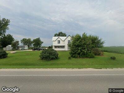
2485 Jametown Ave Independence, IA 50644
Estimated Value: $164,000 - $273,000
5
Beds
2
Baths
2,312
Sq Ft
$94/Sq Ft
Est. Value
About This Home
This home is located at 2485 Jametown Ave, Independence, IA 50644 and is currently estimated at $216,480, approximately $93 per square foot. 2485 Jametown Ave is a home located in Buchanan County with nearby schools including West Elementary School, East Elementary School, and Independence Junior/Senior High School.
Ownership History
Date
Name
Owned For
Owner Type
Purchase Details
Closed on
Jan 15, 2025
Sold by
Paris Tyler Dennis and Paris Amanda Anne
Bought by
Paris Dexter John and Paris Morgan Arias
Current Estimated Value
Purchase Details
Closed on
Aug 31, 2021
Sold by
Mostek and Traci
Bought by
Mostek Timothy and Mostek Traci
Create a Home Valuation Report for This Property
The Home Valuation Report is an in-depth analysis detailing your home's value as well as a comparison with similar homes in the area
Home Values in the Area
Average Home Value in this Area
Purchase History
| Date | Buyer | Sale Price | Title Company |
|---|---|---|---|
| Paris Dexter John | $339,000 | None Listed On Document | |
| Mostek Timothy | -- | None Listed On Document |
Source: Public Records
Mortgage History
| Date | Status | Borrower | Loan Amount |
|---|---|---|---|
| Previous Owner | Paris Dexter John | $161,700 | |
| Previous Owner | Mostek Timothy E | $123,500 | |
| Previous Owner | Heeren Todd W | $22,300 | |
| Previous Owner | Heeren Todd W | $93,000 | |
| Previous Owner | Heeren Todd W | $18,900 |
Source: Public Records
Tax History Compared to Growth
Tax History
| Year | Tax Paid | Tax Assessment Tax Assessment Total Assessment is a certain percentage of the fair market value that is determined by local assessors to be the total taxable value of land and additions on the property. | Land | Improvement |
|---|---|---|---|---|
| 2024 | $1,602 | $150,840 | $46,520 | $104,320 |
| 2023 | $1,602 | $150,840 | $46,520 | $104,320 |
| 2022 | $1,656 | $121,660 | $37,150 | $84,510 |
| 2021 | $1,676 | $120,510 | $37,150 | $83,360 |
| 2020 | $1,676 | $110,830 | $33,750 | $77,080 |
| 2019 | $1,590 | $110,830 | $33,750 | $77,080 |
| 2018 | $1,492 | $108,160 | $33,750 | $74,410 |
| 2017 | $1,394 | $108,160 | $33,750 | $74,410 |
| 2016 | $1,366 | $98,180 | $25,590 | $72,590 |
| 2015 | $1,366 | $98,180 | $25,590 | $72,590 |
| 2014 | $1,686 | $115,710 | $25,590 | $90,120 |
Source: Public Records
Map
Nearby Homes
- Lot 8-9 Pine Dr
- 803 & 805 Pine Dr
- 176 Goldfinch Ct
- 179 Hummingbird Ct N Unit 7
- 2086 3 Elms Park Rd
- 1409 Kellie Ave SW
- 407 Matthew St
- 170 Hummingbird Ct
- 601 Bland Blvd
- 1017 7th Ave SW
- 810 3rd Ave SW
- 200 8th St NE
- 320 6th St SE
- 208 6th St SE
- 516 SE 5th Ave
- 508 5th Ave SE
- 509 SE 6th Ave
- 610 2nd Ave SW
- 507 Upper Terrace Dr
- 404 3rd Ave SE
- 2485 Jametown Ave
- 2485 Jamestown Ave
- 2469 Jamestown Ave
- 00 Jamestown Ave
- 2513 Jamestown Ave
- 2510 Jamestown Ave
- 2450 Jamestown Ave
- 1940 252nd St
- 1930 252nd St
- 1915 252nd St
- 2547 Jamestown Ave
- 2410 Jamestown Ave
- 2561 Jamestown Ave Unit 2563
- 2409 Jamestown Ave
- 2560 Jamestown Ave
- 2565 Jamestown Ave
- 1888 252nd St
- 2395 Jamestown Ave
- 2029 255th St
- 2458 Brandon Diagonal Blvd