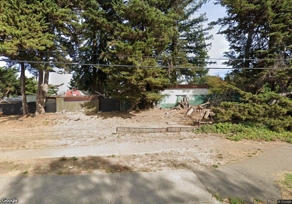
25 Myrtle Ave Cotati, CA 94931
Estimated Value: $736,000 - $895,000
3
Beds
1
Bath
1,346
Sq Ft
$595/Sq Ft
Est. Value
About This Home
This home is located at 25 Myrtle Ave, Cotati, CA 94931 and is currently estimated at $801,488, approximately $595 per square foot. 25 Myrtle Ave is a home located in Sonoma County with nearby schools including Rancho Cotate High School, Cross & Crown Lutheran School, and Bridghaven.
Ownership History
Date
Name
Owned For
Owner Type
Purchase Details
Closed on
Apr 24, 2000
Sold by
Wester John J and Engler Paulette Chamberlin
Bought by
Obrien Peter M and Obrien Mary A
Current Estimated Value
Home Financials for this Owner
Home Financials are based on the most recent Mortgage that was taken out on this home.
Original Mortgage
$317,500
Outstanding Balance
$108,853
Interest Rate
8.24%
Estimated Equity
$692,635
Create a Home Valuation Report for This Property
The Home Valuation Report is an in-depth analysis detailing your home's value as well as a comparison with similar homes in the area
Home Values in the Area
Average Home Value in this Area
Purchase History
| Date | Buyer | Sale Price | Title Company |
|---|---|---|---|
| Obrien Peter M | $397,500 | Old Republic Title Company | |
| Engler Paulette Chamberlin | -- | Old Republic Title Company | |
| Wester John J | -- | Old Republic Title Company |
Source: Public Records
Mortgage History
| Date | Status | Borrower | Loan Amount |
|---|---|---|---|
| Open | Obrien Peter M | $317,500 |
Source: Public Records
Tax History
| Year | Tax Paid | Tax Assessment Tax Assessment Total Assessment is a certain percentage of the fair market value that is determined by local assessors to be the total taxable value of land and additions on the property. | Land | Improvement |
|---|---|---|---|---|
| 2025 | $7,246 | $610,942 | $268,966 | $341,976 |
| 2024 | $7,246 | $598,964 | $263,693 | $335,271 |
| 2023 | $7,246 | $587,221 | $258,523 | $328,698 |
| 2022 | $7,092 | $575,707 | $253,454 | $322,253 |
| 2021 | $7,029 | $564,420 | $248,485 | $315,935 |
| 2020 | $7,120 | $558,634 | $245,938 | $312,696 |
| 2019 | $7,029 | $547,681 | $241,116 | $306,565 |
| 2018 | $6,639 | $536,943 | $236,389 | $300,554 |
| 2017 | $6,528 | $526,415 | $231,754 | $294,661 |
| 2016 | $6,262 | $516,094 | $227,210 | $288,884 |
| 2015 | $4,778 | $395,000 | $174,000 | $221,000 |
| 2014 | $4,838 | $395,000 | $174,000 | $221,000 |
Source: Public Records
Map
Nearby Homes
- 95 Jagla St
- 9 Ramble Creek Dr
- 65 Lasker Ln
- 8873 Lebec Ln
- 293 Lincoln Ave
- 105 Falcon Dr
- 8383 Lasalle Ave Unit 66
- 8175 Arthur St
- 9011 Cypress Ave
- 302 Floral Dr
- 286 Bruce Ave
- 8 Bay Tree Ct
- 8633 Lancaster Dr
- 117 Silver Dr
- 79 William St Unit S
- 7799 Blair Ave
- 850 E Cotati Ave Unit 11
- 6698 Santero Way
- 8020 Beverly Dr
- 1217 Mateo Dr
- 8540 Park Ave
- 8554 Park Ave
- 8520 Park Ave
- 216 Mendelssohn Ct
- 8510 Park Ave
- 208 Mendelssohn Ct
- 204 Mendelssohn Ct
- 8480 Park Ave
- 200 Mendelssohn Ct
- 8575 Old Redwood Hwy
- 103 Macklin Dr
- 103 Forno Way
- 101 Forno Way
- 109 Forno Way
- 56 Benson Ln
- 113 Forno Way
- 211 Mendelssohn Ct
- 107 Macklin Dr
- 117 Forno Way
- 207 Mendelssohn Ct
Your Personal Tour Guide
Ask me questions while you tour the home.