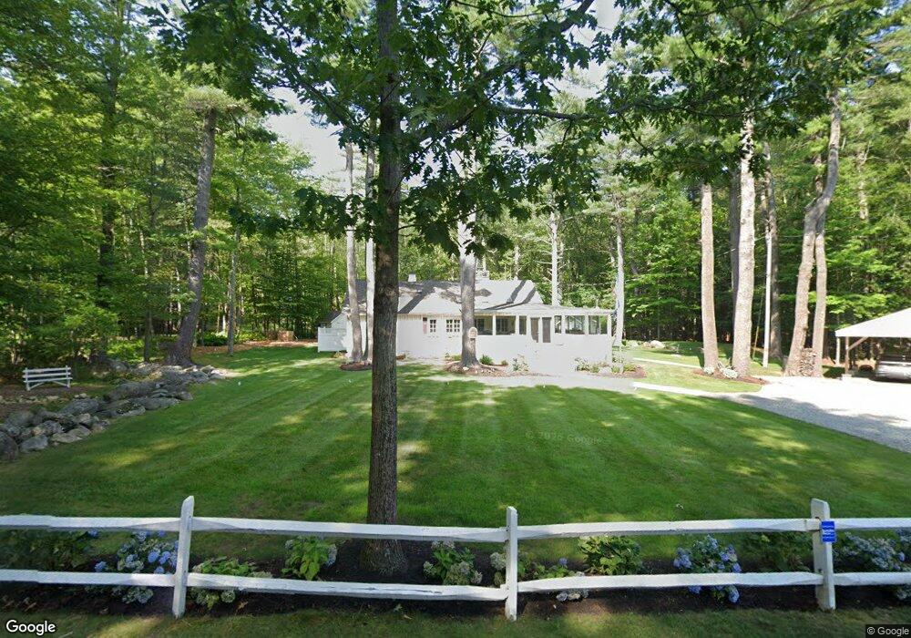
25 Pineway Gilford, NH 03249
Estimated Value: $726,000 - $966,000
3
Beds
2
Baths
1,288
Sq Ft
$643/Sq Ft
Est. Value
About This Home
This home is located at 25 Pineway, Gilford, NH 03249 and is currently estimated at $827,989, approximately $642 per square foot. 25 Pineway is a home located in Belknap County with nearby schools including Gilford Elementary School, Gilford Middle School, and Gilford High School.
Ownership History
Date
Name
Owned For
Owner Type
Purchase Details
Closed on
Jul 2, 2001
Sold by
Dupuis Gary J and Dupuis Carole W
Bought by
Strathern David and Strathern Mary
Current Estimated Value
Home Financials for this Owner
Home Financials are based on the most recent Mortgage that was taken out on this home.
Original Mortgage
$60,000
Interest Rate
7.14%
Create a Home Valuation Report for This Property
The Home Valuation Report is an in-depth analysis detailing your home's value as well as a comparison with similar homes in the area
Home Values in the Area
Average Home Value in this Area
Purchase History
| Date | Buyer | Sale Price | Title Company |
|---|---|---|---|
| Strathern David | $100,000 | -- |
Source: Public Records
Mortgage History
| Date | Status | Borrower | Loan Amount |
|---|---|---|---|
| Open | Strathern David | $132,000 | |
| Closed | Strathern David | $60,000 |
Source: Public Records
Tax History Compared to Growth
Tax History
| Year | Tax Paid | Tax Assessment Tax Assessment Total Assessment is a certain percentage of the fair market value that is determined by local assessors to be the total taxable value of land and additions on the property. | Land | Improvement |
|---|---|---|---|---|
| 2024 | $6,849 | $608,800 | $359,700 | $249,100 |
| 2023 | $6,271 | $608,800 | $359,700 | $249,100 |
| 2022 | $5,302 | $432,800 | $209,700 | $223,100 |
| 2021 | $5,315 | $432,800 | $209,700 | $223,100 |
| 2020 | $5,032 | $334,800 | $209,700 | $125,100 |
| 2019 | $5,056 | $318,800 | $115,100 | $203,700 |
| 2018 | $3,961 | $232,430 | $86,330 | $146,100 |
| 2017 | $3,705 | $214,630 | $86,330 | $128,300 |
| 2016 | $3,750 | $208,920 | $95,920 | $113,000 |
| 2015 | $3,661 | $203,720 | $95,920 | $107,800 |
| 2011 | $4,196 | $226,200 | $119,900 | $106,300 |
Source: Public Records
Map
Nearby Homes
- 164 Edgewater Dr
- 288 Sterling Dr
- 280 Sterling Dr
- 276 Sterling Dr
- 111 Pendleton Rd
- 596 Endicott St E
- 291 Sterling Dr
- 267 Sterling Dr
- 266 Sterling Dr
- 125 Sterling Dr
- 60 Colonial Rd
- 30 Melissa Way Unit B
- 148 Lucerne Ave Unit 4
- 252 Skyview Ln
- 51 Skyview Ln
- 38 Sparrow Ln
- 205 Skyview Ln
- 8 Leisure Time Ln
- 16 Leisure Time Ln
- 2 Harris Rd
- 13 Pineway
- 33 Pineway
- 29 Pineway
- 26 Pineway
- 43 Pineway
- 36 Pineway
- 120 Summit Ave
- 34 Blueberry Hill Ln
- 26 Blueberry Hill Ln
- 106 Summit Ave
- 90 Blueberry Hill Ln
- 121 Summit Ave
- 46 Blueberry Hill Ln
- 138 Summit Ave
- 103 Blueberry Hill Ln
- 4 Natalies Way
- 50 Blueberry Hill Ln
- 92 Summit Ave
- 2 Natalies Way
- 16 Blueberry Hill Ln