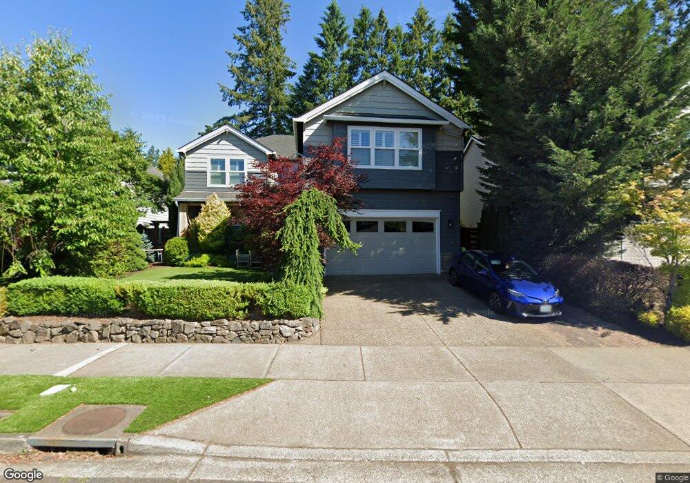
2500 Crestview Dr West Linn, OR 97068
Savanna Oaks NeighborhoodEstimated Value: $834,922 - $1,388,000
5
Beds
3
Baths
2,722
Sq Ft
$382/Sq Ft
Est. Value
About This Home
This home is located at 2500 Crestview Dr, West Linn, OR 97068 and is currently estimated at $1,039,981, approximately $382 per square foot. 2500 Crestview Dr is a home located in Clackamas County with nearby schools including Trillium Creek Primary School, Rosemont Ridge Middle School, and West Linn High School.
Ownership History
Date
Name
Owned For
Owner Type
Purchase Details
Closed on
Oct 7, 2020
Sold by
Pakula Jennifer L and Gelfand Scott
Bought by
Pakula Jennifer L and Gelfand Scot J
Current Estimated Value
Purchase Details
Closed on
Apr 4, 2000
Sold by
Marnella Llc
Bought by
Pakula Jennifer L and Gelfand Scot
Home Financials for this Owner
Home Financials are based on the most recent Mortgage that was taken out on this home.
Original Mortgage
$263,000
Interest Rate
6.9%
Create a Home Valuation Report for This Property
The Home Valuation Report is an in-depth analysis detailing your home's value as well as a comparison with similar homes in the area
Home Values in the Area
Average Home Value in this Area
Purchase History
| Date | Buyer | Sale Price | Title Company |
|---|---|---|---|
| Pakula Jennifer L | -- | None Available | |
| Pakula Jennifer L | $340,353 | Fidelity National Title Co |
Source: Public Records
Mortgage History
| Date | Status | Borrower | Loan Amount |
|---|---|---|---|
| Previous Owner | Pakula Jennifer L | $263,000 |
Source: Public Records
Tax History
| Year | Tax Paid | Tax Assessment Tax Assessment Total Assessment is a certain percentage of the fair market value that is determined by local assessors to be the total taxable value of land and additions on the property. | Land | Improvement |
|---|---|---|---|---|
| 2025 | $10,133 | $525,800 | -- | -- |
| 2024 | $9,754 | $510,486 | -- | -- |
| 2023 | $9,754 | $495,618 | $0 | $0 |
| 2022 | $9,206 | $481,183 | $0 | $0 |
| 2021 | $8,448 | $457,677 | $0 | $0 |
| 2020 | $8,379 | $444,347 | $0 | $0 |
| 2019 | $8,012 | $431,405 | $0 | $0 |
| 2018 | $7,644 | $418,840 | $0 | $0 |
| 2017 | $7,361 | $406,641 | $0 | $0 |
| 2016 | $7,042 | $394,797 | $0 | $0 |
Source: Public Records
Map
Nearby Homes
- 22872 Weatherhill Rd
- 2255 Crestview Dr
- 22880 Weatherhill Rd
- 22898 Weatherhill Rd
- 2288 Saint Moritz Loop
- 3496 Chaparrel Loop
- 22998 Bland Cir
- 2311 Falcon Dr
- 3490 Chaparrel Loop
- 3486 Chaparrel Loop
- 2050 Alpine Dr
- 6795 Summerlinn Way Unit 90
- 6840 Summerlinn Way Unit 93
- 2378 Falcon Dr
- 6535 Summerlinn Way Unit 81
- 2360 Falcon Dr
- 3135 Summerlinn Dr Unit 40
- 2539 Limerick Ln
- 4650 Summerlinn Way
- 1640 Village Park Place
- 2512 Crestview Dr
- 2498 Crestview Dr
- 2524 Crestview Dr
- 2486 Crestview Dr
- 2503 Satter St
- 2515 Satter St
- 2536 Crestview Dr
- 2491 Satter St
- 2507 Crestview Dr
- 2507 Crestview(relist)
- 2495 Crestview Dr
- 2474 Crestview Dr
- 2511 Crestview Dr
- 2527 Satter St Unit L06
- 2483 Crestview Dr
- 2479 Satter St
- 2467 Satter St
- 2531 Crestview Dr
- 2471 Crestview Dr
- 2539 Satter St Unit L07
Your Personal Tour Guide
Ask me questions while you tour the home.