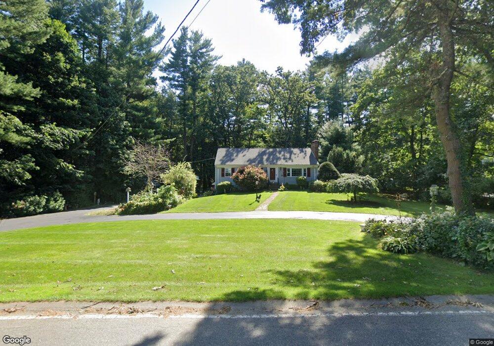
26 Argilla Rd Andover, MA 01810
West Andover NeighborhoodEstimated Value: $953,219 - $1,217,000
4
Beds
3
Baths
2,327
Sq Ft
$469/Sq Ft
Est. Value
About This Home
This home is located at 26 Argilla Rd, Andover, MA 01810 and is currently estimated at $1,090,805, approximately $468 per square foot. 26 Argilla Rd is a home located in Essex County with nearby schools including West Elementary School, Andover West Middle School, and Andover High School.
Ownership History
Date
Name
Owned For
Owner Type
Purchase Details
Closed on
Mar 19, 2015
Sold by
Lenihan John M and Lenihan Barbara R
Bought by
Lenihan
Current Estimated Value
Purchase Details
Closed on
Dec 14, 1995
Sold by
Cronin Leo J
Bought by
Lenihan John M
Home Financials for this Owner
Home Financials are based on the most recent Mortgage that was taken out on this home.
Original Mortgage
$150,000
Interest Rate
7.43%
Mortgage Type
Purchase Money Mortgage
Purchase Details
Closed on
Feb 28, 1994
Sold by
Taft Walter L
Bought by
Cronin Leo J
Create a Home Valuation Report for This Property
The Home Valuation Report is an in-depth analysis detailing your home's value as well as a comparison with similar homes in the area
Home Values in the Area
Average Home Value in this Area
Purchase History
| Date | Buyer | Sale Price | Title Company |
|---|---|---|---|
| Lenihan | -- | -- | |
| Lenihan | -- | -- | |
| Lenihan John M | $230,000 | -- | |
| Lenihan John M | $230,000 | -- | |
| Cronin Leo J | $223,000 | -- | |
| Cronin Leo J | $223,000 | -- |
Source: Public Records
Mortgage History
| Date | Status | Borrower | Loan Amount |
|---|---|---|---|
| Previous Owner | Cronin Leo J | $135,000 | |
| Previous Owner | Cronin Leo J | $150,000 |
Source: Public Records
Tax History Compared to Growth
Tax History
| Year | Tax Paid | Tax Assessment Tax Assessment Total Assessment is a certain percentage of the fair market value that is determined by local assessors to be the total taxable value of land and additions on the property. | Land | Improvement |
|---|---|---|---|---|
| 2024 | $10,486 | $814,100 | $532,400 | $281,700 |
| 2023 | $10,028 | $734,100 | $479,400 | $254,700 |
| 2022 | $9,297 | $636,800 | $417,000 | $219,800 |
| 2021 | $8,890 | $581,400 | $379,100 | $202,300 |
| 2020 | $8,526 | $568,000 | $370,000 | $198,000 |
| 2019 | $8,111 | $531,200 | $338,100 | $193,100 |
| 2018 | $7,865 | $502,900 | $325,000 | $177,900 |
| 2017 | $7,516 | $495,100 | $318,700 | $176,400 |
| 2016 | $7,337 | $495,100 | $318,700 | $176,400 |
| 2015 | $7,082 | $473,100 | $306,500 | $166,600 |
Source: Public Records
Map
Nearby Homes
- 18 Bryan Ln Unit 18
- 105 Central St
- 103 Central St
- 47 Abbot St
- 31 Porter Rd
- Lot 7 Weeping Willow Dr
- 9 Chapman Ave
- 42 Stevens St
- 4 Hazelwood Cir
- 4 Hammond Way
- 18 Dale St Unit 4G
- 37 Crenshaw Ln Unit 37
- 25 Timothy Dr
- 38 Lincoln Cir E
- 2 Powder Mill Square Unit 2B
- 10 Maple Ave Unit 3
- 3 West Hollow
- 61 Elm St Unit 61
- 50 Hidden Rd
- 5 Castle Heights Rd
- 28 Argilla Rd
- 24 Argilla Rd
- 2 Meadow View Ln
- 1 Meadow View Ln
- 9 Heritage Ln
- 30 Argilla Rd
- 44 Michael Way
- 42 Michael Way
- 40 Michael Way
- 38 Michael Way
- 36 Michael Way
- 34 Michael Way
- 40 Michael Way Unit 2
- 36 Michael Way
- 44 Michael Way Unit 27
- 40 Michael Way Unit 40
- 29 Argilla Rd
- 29 Argilla Rd Unit a
- 2 Homestead Cir
- 10 Heritage Ln