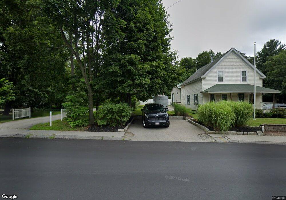
26 Main St Boylston, MA 01505
Estimated Value: $498,000 - $558,000
2
Beds
3
Baths
1,568
Sq Ft
$340/Sq Ft
Est. Value
About This Home
This home is located at 26 Main St, Boylston, MA 01505 and is currently estimated at $533,195, approximately $340 per square foot. 26 Main St is a home located in Worcester County with nearby schools including Tahanto Regional High School, Central New England Christian Academy, and St John's High School.
Ownership History
Date
Name
Owned For
Owner Type
Purchase Details
Closed on
Dec 18, 2024
Sold by
Foley Robyn L and Hazen Faith
Bought by
Hazen Faith
Current Estimated Value
Purchase Details
Closed on
Dec 30, 2020
Sold by
Hazen Faith
Bought by
Foley Robyn L
Create a Home Valuation Report for This Property
The Home Valuation Report is an in-depth analysis detailing your home's value as well as a comparison with similar homes in the area
Home Values in the Area
Average Home Value in this Area
Purchase History
| Date | Buyer | Sale Price | Title Company |
|---|---|---|---|
| Hazen Faith | -- | None Available | |
| Foley Robyn L | -- | None Available |
Source: Public Records
Tax History Compared to Growth
Tax History
| Year | Tax Paid | Tax Assessment Tax Assessment Total Assessment is a certain percentage of the fair market value that is determined by local assessors to be the total taxable value of land and additions on the property. | Land | Improvement |
|---|---|---|---|---|
| 2025 | $5,929 | $428,700 | $151,700 | $277,000 |
| 2024 | $5,448 | $394,500 | $151,700 | $242,800 |
| 2023 | $5,710 | $396,500 | $160,900 | $235,600 |
| 2022 | $5,134 | $324,100 | $160,900 | $163,200 |
| 2021 | $5,279 | $310,900 | $160,900 | $150,000 |
| 2020 | $4,692 | $283,700 | $138,900 | $144,800 |
| 2019 | $4,408 | $274,800 | $136,100 | $138,700 |
| 2018 | $4,490 | $268,400 | $136,100 | $132,300 |
| 2017 | $4,327 | $268,400 | $136,100 | $132,300 |
| 2016 | $4,350 | $265,700 | $129,700 | $136,000 |
| 2015 | $4,626 | $265,700 | $129,700 | $136,000 |
| 2014 | $4,280 | $246,100 | $116,500 | $129,600 |
Source: Public Records
Map
Nearby Homes
- 2 Poe Ave Unit 1
- 12 Birchwood Dr
- 28 Sewall St
- 88 Nicholas Ave
- 313 Gulf St
- 22 Ridge Rd
- 2 Burkhardt Cir Unit 5
- 35 Cobblestone Ln Unit 35
- 345 Sewall St
- 12 Enaya Cir
- 2 Morgan Cir Unit 16
- 291 Sewall St Unit 291
- 289 Sewall St Unit 289
- 2 Maria Ln Unit 2
- 281 Sewall St Unit 281
- 279 Sewall St Unit 279
- 45 Compass Cir Unit 45A
- 655 Plantation St Unit 17 Bldg B
- 247 Saint Nicholas Ave
- 1 Temple Ct