Estimated Value: $429,809 - $476,000
2
Beds
1
Bath
1,316
Sq Ft
$341/Sq Ft
Est. Value
About This Home
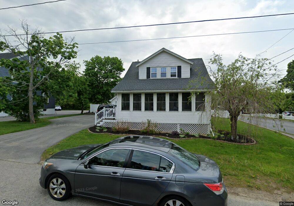
This home is located at 26 Pearl St, Dover, NH 03820 and is currently estimated at $448,702, approximately $340 per square foot. 26 Pearl St is a home located in Strafford County with nearby schools including Horne Street School, Dover Middle School, and Dover Senior High School.
Ownership History
Date
Name
Owned For
Owner Type
Purchase Details
Closed on
Jul 24, 2006
Sold by
Moore Muriel J
Bought by
Paradis Jason M and Paradis Jennifer M
Current Estimated Value
Home Financials for this Owner
Home Financials are based on the most recent Mortgage that was taken out on this home.
Original Mortgage
$206,605
Outstanding Balance
$70,292
Interest Rate
6.67%
Estimated Equity
$378,410
Purchase Details
Closed on
Sep 26, 1997
Sold by
Fernald Maureen G
Bought by
Moore Muriel J
Home Financials for this Owner
Home Financials are based on the most recent Mortgage that was taken out on this home.
Original Mortgage
$84,600
Interest Rate
7.47%
Create a Home Valuation Report for This Property
The Home Valuation Report is an in-depth analysis detailing your home's value as well as a comparison with similar homes in the area
Home Values in the Area
Average Home Value in this Area
Purchase History
| Date | Buyer | Sale Price | Title Company |
|---|---|---|---|
| Paradis Jason M | $205,000 | -- | |
| Paradis Jason M | $205,000 | -- | |
| Moore Muriel J | $89,100 | -- |
Source: Public Records
Mortgage History
| Date | Status | Borrower | Loan Amount |
|---|---|---|---|
| Open | Paradis Jason M | $206,605 | |
| Closed | Moore Muriel J | $206,605 | |
| Previous Owner | Moore Muriel J | $84,600 |
Source: Public Records
Tax History Compared to Growth
Tax History
| Year | Tax Paid | Tax Assessment Tax Assessment Total Assessment is a certain percentage of the fair market value that is determined by local assessors to be the total taxable value of land and additions on the property. | Land | Improvement |
|---|---|---|---|---|
| 2024 | $7,346 | $404,300 | $156,100 | $248,200 |
| 2023 | $6,846 | $366,100 | $148,300 | $217,800 |
| 2022 | $6,692 | $337,300 | $140,500 | $196,800 |
| 2021 | $6,744 | $310,800 | $132,600 | $178,200 |
| 2020 | $6,541 | $263,200 | $117,000 | $146,200 |
| 2019 | $6,260 | $248,500 | $105,300 | $143,200 |
| 2018 | $6,016 | $241,400 | $101,400 | $140,000 |
| 2017 | $5,738 | $221,800 | $85,800 | $136,000 |
| 2016 | $5,295 | $201,400 | $82,400 | $119,000 |
| 2015 | $5,064 | $190,300 | $74,200 | $116,100 |
| 2014 | $4,950 | $190,300 | $74,200 | $116,100 |
| 2011 | $4,316 | $171,800 | $64,500 | $107,300 |
Source: Public Records
Map
Nearby Homes
- 36 Oak St
- 96 Broadway Unit 98
- 34 Floral Ave Unit 5
- 713 Central Ave Unit 1
- 725 Central Ave Unit 203
- 725 Central Ave Unit LL03
- 725 Central Ave Unit 301
- 725 Central Ave Unit 302
- 725 Central Ave Unit LL01
- 725 Central Ave Unit 304
- 45 New York St Unit 8
- 39 New York St
- 47 Central Ave
- 23 Townsend Dr
- 18 5th St
- 63 Sixth St
- 46-50 Cocheco St
- 25 School St Unit 7
- 24 Atlantic Ave
- 27 Atlantic Ave
- 22 Pearl St Unit A
- 22 Pearl St
- 15 Florence St Unit 17
- 24 Florence St
- 24 Florence St
- 21 Pearl St
- 13 Florence St
- 17-19 Pearl St Unit 19
- 18 Pearl St
- 17 Pearl St Unit 19
- 22 Florence St
- 20 Florence St
- 18 Florence St
- 15 Pearl St
- 16 Florence St
- 16 1/2 Florence St
- 23 Florence St
- 9 Florence St
- 20 Pearl St
- 20 Pearl St