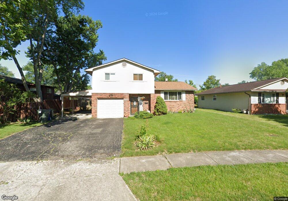
2600 Brownfield Rd Columbus, OH 43232
Walnut Heights NeighborhoodEstimated Value: $236,000 - $241,922
4
Beds
3
Baths
1,502
Sq Ft
$158/Sq Ft
Est. Value
About This Home
This home is located at 2600 Brownfield Rd, Columbus, OH 43232 and is currently estimated at $237,981, approximately $158 per square foot. 2600 Brownfield Rd is a home located in Franklin County with nearby schools including Liberty Elementary School, Yorktown Middle School, and Independence High School.
Ownership History
Date
Name
Owned For
Owner Type
Purchase Details
Closed on
Dec 23, 1999
Sold by
Altmann Giblin Kristy A and Altmann Kristy A
Bought by
Atcherson Lisa E
Current Estimated Value
Home Financials for this Owner
Home Financials are based on the most recent Mortgage that was taken out on this home.
Original Mortgage
$75,800
Outstanding Balance
$23,550
Interest Rate
7.76%
Estimated Equity
$214,431
Purchase Details
Closed on
Nov 9, 1999
Sold by
Giblin Donald J
Bought by
Pastorer Kristy A
Home Financials for this Owner
Home Financials are based on the most recent Mortgage that was taken out on this home.
Original Mortgage
$75,800
Outstanding Balance
$23,550
Interest Rate
7.76%
Estimated Equity
$214,431
Purchase Details
Closed on
May 30, 1995
Sold by
Dominey Jo Anne
Bought by
Donald J Giblin and Altmann Kristy A
Home Financials for this Owner
Home Financials are based on the most recent Mortgage that was taken out on this home.
Original Mortgage
$84,558
Interest Rate
8.4%
Mortgage Type
VA
Purchase Details
Closed on
Jan 28, 1993
Purchase Details
Closed on
Nov 8, 1990
Create a Home Valuation Report for This Property
The Home Valuation Report is an in-depth analysis detailing your home's value as well as a comparison with similar homes in the area
Home Values in the Area
Average Home Value in this Area
Purchase History
| Date | Buyer | Sale Price | Title Company |
|---|---|---|---|
| Atcherson Lisa E | $94,800 | -- | |
| Pastorer Kristy A | -- | -- | |
| Donald J Giblin | $79,900 | -- | |
| -- | $71,600 | -- | |
| -- | -- | -- |
Source: Public Records
Mortgage History
| Date | Status | Borrower | Loan Amount |
|---|---|---|---|
| Open | Atcherson Lisa E | $75,800 | |
| Previous Owner | Donald J Giblin | $84,558 |
Source: Public Records
Tax History Compared to Growth
Tax History
| Year | Tax Paid | Tax Assessment Tax Assessment Total Assessment is a certain percentage of the fair market value that is determined by local assessors to be the total taxable value of land and additions on the property. | Land | Improvement |
|---|---|---|---|---|
| 2024 | $3,085 | $68,750 | $18,100 | $50,650 |
| 2023 | $3,046 | $68,740 | $18,095 | $50,645 |
| 2022 | $1,939 | $37,390 | $6,620 | $30,770 |
| 2021 | $1,943 | $37,390 | $6,620 | $30,770 |
| 2020 | $1,945 | $37,390 | $6,620 | $30,770 |
| 2019 | $1,864 | $30,730 | $5,530 | $25,200 |
| 2018 | $1,766 | $30,730 | $5,530 | $25,200 |
| 2017 | $1,863 | $30,730 | $5,530 | $25,200 |
| 2016 | $1,842 | $27,800 | $4,590 | $23,210 |
| 2015 | $1,672 | $27,800 | $4,590 | $23,210 |
| 2014 | $1,676 | $27,800 | $4,590 | $23,210 |
| 2013 | $918 | $30,870 | $5,075 | $25,795 |
Source: Public Records
Map
Nearby Homes
- 5268 Carbondale Dr
- 2651 Brownfield Rd
- 2705 Denmark Rd
- 5137 Holbrook Dr
- 5114 Carbondale Dr
- 2730 Raphael Dr
- 5123 Jameson Dr
- 5061 Labelle Dr
- 2736 Barrows Rd
- 2744 Barrows Rd
- 5326 Adderley Ave
- 5011 Refugee Rd
- 2706 Maywood Rd
- 2615 Carbondale Place
- 5377 Bleaker Ave
- 5373 Spire Ln
- 5401 Spire Ln
- 2998 Osgood Rd E
- 2991 Blue Moon Dr
- 3067 Argonne Ct
- 2606 Brownfield Rd
- 5291 Carbondale Dr
- 2609 Dellworth St
- 2614 Brownfield Rd
- 2615 Dellworth St
- 2593 Brownfield Rd
- 2623 Dellworth St
- 2622 Brownfield Rd
- 5292 Carbondale Dr
- 2605 Brownfield Rd
- 2631 Dellworth St
- 5269 Carbondale Dr
- 2630 Brownfield Rd
- 2611 Brownfield Rd
- 5306 Carbondale Dr
- 2567 Brownfield Rd
- 2564 Brownfield Rd
- 2639 Dellworth St
- 5267 Carbondale Dr
- 2619 Brownfield Rd