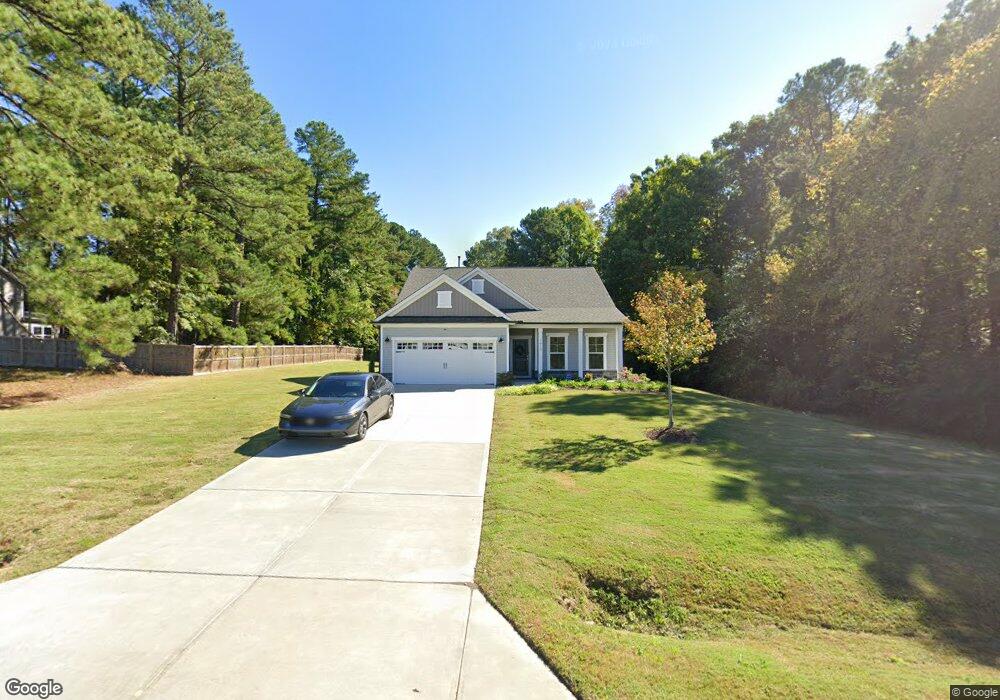
2617 Azalea Dr Unit LS Lot 255 Durham, NC 27703
Estimated Value: $489,968 - $629,000
4
Beds
3
Baths
2,317
Sq Ft
$244/Sq Ft
Est. Value
About This Home
This home is located at 2617 Azalea Dr Unit LS Lot 255, Durham, NC 27703 and is currently estimated at $564,492, approximately $243 per square foot. 2617 Azalea Dr Unit LS Lot 255 is a home located in Durham County with nearby schools including Bethesda Elementary School, John W Neal Middle School, and Southern School of Energy & Sustainability.
Ownership History
Date
Name
Owned For
Owner Type
Purchase Details
Closed on
Jan 16, 2020
Sold by
Pulte Home Company Llc
Bought by
Cates Dorthea Y and Cates Ernest W
Current Estimated Value
Home Financials for this Owner
Home Financials are based on the most recent Mortgage that was taken out on this home.
Original Mortgage
$386,332
Outstanding Balance
$341,340
Interest Rate
3.6%
Mortgage Type
FHA
Estimated Equity
$223,152
Purchase Details
Closed on
Mar 22, 2018
Sold by
Lakeshore Golf Course
Bought by
Pulte Home Company Llc
Create a Home Valuation Report for This Property
The Home Valuation Report is an in-depth analysis detailing your home's value as well as a comparison with similar homes in the area
Home Values in the Area
Average Home Value in this Area
Purchase History
| Date | Buyer | Sale Price | Title Company |
|---|---|---|---|
| Cates Dorthea Y | $393,500 | None Available | |
| Pulte Home Company Llc | $5,665,000 | None Available |
Source: Public Records
Mortgage History
| Date | Status | Borrower | Loan Amount |
|---|---|---|---|
| Open | Cates Dorthea Y | $386,332 |
Source: Public Records
Tax History Compared to Growth
Tax History
| Year | Tax Paid | Tax Assessment Tax Assessment Total Assessment is a certain percentage of the fair market value that is determined by local assessors to be the total taxable value of land and additions on the property. | Land | Improvement |
|---|---|---|---|---|
| 2025 | $3,747 | $564,732 | $117,000 | $447,732 |
| 2024 | $3,747 | $268,657 | $31,220 | $237,437 |
| 2023 | $3,519 | $268,657 | $31,220 | $237,437 |
| 2022 | $3,439 | $268,657 | $31,220 | $237,437 |
| 2021 | $3,422 | $268,657 | $31,220 | $237,437 |
| 2020 | $3,342 | $268,657 | $31,220 | $237,437 |
| 2019 | $388 | $31,220 | $31,220 | $0 |
| 2018 | $476 | $35,122 | $35,122 | $0 |
| 2017 | $473 | $35,122 | $35,122 | $0 |
| 2016 | $457 | $35,122 | $35,122 | $0 |
| 2015 | $503 | $36,361 | $36,361 | $0 |
| 2014 | $503 | $36,361 | $36,361 | $0 |
Source: Public Records
Map
Nearby Homes
- 2701 Skybrook Ln
- 2811 Skybrook Ln
- 2709 Hamilton Green Dr
- 5014 Rolling Meadows Dr
- 2013 Cedar Grove Dr
- 3019 Newfields Place
- 1107 Tigerlily Way
- 3610 Long Ridge Rd
- 1018 Flyfish Ave
- 111 Lang St
- 3602 Appling Way
- 2228 Cedar Grove Dr
- 2905 Scuppernong Ln
- 2214 Tw Alexander Dr
- 2409 Rolling Pines Ave
- 2512 Rolling Pines Ave
- 910 Wood Chapel Ln
- 4539 Cottendale Dr
- 2217 S Miami Blvd
- 4613 Angier Ave
- 4701 Lumley Rd
- 2613 Azalea Dr Unit LS Lot 254
- 2002 Canarsie Way
- 4715 Lumley Rd
- 2000 Canarsie Way
- 2609 Azalea Dr Unit LS Lot 253
- 2610 Windy Hill Rd
- 1110 Hollis Cir
- 1108 Hollis Cir
- 1106 Hollis Cir
- 2003 Canarsie Way
- 1104 Hollis Cir
- 2001 Canarsie Way
- 3305 Skybrook Ln
- 3303 Skybrook Ln
- 3307 Skybrook Ln
- 3301 Skybrook Ln
- 2608 Windy Hill Rd
- 3309 Skybrook Ln
- 1102 Hollis Cir