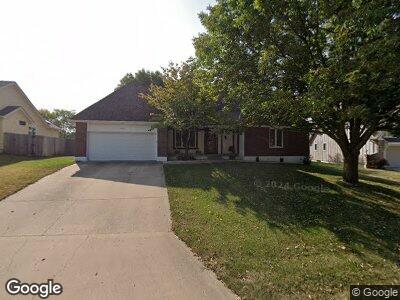
2617 NW Bent Tree Cir Lees Summit, MO 64081
Lee's Summit NeighborhoodEstimated Value: $374,000 - $437,000
4
Beds
4
Baths
1,968
Sq Ft
$204/Sq Ft
Est. Value
About This Home
This home is located at 2617 NW Bent Tree Cir, Lees Summit, MO 64081 and is currently estimated at $401,681, approximately $204 per square foot. 2617 NW Bent Tree Cir is a home located in Jackson County with nearby schools including Cedar Creek Elementary School, Bernard C. Campbell Middle School, and Lee's Summit North High School.
Ownership History
Date
Name
Owned For
Owner Type
Purchase Details
Closed on
May 2, 2000
Sold by
Fritchie Kent L and Fritchie Kim A
Bought by
Fritchie Kent and Fritchie Kim
Current Estimated Value
Purchase Details
Closed on
Oct 6, 1997
Sold by
Fritchie Kent L and Fritchie Kimberly A
Bought by
Fritchie Kent L and Fritchie Kim A
Home Financials for this Owner
Home Financials are based on the most recent Mortgage that was taken out on this home.
Original Mortgage
$112,500
Interest Rate
7.14%
Mortgage Type
Purchase Money Mortgage
Create a Home Valuation Report for This Property
The Home Valuation Report is an in-depth analysis detailing your home's value as well as a comparison with similar homes in the area
Home Values in the Area
Average Home Value in this Area
Purchase History
| Date | Buyer | Sale Price | Title Company |
|---|---|---|---|
| Fritchie Kent | -- | -- | |
| Fritchie Kent L | -- | Chicago Title Insurance Co |
Source: Public Records
Mortgage History
| Date | Status | Borrower | Loan Amount |
|---|---|---|---|
| Closed | Fritchie Kent L | $112,500 |
Source: Public Records
Tax History Compared to Growth
Tax History
| Year | Tax Paid | Tax Assessment Tax Assessment Total Assessment is a certain percentage of the fair market value that is determined by local assessors to be the total taxable value of land and additions on the property. | Land | Improvement |
|---|---|---|---|---|
| 2024 | $3,796 | $52,955 | $5,805 | $47,150 |
| 2023 | $3,796 | $52,955 | $5,805 | $47,150 |
| 2022 | $3,834 | $47,500 | $7,239 | $40,261 |
| 2021 | $3,914 | $47,500 | $7,239 | $40,261 |
| 2020 | $3,956 | $47,542 | $7,239 | $40,303 |
| 2019 | $3,848 | $47,542 | $7,239 | $40,303 |
| 2018 | $3,564 | $40,867 | $4,781 | $36,086 |
| 2017 | $3,564 | $40,867 | $4,781 | $36,086 |
| 2016 | $3,511 | $39,843 | $6,270 | $33,573 |
| 2014 | $3,561 | $39,614 | $5,861 | $33,753 |
Source: Public Records
Map
Nearby Homes
- 2516 NW Bent Tree Cir
- 901 NW High Point Dr
- 613 NW Alexa Ln
- 516 NW Timberbrooke Dr
- 2316 NW Summerfield Dr
- 904 NW Winterset St
- 1004 NW Springdale Dr
- 717 NW Silver Ridge
- 633 NW Brookhaven Dr
- 325 NW Ambersham Dr
- 209 NW Ambersham Dr
- 336 NW Thoreau Cir
- 2804 NW Nutall Ct
- 313 NW Thoreau Ct
- 1031 NW Cedar Creek Ln
- 289 NW Rockwood Ct
- 313 NW Rockhill Cir
- 2120 NW O'Brien Rd
- 2701 NW Olmstead Dr
- 240 NW Whitlock Dr
- 2617 NW Bent Tree Cir
- 2613 NW Bent Tree Cir
- 2621 NW Bent Tree Cir
- 2609 NW Bent Tree Cir
- 2620 NW Bent Tree Cir
- 2604 NW Bent Tree Cir
- 2625 NW Bent Tree Cir
- 2628 NW Bent Tree Cir
- 2605 NW Bent Tree Cir
- 2629 NW Bent Tree Cir
- 2600 NW Bent Tree Cir
- 2601 NW Lookout Ridge
- 2605 NW Lookout Ridge
- 2632 NW Bent Tree Cir
- 2633 NW Bent Tree Cir
- 2600 NW Lookout Ridge
- 2548 NW Bent Tree Cir
- 2516 NW Shady Bend Ln
- 2529 NW Overbrook Dr
- 2561 NW Bent Tree Cir