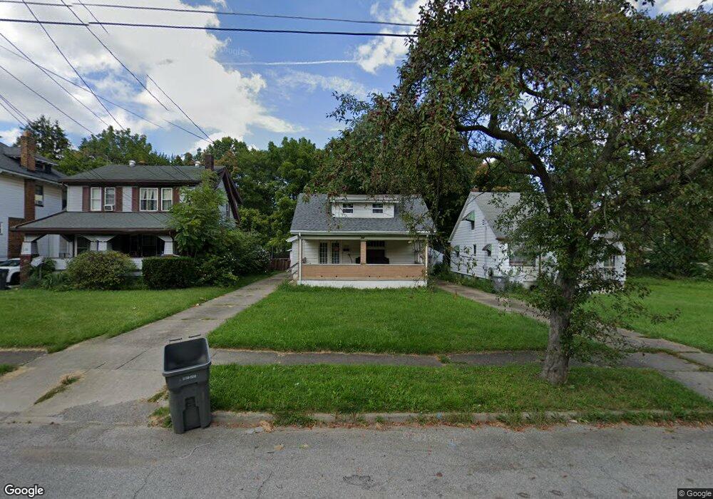
262 E Auburndale Ave Youngstown, OH 44507
Cottage Grove NeighborhoodEstimated Value: $47,031 - $68,000
3
Beds
1
Bath
984
Sq Ft
$58/Sq Ft
Est. Value
About This Home
This home is located at 262 E Auburndale Ave, Youngstown, OH 44507 and is currently estimated at $56,758, approximately $57 per square foot. 262 E Auburndale Ave is a home located in Mahoning County with nearby schools including Taft Elementary School, Williamson Elementary School, and East High School.
Ownership History
Date
Name
Owned For
Owner Type
Purchase Details
Closed on
Oct 19, 2023
Sold by
Youngstown Houses Llc
Bought by
Youngstown Houses Llc
Current Estimated Value
Purchase Details
Closed on
Apr 21, 2023
Bought by
Youngstown Houses Llc
Purchase Details
Closed on
Apr 9, 2002
Sold by
Russ John C
Bought by
Gary M Crim Inc
Purchase Details
Closed on
Apr 8, 2002
Sold by
Smith Donald
Bought by
Gary M Crim Inc
Purchase Details
Closed on
Apr 5, 2002
Sold by
Russ Richard Allen and Smith Ernest
Bought by
Gary M Crim Inc
Create a Home Valuation Report for This Property
The Home Valuation Report is an in-depth analysis detailing your home's value as well as a comparison with similar homes in the area
Home Values in the Area
Average Home Value in this Area
Purchase History
| Date | Buyer | Sale Price | Title Company |
|---|---|---|---|
| Youngstown Houses Llc | -- | None Listed On Document | |
| Youngstown Houses Llc | -- | None Listed On Document | |
| Youngstown Houses Llc | $2,170,000 | -- | |
| Gary M Crim Inc | $19,000 | -- | |
| Gary M Crim Inc | -- | -- | |
| Gary M Crim Inc | -- | -- |
Source: Public Records
Tax History
| Year | Tax Paid | Tax Assessment Tax Assessment Total Assessment is a certain percentage of the fair market value that is determined by local assessors to be the total taxable value of land and additions on the property. | Land | Improvement |
|---|---|---|---|---|
| 2025 | $233 | $5,350 | $670 | $4,680 |
| 2024 | $264 | $5,350 | $670 | $4,680 |
| 2023 | $262 | $5,350 | $670 | $4,680 |
| 2022 | $183 | $2,860 | $740 | $2,120 |
| 2021 | $183 | $2,860 | $740 | $2,120 |
| 2020 | $184 | $2,860 | $740 | $2,120 |
| 2019 | $189 | $2,600 | $670 | $1,930 |
| 2018 | $191 | $2,600 | $670 | $1,930 |
| 2017 | $272 | $2,600 | $670 | $1,930 |
| 2016 | $357 | $5,360 | $670 | $4,690 |
| 2015 | $350 | $5,360 | $670 | $4,690 |
| 2014 | $347 | $5,360 | $670 | $4,690 |
| 2013 | $343 | $5,360 | $670 | $4,690 |
Source: Public Records
Map
Nearby Homes
- 221 E Avondale Ave
- 178 E Ravenwood Ave
- 559 E Avondale Ave
- 359 Potomac Ave
- 328 Marmion Ave
- 3919 Rush Blvd
- 582 Roxbury Ave
- 353 Cornell Ave
- 734 Cambridge Ave
- 124 E Midlothian Blvd
- 32 E Avondale Ave
- 173 Clarencedale Ave
- 192 Hollywood Ave
- 3031 Market St
- 4038 Sunset Blvd
- 72 Labelle Ave
- 28 W Philadelphia Ave
- 544 Miller St
- 4206 Rush Blvd
- 564 Miller St
- 258 E Auburndale Ave
- 264 E Auburndale Ave
- 254 E Auburndale Ave
- 274 E Auburndale Ave
- 250 E Auburndale Ave
- 278 E Auburndale Ave
- 263 E Lucius Ave
- 269 E Lucius Ave
- 246 E Auburndale Ave
- 273 E Lucius Ave
- 259 E Lucius Ave
- 261 E Auburndale Ave
- 253 E Lucius Ave
- 257 E Auburndale Ave
- 267 E Auburndale Ave
- 249 E Lucius Ave
- 279 E Lucius Ave
- 253 E Auburndale Ave
- 242 E Auburndale Ave
- 245 E Lucius Ave
Your Personal Tour Guide
Ask me questions while you tour the home.