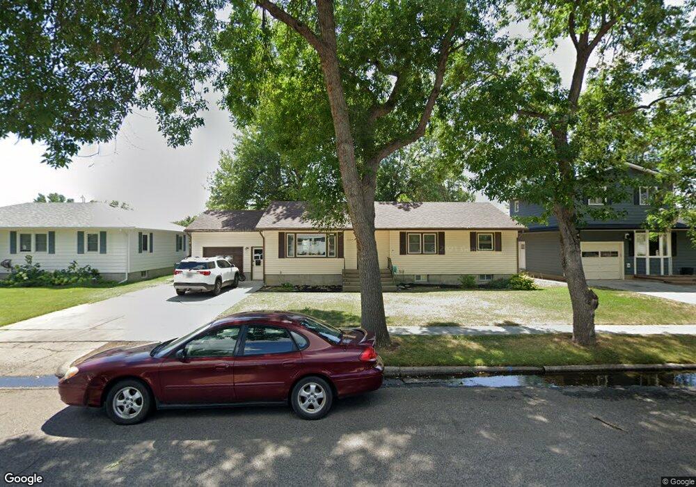
2642 Wyoming Ave Billings, MT 59102
West End NeighborhoodEstimated Value: $357,000 - $378,000
4
Beds
2
Baths
2,616
Sq Ft
$141/Sq Ft
Est. Value
About This Home
This home is located at 2642 Wyoming Ave, Billings, MT 59102 and is currently estimated at $368,371, approximately $140 per square foot. 2642 Wyoming Ave is a home located in Yellowstone County with nearby schools including Burlington School, Will James Junior High School, and Billings West High School.
Ownership History
Date
Name
Owned For
Owner Type
Purchase Details
Closed on
Dec 10, 2019
Sold by
Rudolph Elmer L and Rudolph Lavonne K
Bought by
Ribble Jonathan and Ribble Carly
Current Estimated Value
Home Financials for this Owner
Home Financials are based on the most recent Mortgage that was taken out on this home.
Original Mortgage
$225,441
Outstanding Balance
$200,735
Interest Rate
4.12%
Mortgage Type
FHA
Estimated Equity
$167,636
Create a Home Valuation Report for This Property
The Home Valuation Report is an in-depth analysis detailing your home's value as well as a comparison with similar homes in the area
Home Values in the Area
Average Home Value in this Area
Purchase History
| Date | Buyer | Sale Price | Title Company |
|---|---|---|---|
| Ribble Jonathan | -- | Stewart Title |
Source: Public Records
Mortgage History
| Date | Status | Borrower | Loan Amount |
|---|---|---|---|
| Open | Ribble Jonathan | $225,441 |
Source: Public Records
Tax History Compared to Growth
Tax History
| Year | Tax Paid | Tax Assessment Tax Assessment Total Assessment is a certain percentage of the fair market value that is determined by local assessors to be the total taxable value of land and additions on the property. | Land | Improvement |
|---|---|---|---|---|
| 2025 | $3,387 | $368,800 | $56,090 | $312,710 |
| 2024 | $3,387 | $335,100 | $50,041 | $285,059 |
| 2023 | $3,391 | $335,100 | $50,041 | $285,059 |
| 2022 | $2,269 | $240,400 | $0 | $0 |
| 2021 | $2,671 | $240,400 | $0 | $0 |
| 2020 | $2,673 | $228,400 | $0 | $0 |
| 2019 | $2,729 | $246,200 | $0 | $0 |
| 2018 | $2,559 | $224,900 | $0 | $0 |
| 2017 | $2,082 | $224,900 | $0 | $0 |
| 2016 | $2,309 | $209,100 | $0 | $0 |
| 2015 | $2,260 | $209,100 | $0 | $0 |
| 2014 | $1,956 | $94,552 | $0 | $0 |
Source: Public Records
Map
Nearby Homes
- 2619 Yellowstone Ave
- 2645 Custer Ave
- 2636 Custer Ave
- 2640 Terry Ave
- 2533 Yellowstone Ave
- 2900 Manhattan Dr
- 2537 Clark Ave
- 2905 Lynwood Cir
- 2546 Burlington Ave
- 909 Maywood Dr
- 915 Maywood Dr
- 2420 Wyoming Ave
- 2702 Howard Ave
- 2937 Miles Ave
- 2903 Belvedere Dr
- 0 Wyatt Cir Unit 356022
- 1125 30th St W
- 2509 Cook Ave
- 2641 Forest Meadow Ln
- 2550 Forest Meadow Ln
- 2638 Wyoming Ave
- 2646 Wyoming Ave
- 2632 Wyoming Ave
- 2643 Broadwater Ave
- 2702 Wyoming Ave
- 2649 Broadwater Ave
- 2637 Broadwater Ave
- 2631 Broadwater Ave
- 2701 Broadwater Ave
- 2637 Wyoming Ave
- 2645 Wyoming Ave
- 2626 Wyoming Ave
- 2708 Wyoming Ave
- 2631 Wyoming Ave
- 2701 Wyoming Ave
- 2625 Broadwater Ave
- 2707 Broadwater Ave
- 2620 Wyoming Ave
- 2625 Wyoming Ave
- 2707 Wyoming Ave