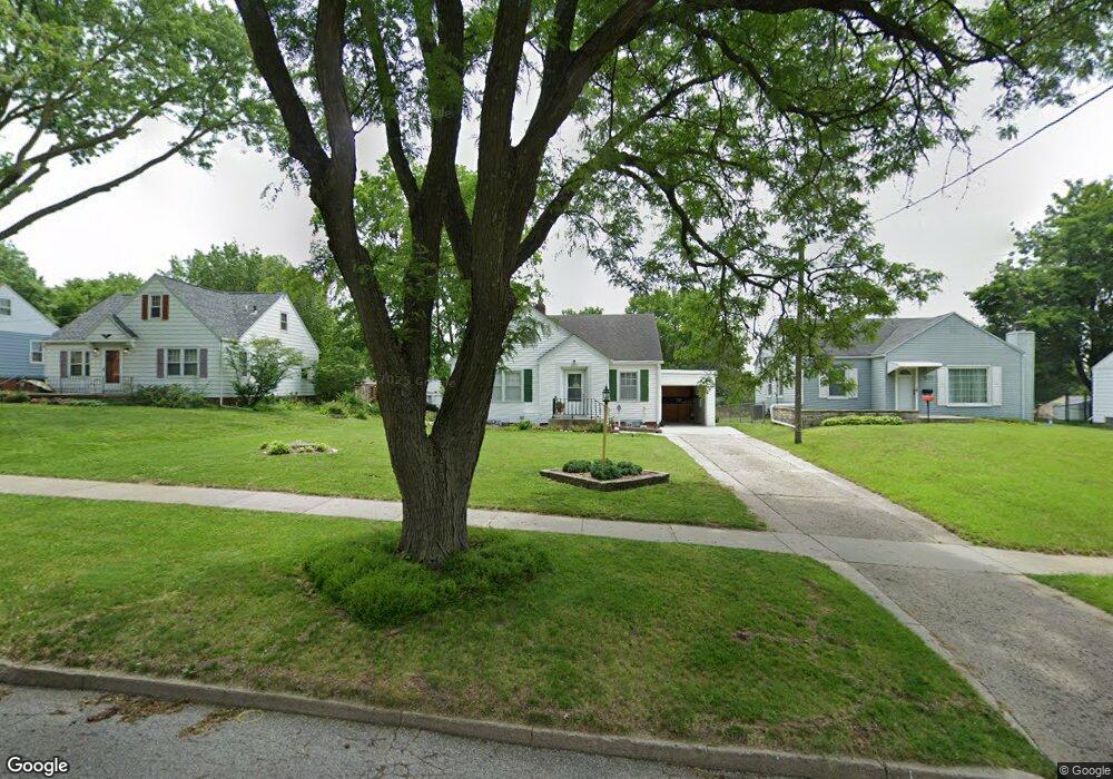
2679 Arthur Ave Des Moines, IA 50317
Accent NeighborhoodEstimated Value: $212,000 - $247,000
3
Beds
2
Baths
1,592
Sq Ft
$141/Sq Ft
Est. Value
About This Home
This home is located at 2679 Arthur Ave, Des Moines, IA 50317 and is currently estimated at $224,679, approximately $141 per square foot. 2679 Arthur Ave is a home located in Polk County with nearby schools including Stowe Elementary School, Goodrell Middle School, and St Joseph Elementary School.
Ownership History
Date
Name
Owned For
Owner Type
Purchase Details
Closed on
Nov 9, 2017
Sold by
Hoag Norman E and Hoag Yvonne M
Bought by
Hoag Norman E and Hoag Yvonne M
Current Estimated Value
Purchase Details
Closed on
Jul 6, 1998
Sold by
Grant James Michael and Grant Dawn I
Bought by
Hoag Norman E and Hoag Yvonne M
Home Financials for this Owner
Home Financials are based on the most recent Mortgage that was taken out on this home.
Original Mortgage
$72,800
Outstanding Balance
$14,716
Interest Rate
7.17%
Estimated Equity
$209,963
Create a Home Valuation Report for This Property
The Home Valuation Report is an in-depth analysis detailing your home's value as well as a comparison with similar homes in the area
Home Values in the Area
Average Home Value in this Area
Purchase History
| Date | Buyer | Sale Price | Title Company |
|---|---|---|---|
| Hoag Norman E | -- | None Available | |
| Hoag Norman E | $90,500 | -- |
Source: Public Records
Mortgage History
| Date | Status | Borrower | Loan Amount |
|---|---|---|---|
| Open | Hoag Norman E | $72,800 |
Source: Public Records
Tax History Compared to Growth
Tax History
| Year | Tax Paid | Tax Assessment Tax Assessment Total Assessment is a certain percentage of the fair market value that is determined by local assessors to be the total taxable value of land and additions on the property. | Land | Improvement |
|---|---|---|---|---|
| 2025 | $3,172 | $194,100 | $33,700 | $160,400 |
| 2024 | $3,172 | $178,700 | $30,500 | $148,200 |
| 2023 | $3,114 | $178,700 | $30,500 | $148,200 |
| 2022 | $3,088 | $141,000 | $25,000 | $116,000 |
| 2021 | $3,012 | $141,000 | $25,000 | $116,000 |
| 2020 | $3,124 | $129,300 | $22,800 | $106,500 |
| 2019 | $3,080 | $129,300 | $22,800 | $106,500 |
| 2018 | $3,042 | $123,100 | $21,200 | $101,900 |
| 2017 | $2,896 | $123,100 | $21,200 | $101,900 |
| 2016 | $2,816 | $115,600 | $19,700 | $95,900 |
| 2015 | $2,816 | $115,600 | $19,700 | $95,900 |
| 2014 | $2,698 | $114,300 | $19,000 | $95,300 |
Source: Public Records
Map
Nearby Homes
- 2645 Wisconsin Ave
- 2622 E 29th St
- 2633 Grandview Ave
- 3019 John Patterson Rd
- 1924 E 29th St
- 3101 John Patterson Rd
- 2680 Hull Ave
- 2817 Richmond Ave
- 2718 Richmond Ave
- 2803 Easton Blvd
- 2021 E 25th St
- 2757 Easton Blvd
- 2503 E 24th St
- 2719 E Tiffin Ave
- 2216 Lay St
- 2746 E Tiffin Ave
- 2722 E Tiffin Ave
- 3001 Don Lee Ct
- 3005 Don Lee Ct
- 1821 E 25th St
- 2677 Arthur Ave
- 2701 Arthur Ave
- 2671 Arthur Ave
- 2408 E 28th St
- 2709 Arthur Ave
- 2348 E 28th St
- 2665 Arthur Ave
- 2723 Hubbell Ave
- 2801 Arthur Ave
- 2676 Arthur Ave
- 2700 Arthur Ave
- 2330 E 28th St
- 2735 Hubbell Ave
- 2721 Hubbell Ave
- 2704 Arthur Ave
- 2809 Arthur Ave
- 2708 Arthur Ave
- 2670 Wisconsin Ave
- 2409 E 28th St
- 2712 Arthur Ave