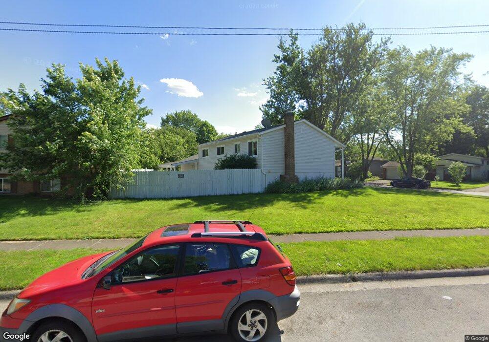
2684 Mellowbrook St Columbus, OH 43232
Walnut Heights NeighborhoodEstimated Value: $230,000 - $273,758
4
Beds
2
Baths
945
Sq Ft
$271/Sq Ft
Est. Value
About This Home
This home is located at 2684 Mellowbrook St, Columbus, OH 43232 and is currently estimated at $256,190, approximately $271 per square foot. 2684 Mellowbrook St is a home located in Franklin County with nearby schools including Liberty Elementary School, Yorktown Middle School, and Independence High School.
Ownership History
Date
Name
Owned For
Owner Type
Purchase Details
Closed on
Apr 27, 2023
Sold by
Aucoin Benjamin
Bought by
Reardon Dexter
Current Estimated Value
Home Financials for this Owner
Home Financials are based on the most recent Mortgage that was taken out on this home.
Original Mortgage
$208,000
Outstanding Balance
$202,099
Interest Rate
6.28%
Mortgage Type
New Conventional
Estimated Equity
$54,091
Purchase Details
Closed on
Aug 18, 2022
Sold by
Adkins Brenda L
Bought by
Aucoin Benjamin
Purchase Details
Closed on
Jun 7, 2022
Sold by
Jon Adkins
Bought by
Adkins Brenda L
Purchase Details
Closed on
Nov 13, 1989
Bought by
Adkins Jon and Adkins Brenda L
Purchase Details
Closed on
Sep 8, 1989
Create a Home Valuation Report for This Property
The Home Valuation Report is an in-depth analysis detailing your home's value as well as a comparison with similar homes in the area
Home Values in the Area
Average Home Value in this Area
Purchase History
| Date | Buyer | Sale Price | Title Company |
|---|---|---|---|
| Reardon Dexter | $265,000 | World Class Title | |
| Aucoin Benjamin | $125,000 | Elite Land Title | |
| Adkins Brenda L | -- | None Listed On Document | |
| Adkins Jon | $53,000 | -- | |
| -- | $46,000 | -- |
Source: Public Records
Mortgage History
| Date | Status | Borrower | Loan Amount |
|---|---|---|---|
| Open | Reardon Dexter | $208,000 |
Source: Public Records
Tax History Compared to Growth
Tax History
| Year | Tax Paid | Tax Assessment Tax Assessment Total Assessment is a certain percentage of the fair market value that is determined by local assessors to be the total taxable value of land and additions on the property. | Land | Improvement |
|---|---|---|---|---|
| 2024 | $3,353 | $74,700 | $19,360 | $55,340 |
| 2023 | $3,310 | $74,700 | $19,360 | $55,340 |
| 2022 | $1,997 | $38,500 | $8,190 | $30,310 |
| 2021 | $2,000 | $38,500 | $8,190 | $30,310 |
| 2020 | $2,003 | $38,500 | $8,190 | $30,310 |
| 2019 | $1,903 | $31,370 | $6,830 | $24,540 |
| 2018 | $1,851 | $31,370 | $6,830 | $24,540 |
| 2017 | $1,944 | $31,370 | $6,830 | $24,540 |
| 2016 | $1,985 | $29,970 | $5,080 | $24,890 |
| 2015 | $1,802 | $29,970 | $5,080 | $24,890 |
| 2014 | $1,807 | $29,970 | $5,080 | $24,890 |
| 2013 | $990 | $33,285 | $5,635 | $27,650 |
Source: Public Records
Map
Nearby Homes
- 2730 Raphael Dr
- 5278 Glenbriar Ct
- 2651 Brownfield Rd
- 5268 Carbondale Dr
- 2736 Barrows Rd
- 2744 Barrows Rd
- 2705 Denmark Rd
- 5377 Bleaker Ave
- 2991 Blue Moon Dr
- 2447 Maybury Rd
- 5114 Carbondale Dr
- 5123 Jameson Dr
- 5401 Spire Ln
- 5061 Labelle Dr
- 5144 Botsford Dr
- 5373 Spire Ln
- 5011 Refugee Rd
- 2998 Osgood Rd E
- 2615 Carbondale Place
- 3148 Aldgate St
- 2684 Moundcrest St
- 2687 Mellowbrook St
- 2692 Moundcrest St
- 2693 Mellowbrook St
- 2679 Moundcrest St
- 2685 Moundcrest St
- 2673 Moundcrest St
- 2664 Mellowbrook St
- 2706 Moundcrest St
- 2672 Mellowbrook St
- 2701 Mellowbrook St
- 2665 Mellowbrook St
- 2693 Moundcrest St
- 2676 Mellowbrook St
- 2656 Mellowbrook St
- 2709 Mellowbrook St
- 2699 Moundcrest St
- 2710 Moundcrest St
- 2657 Mellowbrook St
- 2686 Mellowbrook St