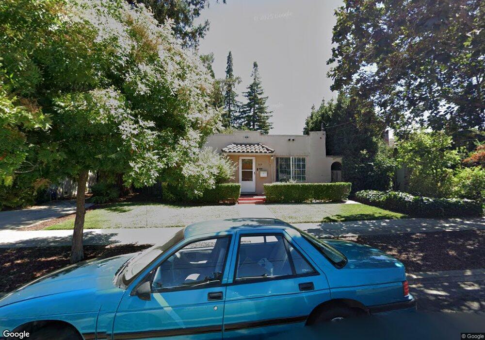
269 Pettis Ave Mountain View, CA 94041
Mountain View West NeighborhoodEstimated Value: $1,659,000 - $2,070,775
2
Beds
1
Bath
972
Sq Ft
$1,905/Sq Ft
Est. Value
About This Home
This home is located at 269 Pettis Ave, Mountain View, CA 94041 and is currently estimated at $1,851,444, approximately $1,904 per square foot. 269 Pettis Ave is a home located in Santa Clara County with nearby schools including Benjamin Bubb Elementary School, Isaac Newton Graham Middle School, and Los Altos High School.
Ownership History
Date
Name
Owned For
Owner Type
Purchase Details
Closed on
Jan 22, 2026
Sold by
Hua Vin Paul and Hua Ruth
Bought by
Hua Family Trust and Hua
Current Estimated Value
Purchase Details
Closed on
Dec 21, 2004
Sold by
Ison Diane Carol
Bought by
Hua Vin Paul and Hua Ruth
Purchase Details
Closed on
Jul 16, 2002
Sold by
Fontes Carnation
Bought by
Fontes Carnation
Purchase Details
Closed on
Jun 23, 1997
Sold by
Fontes Manuel A and Fontes Manuel
Bought by
Fontes Manuel and Fontes Carnation
Create a Home Valuation Report for This Property
The Home Valuation Report is an in-depth analysis detailing your home's value as well as a comparison with similar homes in the area
Home Values in the Area
Average Home Value in this Area
Purchase History
We collect this data history from publicly available records. To have your information removed, we recommend requesting removal directly through your county’s website.
| Date | Buyer | Sale Price | Title Company |
|---|---|---|---|
| Hua Family Trust | -- | None Listed On Document | |
| Hua Vin Paul | $600,000 | Old Republic Title Company | |
| Fontes Carnation | -- | -- | |
| Fontes Manuel | -- | -- |
Source: Public Records
Tax History
| Year | Tax Paid | Tax Assessment Tax Assessment Total Assessment is a certain percentage of the fair market value that is determined by local assessors to be the total taxable value of land and additions on the property. | Land | Improvement |
|---|---|---|---|---|
| 2025 | $9,814 | $836,333 | $585,437 | $250,896 |
| 2024 | $9,814 | $819,935 | $573,958 | $245,977 |
| 2023 | $9,714 | $803,858 | $562,704 | $241,154 |
| 2022 | $9,687 | $788,097 | $551,671 | $236,426 |
| 2021 | $9,452 | $772,645 | $540,854 | $231,791 |
| 2020 | $9,464 | $764,724 | $535,309 | $229,415 |
| 2019 | $9,070 | $749,730 | $524,813 | $224,917 |
| 2018 | $8,978 | $735,030 | $514,523 | $220,507 |
| 2017 | $8,611 | $720,619 | $504,435 | $216,184 |
| 2016 | $8,343 | $706,491 | $494,545 | $211,946 |
| 2015 | $8,105 | $695,880 | $487,117 | $208,763 |
| 2014 | $8,032 | $682,250 | $477,576 | $204,674 |
Source: Public Records
Map
Nearby Homes
- 256 Pettis Ave
- 263 Mariposa Ave
- 328 Higdon Ave
- 1801 Villa St
- 172 Permanente Way
- 434 Franklin St
- 1826 Higdon Ave
- 1838 Higdon Ave
- 958 California St
- 903 W Dana St
- 108 Bryant St Unit 36
- 108 Bryant St Unit 28
- 0 Elmwood St
- 284 Elmwood St
- 1506 Canna Ct
- 452 Mountain Laurel Ct
- 1915 Mount Vernon Ct Unit 15
- 1915 Mount Vernon Ct Unit 16
- 928 Wright Ave Unit 902
- 928 Wright Ave Unit 401
- 257 Pettis Ave
- 285 Pettis Ave
- 295 Pettis Ave
- 247 Pettis Ave
- 235 Pettis Ave
- 258 Palo Alto Ave
- 258 Palo Alto Ave Unit 5
- 272 Palo Alto Ave
- 286 Palo Alto Ave
- 270 Pettis Ave
- 250 Palo Alto Ave
- 260 Pettis Ave
- 260 Pettis Ave Unit 2
- 260 Pettis Ave
- 286 Pettis Ave
- 296 Palo Alto Ave
- 305 Pettis Ave
- 298 Pettis Ave
- 234 Palo Alto Ave
- 238 Pettis Ave
Your Personal Tour Guide
Ask me questions while you tour the home.