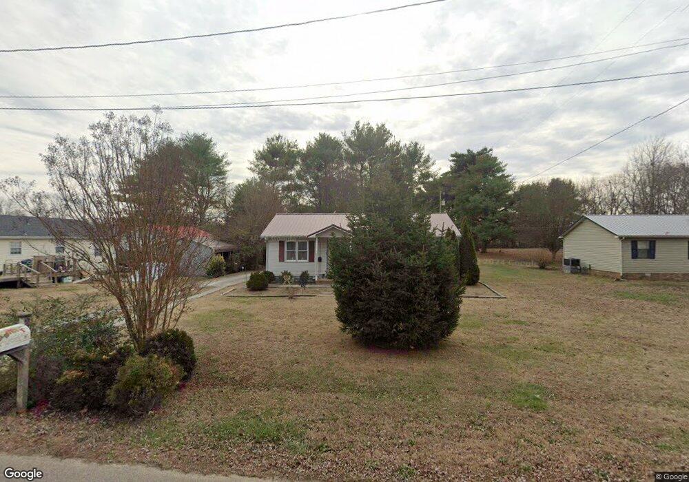
27 Flint Dr Decherd, TN 37324
Estimated Value: $148,373 - $218,000
Studio
1
Bath
956
Sq Ft
$195/Sq Ft
Est. Value
About This Home
This home is located at 27 Flint Dr, Decherd, TN 37324 and is currently estimated at $186,843, approximately $195 per square foot. 27 Flint Dr is a home located in Franklin County with nearby schools including North Middle School, Franklin County High School, and School of the Good Shepherd.
Ownership History
Date
Name
Owned For
Owner Type
Purchase Details
Closed on
Oct 27, 2020
Sold by
Gill Joseph William
Bought by
Steele Gloria E
Current Estimated Value
Purchase Details
Closed on
Aug 24, 2009
Sold by
Morris James A
Bought by
Steele Gloria E
Purchase Details
Closed on
Nov 23, 2005
Sold by
Morris Bonnie J
Bought by
Morris James A
Home Financials for this Owner
Home Financials are based on the most recent Mortgage that was taken out on this home.
Original Mortgage
$35,500
Interest Rate
6.04%
Purchase Details
Closed on
Apr 10, 1978
Bought by
Burt Fred A and Burt Catherine
Create a Home Valuation Report for This Property
The Home Valuation Report is an in-depth analysis detailing your home's value as well as a comparison with similar homes in the area
Purchase History
| Date | Buyer | Sale Price | Title Company |
|---|---|---|---|
| Steele Gloria E | -- | None Available | |
| Steele Gloria E | $68,900 | -- | |
| Morris James A | $48,000 | -- | |
| Burt Fred A | -- | -- |
Source: Public Records
Mortgage History
| Date | Status | Borrower | Loan Amount |
|---|---|---|---|
| Previous Owner | Burt Fred A | $35,500 |
Source: Public Records
Tax History
| Year | Tax Paid | Tax Assessment Tax Assessment Total Assessment is a certain percentage of the fair market value that is determined by local assessors to be the total taxable value of land and additions on the property. | Land | Improvement |
|---|---|---|---|---|
| 2025 | -- | $26,150 | $2,725 | $23,425 |
| 2024 | -- | $26,150 | $2,725 | $23,425 |
| 2023 | $720 | $26,150 | $2,725 | $23,425 |
| 2022 | $681 | $26,150 | $2,725 | $23,425 |
| 2021 | $427 | $26,150 | $2,725 | $23,425 |
| 2020 | $611 | $15,225 | $1,925 | $13,300 |
| 2019 | $611 | $15,225 | $1,925 | $13,300 |
| 2018 | $580 | $15,225 | $1,925 | $13,300 |
| 2017 | $580 | $15,225 | $1,925 | $13,300 |
| 2016 | $556 | $14,600 | $1,975 | $12,625 |
| 2015 | $556 | $14,600 | $1,975 | $12,625 |
| 2014 | $555 | $14,590 | $0 | $0 |
Source: Public Records
Map
Nearby Homes
- 44 Flint Dr
- 1105 Cumberland St Unit 1107
- 909 Cumberland St Unit 911
- 1001 Henley St
- 401 3rd Ave N
- 201 10th Ave N
- 240 Dogwood Dr
- 203 5th Ave N
- 501 W Broad St
- 106 5th Ave N
- 502 E Market St
- 202 W Main St
- 0 Aedc Rd Unit 2
- 205 Mary Sharp Dr
- 404 Horton St
- 107 N West St
- 206 Hotel St
- 105 Lakeview Dr
- 207 Powell St
- 301 Bennett St
- 97 Christian Ln
- 111 Christian Ln
- 77 Christian Ln
- 57 Flint Dr
- 137 Christian Ln
- 28 Flint Dr
- 149 Christian Ln
- 56 Flint Dr
- 45 Christian Ln
- 1104 Cumberland St
- 1118 Cumberland St
- 25 Taylor Dr
- 1109 Cumberland St Unit 1111
- 1119 Cumberland St
- 1011 Cumberland St Unit 1013
- 1201 Cumberland St Unit 1203
- 1007 Cumberland St Unit 1009
- 910 Cumberland St
- 104 Sunshine Dr Unit 106
- 104 Sunshine Dr Unit 2
Your Personal Tour Guide
Ask me questions while you tour the home.