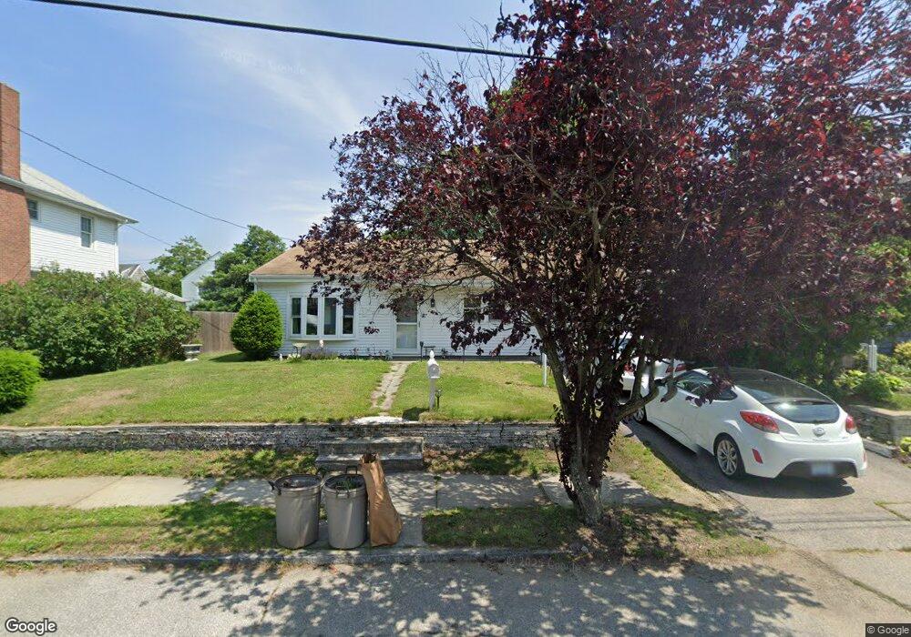
27 Tallman Ave Cranston, RI 02910
Eden Park NeighborhoodEstimated Value: $405,000 - $448,000
3
Beds
2
Baths
2,052
Sq Ft
$209/Sq Ft
Est. Value
About This Home
This home is located at 27 Tallman Ave, Cranston, RI 02910 and is currently estimated at $429,026, approximately $209 per square foot. 27 Tallman Ave is a home located in Providence County with nearby schools including Daniel D. Waterman School, Park View Middle School, and Cranston High School East.
Ownership History
Date
Name
Owned For
Owner Type
Purchase Details
Closed on
Dec 10, 2008
Sold by
Hsbc Bank Usa
Bought by
Monahon Kristen A
Current Estimated Value
Home Financials for this Owner
Home Financials are based on the most recent Mortgage that was taken out on this home.
Original Mortgage
$147,150
Outstanding Balance
$98,133
Interest Rate
6.49%
Estimated Equity
$330,893
Purchase Details
Closed on
Aug 11, 2004
Sold by
Giordano Antonio and Giordano Marion
Bought by
Mollo Donna
Home Financials for this Owner
Home Financials are based on the most recent Mortgage that was taken out on this home.
Original Mortgage
$15,748
Interest Rate
5.89%
Purchase Details
Closed on
May 24, 1990
Sold by
Harju Eino
Bought by
Giordano Antonio
Create a Home Valuation Report for This Property
The Home Valuation Report is an in-depth analysis detailing your home's value as well as a comparison with similar homes in the area
Home Values in the Area
Average Home Value in this Area
Purchase History
| Date | Buyer | Sale Price | Title Company |
|---|---|---|---|
| Monahon Kristen A | $164,000 | -- | |
| Hsbc Bank Usa | $147,000 | -- | |
| Mollo Donna | $244,500 | -- | |
| Giordano Antonio | $115,500 | -- |
Source: Public Records
Mortgage History
| Date | Status | Borrower | Loan Amount |
|---|---|---|---|
| Open | Giordano Antonio | $147,150 | |
| Previous Owner | Giordano Antonio | $255,000 | |
| Previous Owner | Giordano Antonio | $15,748 |
Source: Public Records
Tax History Compared to Growth
Tax History
| Year | Tax Paid | Tax Assessment Tax Assessment Total Assessment is a certain percentage of the fair market value that is determined by local assessors to be the total taxable value of land and additions on the property. | Land | Improvement |
|---|---|---|---|---|
| 2025 | $5,002 | $360,400 | $108,800 | $251,600 |
| 2024 | $4,905 | $360,400 | $108,800 | $251,600 |
| 2023 | $4,576 | $242,100 | $71,700 | $170,400 |
| 2022 | $4,481 | $242,100 | $71,700 | $170,400 |
| 2021 | $4,358 | $242,100 | $71,700 | $170,400 |
| 2020 | $4,457 | $214,600 | $68,200 | $146,400 |
| 2019 | $4,457 | $214,600 | $68,200 | $146,400 |
| 2018 | $4,354 | $214,600 | $68,200 | $146,400 |
| 2017 | $4,476 | $195,100 | $61,400 | $133,700 |
| 2016 | $4,380 | $195,100 | $61,400 | $133,700 |
| 2015 | $4,380 | $195,100 | $61,400 | $133,700 |
| 2014 | $4,287 | $187,700 | $61,400 | $126,300 |
Source: Public Records
Map
Nearby Homes
- 638 Pontiac Ave
- 26 Keith Ave
- 18 Glenwood Ave
- 105 Fordson Ave
- 113 Fordson Ave
- 132 Fordson Ave Unit 12
- 36 Blackamore Ave
- 105 Broadmoor Rd
- 10 Woburn St
- 81 Allen Ave
- 140 Concord Ave
- 15 Spruce Ave
- 150 Riverside Ave
- 124 Clarence St
- 28 Hybrid Dr
- 1 Rolfe Square
- 34 Keller Ave
- 12 Stevens Rd
- 51 Norfolk St
- 10 Sheffield Rd