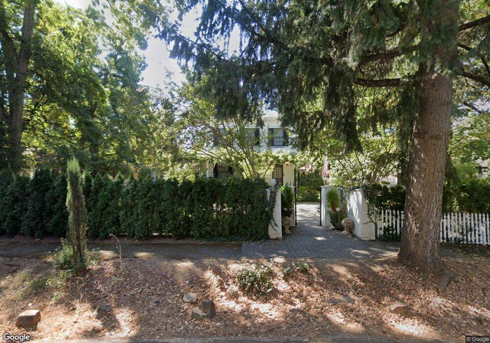
271 Jones St Murphys, CA 95247
Estimated Value: $1,382,912
6
Beds
5
Baths
4,479
Sq Ft
$309/Sq Ft
Est. Value
About This Home
This home is located at 271 Jones St, Murphys, CA 95247 and is currently estimated at $1,382,912, approximately $308 per square foot. 271 Jones St is a home located in Calaveras County with nearby schools including Bret Harte Union High School and Christian Heritage Academy.
Ownership History
Date
Name
Owned For
Owner Type
Purchase Details
Closed on
Feb 26, 2026
Sold by
Ninos Michael J
Bought by
Ninos Michael J
Current Estimated Value
Home Financials for this Owner
Home Financials are based on the most recent Mortgage that was taken out on this home.
Original Mortgage
$500,000
Outstanding Balance
$500,000
Interest Rate
6.06%
Mortgage Type
Credit Line Revolving
Estimated Equity
$882,912
Purchase Details
Closed on
Feb 9, 2022
Sold by
Melissa Ninos
Bought by
Ninos Michael J
Home Financials for this Owner
Home Financials are based on the most recent Mortgage that was taken out on this home.
Original Mortgage
$2,195,000
Interest Rate
3.55%
Mortgage Type
New Conventional
Purchase Details
Closed on
Mar 30, 2017
Sold by
Dunbar House 1880 Llc
Bought by
Ninos Michael
Home Financials for this Owner
Home Financials are based on the most recent Mortgage that was taken out on this home.
Original Mortgage
$900,000
Interest Rate
4.15%
Mortgage Type
Commercial
Purchase Details
Closed on
May 21, 2004
Sold by
Costa Robert R and Costa Barbara E
Bought by
Dunbar House 1880 Llc
Home Financials for this Owner
Home Financials are based on the most recent Mortgage that was taken out on this home.
Original Mortgage
$900,000
Interest Rate
5.86%
Mortgage Type
Commercial
Create a Home Valuation Report for This Property
The Home Valuation Report is an in-depth analysis detailing your home's value as well as a comparison with similar homes in the area
Home Values in the Area
Average Home Value in this Area
Purchase History
| Date | Buyer | Sale Price | Title Company |
|---|---|---|---|
| Ninos Michael J | -- | First American Title | |
| Ninos Michael J | -- | First American Title | |
| Ninos Michael | $900,000 | First American Title Company | |
| Dunbar House 1880 Llc | $950,000 | Calaveras Title Company |
Source: Public Records
Mortgage History
| Date | Status | Borrower | Loan Amount |
|---|---|---|---|
| Open | Ninos Michael J | $500,000 | |
| Previous Owner | Ninos Michael J | $2,195,000 | |
| Previous Owner | Ninos Michael | $900,000 | |
| Previous Owner | Dunbar House 1880 Llc | $900,000 |
Source: Public Records
Tax History
| Year | Tax Paid | Tax Assessment Tax Assessment Total Assessment is a certain percentage of the fair market value that is determined by local assessors to be the total taxable value of land and additions on the property. | Land | Improvement |
|---|---|---|---|---|
| 2025 | $11,675 | $1,061,391 | $232,114 | $829,277 |
| 2023 | $11,363 | $1,022,299 | $223,101 | $799,198 |
| 2022 | $10,836 | $990,437 | $218,727 | $771,710 |
| 2021 | $10,799 | $971,249 | $214,439 | $756,810 |
| 2020 | $13,751 | $1,241,414 | $305,504 | $935,910 |
| 2019 | $13,591 | $1,216,978 | $299,514 | $917,464 |
| 2018 | $13,238 | $1,193,348 | $293,642 | $899,706 |
| 2017 | $12,950 | $1,176,953 | $287,885 | $889,068 |
| 2016 | $12,950 | $1,157,925 | $282,241 | $875,684 |
| 2015 | $12,792 | $1,142,602 | $278,002 | $864,600 |
| 2014 | -- | $1,120,589 | $272,557 | $848,032 |
Source: Public Records
Map
Nearby Homes
- 494 Surrey Ct
- 511 Surrey Ln
- 102 Cottage Cir
- 133 Mitchler St
- 566 Friendly Ct
- 340 Tom Bell Rd
- 1 Watkins St
- 105 Fieldstone Dr
- 260 Fieldstone Dr
- 576 Quiet Place
- 343 Fieldstone Dr
- 209 Black Bart Blvd
- 830 Sheep Ranch Rd
- 831 Rocky Hill Rd
- 166 Oak Tree Cir
- 433 E Highway 4
- 128 Creekside Ct
- 536 Williams St
- 850 Murphys Creek Rd
- 626 Williams St
Your Personal Tour Guide
Ask me questions while you tour the home.