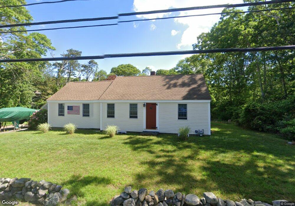
272 Cedar St West Barnstable, MA 02668
West Barnstable NeighborhoodEstimated Value: $480,000 - $744,000
2
Beds
1
Bath
1,032
Sq Ft
$582/Sq Ft
Est. Value
About This Home
This home is located at 272 Cedar St, West Barnstable, MA 02668 and is currently estimated at $600,136, approximately $581 per square foot. 272 Cedar St is a home located in Barnstable County with nearby schools including West Barnstable Elementary School, Barnstable United Elementary School, and Barnstable Intermediate School.
Ownership History
Date
Name
Owned For
Owner Type
Purchase Details
Closed on
Apr 19, 2021
Sold by
Cox Patrick W and Cox Christopher W
Bought by
Cox Christopher W
Current Estimated Value
Home Financials for this Owner
Home Financials are based on the most recent Mortgage that was taken out on this home.
Original Mortgage
$277,260
Outstanding Balance
$249,658
Interest Rate
3.1%
Mortgage Type
New Conventional
Estimated Equity
$350,478
Purchase Details
Closed on
Mar 31, 2006
Sold by
Cox Christopher W and Cox Eliza Z
Bought by
Cox Christopher W and Cox Patrick W
Home Financials for this Owner
Home Financials are based on the most recent Mortgage that was taken out on this home.
Original Mortgage
$305,000
Interest Rate
6.32%
Mortgage Type
Purchase Money Mortgage
Purchase Details
Closed on
Jul 2, 1998
Sold by
Toolas Peter G and Toolas Rachael M
Bought by
Cox Christopher W
Purchase Details
Closed on
Jun 15, 1992
Sold by
Campbell Martha W
Bought by
Toolas Peter G and Toolas Richard M
Create a Home Valuation Report for This Property
The Home Valuation Report is an in-depth analysis detailing your home's value as well as a comparison with similar homes in the area
Home Values in the Area
Average Home Value in this Area
Purchase History
| Date | Buyer | Sale Price | Title Company |
|---|---|---|---|
| Cox Christopher W | -- | None Available | |
| Cox Christopher W | -- | None Available | |
| Cox Christopher W | -- | -- | |
| Cox Christopher W | -- | -- | |
| Cox Christopher W | $119,000 | -- | |
| Toolas Peter G | $75,100 | -- | |
| Cox Christopher W | -- | -- | |
| Cox Christopher W | $119,000 | -- | |
| Toolas Peter G | $75,100 | -- |
Source: Public Records
Mortgage History
| Date | Status | Borrower | Loan Amount |
|---|---|---|---|
| Open | Cox Christopher W | $277,260 | |
| Closed | Cox Christopher W | $277,260 | |
| Previous Owner | Cox Christopher W | $305,000 | |
| Previous Owner | Toolas Peter G | $185,000 |
Source: Public Records
Tax History
| Year | Tax Paid | Tax Assessment Tax Assessment Total Assessment is a certain percentage of the fair market value that is determined by local assessors to be the total taxable value of land and additions on the property. | Land | Improvement |
|---|---|---|---|---|
| 2025 | $3,993 | $427,500 | $184,500 | $243,000 |
| 2024 | $3,657 | $426,200 | $184,500 | $241,700 |
| 2023 | $3,574 | $392,300 | $182,300 | $210,000 |
| 2022 | $3,445 | $310,100 | $129,600 | $180,500 |
| 2021 | $3,248 | $277,100 | $129,600 | $147,500 |
| 2020 | $3,253 | $268,400 | $129,600 | $138,800 |
| 2019 | $3,085 | $251,200 | $129,600 | $121,600 |
| 2018 | $80 | $242,400 | $142,100 | $100,300 |
| 2017 | $81 | $237,200 | $142,100 | $95,100 |
| 2016 | $2,842 | $237,000 | $141,900 | $95,100 |
| 2015 | $2,863 | $239,400 | $140,800 | $98,600 |
Source: Public Records
Map
Nearby Homes
- 510 Cedar St
- 75 Old Toll Rd
- 50 Wayside Ln
- 84 White Birch Way
- 282 Parker Rd
- 50 Currycomb Cir
- 6 Harpers Hollow
- 46 Service Rd
- 159 Great Hill Rd
- 74 Saddler Ln
- 32 Willington Ave
- 80 Branch Terrace
- 120 Great Hill Dr
- 3 Mulberry Cir
- 38 Lakeside Dr
- 1044 Old Falmouth Rd
- 1028 Old Falmouth Rd
- 324 Patriot Way
- 29 Fish House Rd
- 62 Three Ponds Dr
Your Personal Tour Guide
Ask me questions while you tour the home.