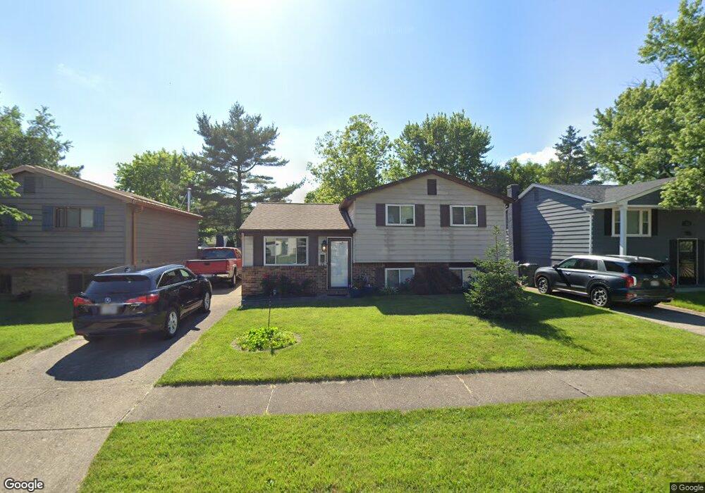
2729 Mellowbrook St Columbus, OH 43232
Walnut Heights NeighborhoodEstimated Value: $170,615 - $257,000
3
Beds
1
Bath
993
Sq Ft
$216/Sq Ft
Est. Value
About This Home
This home is located at 2729 Mellowbrook St, Columbus, OH 43232 and is currently estimated at $214,404, approximately $215 per square foot. 2729 Mellowbrook St is a home located in Franklin County with nearby schools including Liberty Elementary School, Yorktown Middle School, and Independence High School.
Ownership History
Date
Name
Owned For
Owner Type
Purchase Details
Closed on
Jun 1, 2022
Sold by
Maynard Dwight D
Bought by
Maynard Dwight D and Maynard Verda S
Current Estimated Value
Purchase Details
Closed on
Apr 14, 1982
Bought by
Maynard Dwight D
Purchase Details
Closed on
Sep 1, 1981
Create a Home Valuation Report for This Property
The Home Valuation Report is an in-depth analysis detailing your home's value as well as a comparison with similar homes in the area
Home Values in the Area
Average Home Value in this Area
Purchase History
| Date | Buyer | Sale Price | Title Company |
|---|---|---|---|
| Maynard Dwight D | -- | Gahanna Title | |
| Maynard Dwight D | -- | -- | |
| -- | $38,100 | -- |
Source: Public Records
Tax History Compared to Growth
Tax History
| Year | Tax Paid | Tax Assessment Tax Assessment Total Assessment is a certain percentage of the fair market value that is determined by local assessors to be the total taxable value of land and additions on the property. | Land | Improvement |
|---|---|---|---|---|
| 2024 | $2,064 | $55,800 | $16,980 | $38,820 |
| 2023 | $2,066 | $55,800 | $16,980 | $38,820 |
| 2022 | $944 | $26,950 | $5,250 | $21,700 |
| 2021 | $946 | $26,950 | $5,250 | $21,700 |
| 2020 | $947 | $26,950 | $5,250 | $21,700 |
| 2019 | $818 | $22,230 | $4,380 | $17,850 |
| 2018 | $1,301 | $22,230 | $4,380 | $17,850 |
| 2017 | $1,348 | $22,230 | $4,380 | $17,850 |
| 2016 | $1,384 | $20,900 | $3,640 | $17,260 |
| 2015 | $1,257 | $20,900 | $3,640 | $17,260 |
| 2014 | $1,260 | $20,900 | $3,640 | $17,260 |
| 2013 | $690 | $23,205 | $4,025 | $19,180 |
Source: Public Records
Map
Nearby Homes
- 2730 Raphael Dr
- 5278 Glenbriar Ct
- 2744 Barrows Rd
- 2736 Barrows Rd
- 2651 Brownfield Rd
- 2705 Denmark Rd
- 5268 Carbondale Dr
- 5377 Bleaker Ave
- 2991 Blue Moon Dr
- 5401 Spire Ln
- 5373 Spire Ln
- 5114 Carbondale Dr
- 2447 Maybury Rd
- 5011 Refugee Rd
- 2998 Osgood Rd E
- 5061 Labelle Dr
- 5123 Jameson Dr
- 5144 Botsford Dr
- 3148 Aldgate St
- 3198 Gallant Dr
- 2721 Mellowbrook St
- 2735 Mellowbrook St
- 2715 Mellowbrook St
- 2743 Mellowbrook St
- 2724 Moundcrest St
- 2718 Moundcrest St
- 2730 Moundcrest St
- 2710 Moundcrest St
- 2709 Mellowbrook St
- 2730 Mellowbrook St
- 2738 Moundcrest St
- 2738 Mellowbrook St
- 2724 Mellowbrook St
- 2706 Moundcrest St
- 2749 Mellowbrook St
- 2718 Mellowbrook St
- 2746 Mellowbrook St
- 2701 Mellowbrook St
- 2744 Moundcrest St
- 5421 Mellowbrook Ct