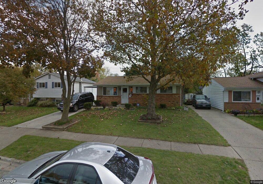
2738 Moundcrest St Columbus, OH 43232
Walnut Heights NeighborhoodEstimated Value: $182,646 - $246,000
4
Beds
1
Bath
945
Sq Ft
$218/Sq Ft
Est. Value
About This Home
This home is located at 2738 Moundcrest St, Columbus, OH 43232 and is currently estimated at $206,162, approximately $218 per square foot. 2738 Moundcrest St is a home located in Franklin County with nearby schools including Liberty Elementary School, Yorktown Middle School, and Independence High School.
Ownership History
Date
Name
Owned For
Owner Type
Purchase Details
Closed on
Dec 31, 2003
Sold by
Steiner James A and Steiner Denise L
Bought by
Radford Barbara J
Current Estimated Value
Home Financials for this Owner
Home Financials are based on the most recent Mortgage that was taken out on this home.
Original Mortgage
$79,748
Outstanding Balance
$37,760
Interest Rate
6.08%
Mortgage Type
FHA
Estimated Equity
$168,402
Purchase Details
Closed on
Feb 3, 1987
Bought by
Steiner James A
Create a Home Valuation Report for This Property
The Home Valuation Report is an in-depth analysis detailing your home's value as well as a comparison with similar homes in the area
Home Values in the Area
Average Home Value in this Area
Purchase History
| Date | Buyer | Sale Price | Title Company |
|---|---|---|---|
| Radford Barbara J | $81,000 | -- | |
| Steiner James A | $48,000 | -- |
Source: Public Records
Mortgage History
| Date | Status | Borrower | Loan Amount |
|---|---|---|---|
| Open | Radford Barbara J | $79,748 |
Source: Public Records
Tax History Compared to Growth
Tax History
| Year | Tax Paid | Tax Assessment Tax Assessment Total Assessment is a certain percentage of the fair market value that is determined by local assessors to be the total taxable value of land and additions on the property. | Land | Improvement |
|---|---|---|---|---|
| 2024 | $2,743 | $61,120 | $17,050 | $44,070 |
| 2023 | $2,708 | $61,110 | $17,045 | $44,065 |
| 2022 | $1,514 | $29,200 | $5,360 | $23,840 |
| 2021 | $1,517 | $29,200 | $5,360 | $23,840 |
| 2020 | $1,519 | $29,200 | $5,360 | $23,840 |
| 2019 | $1,472 | $24,260 | $4,480 | $19,780 |
| 2018 | $1,409 | $24,260 | $4,480 | $19,780 |
| 2017 | $1,479 | $24,260 | $4,480 | $19,780 |
| 2016 | $1,486 | $22,440 | $3,680 | $18,760 |
| 2015 | $1,349 | $22,440 | $3,680 | $18,760 |
| 2014 | $1,353 | $22,440 | $3,680 | $18,760 |
| 2013 | $742 | $24,955 | $4,095 | $20,860 |
Source: Public Records
Map
Nearby Homes
- 2730 Raphael Dr
- 5278 Glenbriar Ct
- 2744 Barrows Rd
- 2736 Barrows Rd
- 2651 Brownfield Rd
- 2705 Denmark Rd
- 5377 Bleaker Ave
- 5268 Carbondale Dr
- 2991 Blue Moon Dr
- 5401 Spire Ln
- 5373 Spire Ln
- 2998 Osgood Rd E
- 5011 Refugee Rd
- 5114 Carbondale Dr
- 2447 Maybury Rd
- 3148 Aldgate St
- 3198 Gallant Dr
- 5061 Labelle Dr
- 5123 Jameson Dr
- 5144 Botsford Dr
- 2744 Moundcrest St
- 2730 Moundcrest St
- 2752 Moundcrest St
- 2724 Moundcrest St
- 2743 Mellowbrook St
- 2749 Mellowbrook St
- 2735 Mellowbrook St
- 2758 Moundcrest St
- 2718 Moundcrest St
- 2733 Moundcrest St
- 2729 Mellowbrook St
- 2739 Moundcrest St
- 2727 Moundcrest St
- 2747 Moundcrest St
- 2764 Moundcrest St
- 2757 Mellowbrook St
- 2710 Moundcrest St
- 2719 Moundcrest St
- 2721 Mellowbrook St
- 2753 Moundcrest St