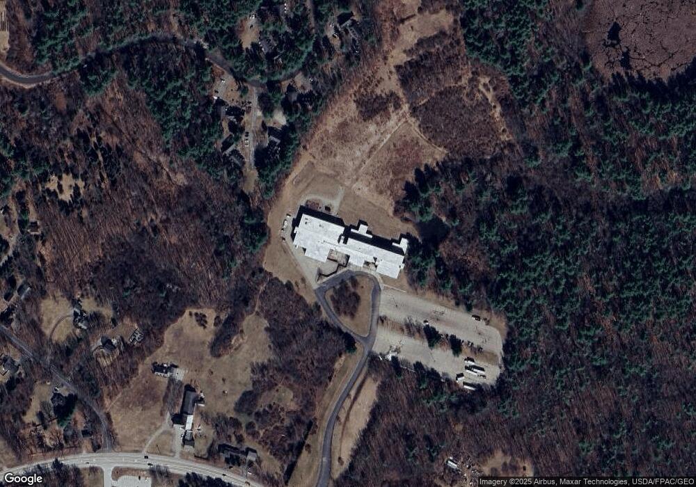
275 Portsmouth Ave Stratham, NH 03885
Estimated Value: $3,319,305
--
Bed
9
Baths
115,652
Sq Ft
$29/Sq Ft
Est. Value
About This Home
This home is located at 275 Portsmouth Ave, Stratham, NH 03885 and is currently estimated at $3,319,305, approximately $28 per square foot. 275 Portsmouth Ave is a home located in Rockingham County with nearby schools including Stratham Memorial School, Cooperative Middle School, and Exeter High School.
Ownership History
Date
Name
Owned For
Owner Type
Purchase Details
Closed on
Oct 15, 2014
Sold by
Community College Syst
Bought by
Juliet Marine Realty L
Current Estimated Value
Purchase Details
Closed on
Apr 3, 2013
Sold by
New Hampshire State Of
Bought by
Community College Sys
Create a Home Valuation Report for This Property
The Home Valuation Report is an in-depth analysis detailing your home's value as well as a comparison with similar homes in the area
Home Values in the Area
Average Home Value in this Area
Purchase History
| Date | Buyer | Sale Price | Title Company |
|---|---|---|---|
| Juliet Marine Realty L | $1,375,000 | -- | |
| Juliet Marine Realty L | $1,375,000 | -- | |
| Community College Sys | -- | -- | |
| Community College Sys | -- | -- |
Source: Public Records
Mortgage History
| Date | Status | Borrower | Loan Amount |
|---|---|---|---|
| Closed | Community College Sys | $0 |
Source: Public Records
Tax History Compared to Growth
Tax History
| Year | Tax Paid | Tax Assessment Tax Assessment Total Assessment is a certain percentage of the fair market value that is determined by local assessors to be the total taxable value of land and additions on the property. | Land | Improvement |
|---|---|---|---|---|
| 2024 | $36,475 | $2,780,100 | $807,000 | $1,973,100 |
| 2023 | $42,972 | $2,055,100 | $642,000 | $1,413,100 |
| 2022 | $38,451 | $2,055,100 | $642,000 | $1,413,100 |
| 2021 | $38,060 | $2,055,100 | $642,000 | $1,413,100 |
| 2020 | $38,944 | $2,055,100 | $642,000 | $1,413,100 |
| 2019 | $38,287 | $2,055,100 | $642,000 | $1,413,100 |
| 2018 | $58,449 | $2,783,300 | $507,000 | $2,276,300 |
| 2017 | $56,501 | $2,783,300 | $507,000 | $2,276,300 |
| 2016 | $56,779 | $2,783,300 | $507,000 | $2,276,300 |
| 2015 | $55,388 | $2,783,300 | $507,000 | $2,276,300 |
| 2014 | $56,092 | $2,817,300 | $507,000 | $2,310,300 |
| 2013 | $146,457 | $7,453,300 | $771,400 | $6,681,900 |
Source: Public Records
Map
Nearby Homes
- 39 Glengarry Dr
- 141 Dearborn Rd
- 227 Portsmouth Ave
- 24 Great Bay Rd
- 217 Portsmouth Ave
- 00 Lovell Rd Unit 22
- 54 Brookside Dr
- 5 Brookside Dr
- 34 Kinloch Dr
- 4 Kildary Dr
- 13 Dearborn Rd
- 00 Scamman Rd
- 44 High St
- 40 Stratham Green
- 14 Balmoral Dr
- 2 Osprey Ln
- 85 College Rd
- 18 Treat Farm Rd
- 23 Winding Brook Dr
- 9 Swamscott St
- 275 Portsmouth Ave Unit 16
- 23 Glengarry Dr
- 269 Portsmouth Ave
- 271 Portsmouth Ave
- 273 Portsmouth Ave
- 6 Sandy Point Rd
- 114 Glengarry Dr
- 113 Glengarry Dr
- 112 Glengarry Dr
- 111 Glengarry Dr
- 110 Glengarry Dr
- 109 Glengarry Dr
- 108 Glengarry Dr
- 107 Glengarry Dr
- 106 Glengarry Dr
- 105 Glengarry Dr
- 104 Glengarry Dr
- 102 Glengarry Dr
- 101 Glengarry Dr
- 100 Glengarry Dr