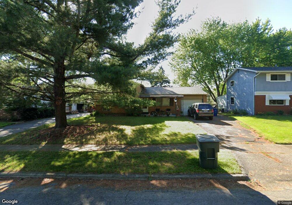
2767 Brownfield Rd Columbus, OH 43232
Walnut Heights NeighborhoodEstimated Value: $177,877 - $224,000
3
Beds
1
Bath
904
Sq Ft
$218/Sq Ft
Est. Value
About This Home
This home is located at 2767 Brownfield Rd, Columbus, OH 43232 and is currently estimated at $197,469, approximately $218 per square foot. 2767 Brownfield Rd is a home located in Franklin County with nearby schools including Liberty Elementary School, Yorktown Middle School, and Independence High School.
Ownership History
Date
Name
Owned For
Owner Type
Purchase Details
Closed on
Feb 17, 2000
Sold by
R & R Group
Bought by
Schlanger William R and Gossman Jeffrey R
Current Estimated Value
Home Financials for this Owner
Home Financials are based on the most recent Mortgage that was taken out on this home.
Original Mortgage
$68,000
Outstanding Balance
$22,003
Interest Rate
7.87%
Estimated Equity
$175,466
Purchase Details
Closed on
Oct 14, 1992
Bought by
R&R Group
Purchase Details
Closed on
Sep 1, 1985
Purchase Details
Closed on
Dec 1, 1984
Create a Home Valuation Report for This Property
The Home Valuation Report is an in-depth analysis detailing your home's value as well as a comparison with similar homes in the area
Home Values in the Area
Average Home Value in this Area
Purchase History
| Date | Buyer | Sale Price | Title Company |
|---|---|---|---|
| Schlanger William R | -- | Title First Agency Inc | |
| R&R Group | $57,000 | -- | |
| -- | -- | -- | |
| -- | -- | -- |
Source: Public Records
Mortgage History
| Date | Status | Borrower | Loan Amount |
|---|---|---|---|
| Open | Schlanger William R | $68,000 |
Source: Public Records
Tax History Compared to Growth
Tax History
| Year | Tax Paid | Tax Assessment Tax Assessment Total Assessment is a certain percentage of the fair market value that is determined by local assessors to be the total taxable value of land and additions on the property. | Land | Improvement |
|---|---|---|---|---|
| 2024 | $4,105 | $59,960 | $19,990 | $39,970 |
| 2023 | $2,714 | $59,955 | $19,985 | $39,970 |
| 2022 | $1,719 | $32,350 | $7,390 | $24,960 |
| 2021 | $1,722 | $32,350 | $7,390 | $24,960 |
| 2020 | $1,725 | $32,350 | $7,390 | $24,960 |
| 2019 | $1,698 | $27,300 | $6,160 | $21,140 |
| 2018 | $1,562 | $27,300 | $6,160 | $21,140 |
| 2017 | $1,633 | $27,300 | $6,160 | $21,140 |
| 2016 | $1,569 | $23,100 | $5,110 | $17,990 |
| 2015 | $1,429 | $23,100 | $5,110 | $17,990 |
| 2014 | $1,432 | $23,100 | $5,110 | $17,990 |
| 2013 | $785 | $25,655 | $5,670 | $19,985 |
Source: Public Records
Map
Nearby Homes
- 2705 Denmark Rd
- 5278 Glenbriar Ct
- 2651 Brownfield Rd
- 5011 Refugee Rd
- 5268 Carbondale Dr
- 5114 Carbondale Dr
- 5061 Labelle Dr
- 5373 Spire Ln
- 2998 Osgood Rd E
- 2615 Carbondale Place
- 5401 Spire Ln
- 2730 Raphael Dr
- 2447 Maybury Rd
- 5377 Bleaker Ave
- 5123 Jameson Dr
- 5125 Upton Rd N
- 5144 Botsford Dr
- 2744 Barrows Rd
- 2736 Barrows Rd
- 2901 Renfro Rd
- 2759 Brownfield Rd
- 2775 Brownfield Rd
- 2753 Brownfield Rd
- 2750 Denmark Rd
- 2756 Denmark Rd
- 5170 Refugee Rd
- 2742 Denmark Rd
- 2764 Brownfield Rd
- 2762 Denmark Rd
- 2780 Brownfield Rd
- 2747 Brownfield Rd
- 2764 Brownfield Rd
- 2736 Denmark Rd
- 2695 Brownfield Ct
- 2694 Brownfield Ct
- 2770 Denmark Rd
- 5204 Refugee Rd
- 2730 Denmark Rd
- 5217 Brownfield Ct
- 2739 Brownfield Rd